
Museums · East of England
Basildon
In or near Little Burstead.
Basildon ( BAZ-il-dən) is a town in Essex, England. It lies 27 miles (43 km) east of Central London, 11 miles (18 km) south of Chelmsford, and 10 miles (16 km) west of Southend-on-Sea. It gives its na

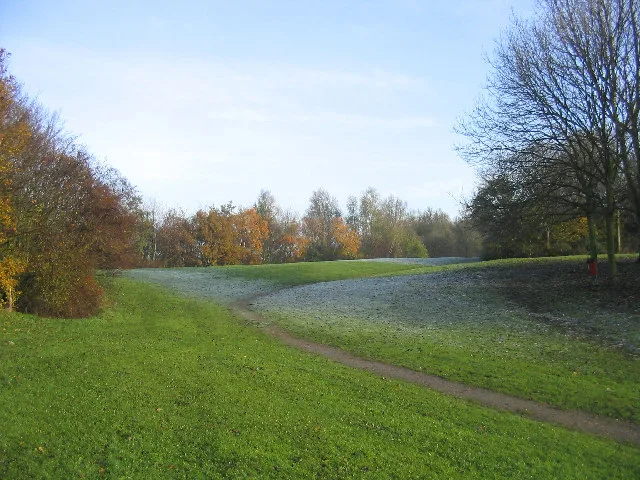
Paul Francis — CC BY-SA 2.0 via Wikimedia Commons licence

Plan your visit
- Typical visit
- 1.5 h–3 h
- Best time of year
- Year-round
- Nearest railway station
- Pitsea · 2.5 km
- Family-friendly
- Limited wheelchair access
Getting there & planning your visit
To visit Basildon museum, the nearest railway station is Pitsea, located 2.5 km away. The postcode for the museum is SS14 3PX. Accessibility is limited for wheelchair users.
About
Basildon ( BAZ-il-dən) is a town in Essex, England. It lies 27 miles (43 km) east of Central London, 11 miles (18 km) south of Chelmsford, and 10 miles (16 km) west of Southend-on-Sea. It gives its name to the wider Borough of Basildon which also includes the towns of Billericay and Wickford and surrounding rural areas. Basildon was a small village until the mid-20th century. In 1949 Basildon was designated a new town to accommodate London overspill, with the designated area for the new town also covering the existing villages of Pitsea, Laindon, and Vange, along with smaller hamlets. The town was then developed with new residential and industrial areas, and a new town centre. At the 2021 census the Basildon built up area had a population of 115,955. The town is served by three railway stations on the London, Tilbury and Southend line, being Laindon, Basildon, and Pitsea. The main part of the town lies between the A127 road to the north and the A13 road to the south, both of which are dual carriageways linking London to Southend.
Photo gallery
From the Wikipedia article
Basildon ( BAZ-il-dən) is a town in Essex, England. It lies 27 miles (43 km) east of Central London, 11 miles (18 km) south of Chelmsford, and 10 miles (16 km) west of Southend-on-Sea. It gives its name to the wider Borough of Basildon which also includes the towns of Billericay and Wickford and surrounding rural areas. Basildon was a small village until the mid-20th century. In 1949 Basildon was designated a new town to accommodate London overspill, with the designated area for the new town also covering the existing villages of Pitsea, Laindon, and Vange, along with smaller hamlets. The town was then developed with new residential and industrial areas, and a new town centre. At the 2021 census the Basildon built up area had a population of 115,955. The town is served by three railway stations on the London, Tilbury and Southend line, being Laindon, Basildon, and Pitsea. The main part of the town lies between the A127 road to the north and the A13 road to the south, both of which are dual carriageways linking London to Southend.
Excerpt from Wikipedia under CC BY-SA 4.0. See the source article linked in Sources below.
Background
Description
In the 1940s, Billericay Urban District Council and Essex County Council, concerned by lack of amenities in the area and by its development, petitioned the government to create a new town. On 4 January 1949 Lewis Silkin, Minister of Town and Country Planning, officially designated Basildon as a new town. Basildon Development Corporation was formed in February 1949 to transform the designated area into a modern new town. The main villages within the designated area for the new town were Laindon and Pitsea, with other settlements including the smaller Basildon and Vange. The first house built under the new town programme was completed in June 1951. The masterplan included employment areas…
Sourced from Wikipedia under CC BY-SA 4.0.
- Coordinates
- 51.5800, 0.4900
- County
- Essex
- District
- Basildon
- Parish
- Basildon, unparished area
- Postcode
- SS14 3PX
- Parliamentary constituency
- Basildon and Billericay
- Nearest railway station
- Pitsea — 2.5 km
Sources
- wikipedia: Basildon (CC BY-SA 4.0)
Other places nearby
Northlands Park, Basildon
Country parks · 0.6 km
Barstable School
Natural landmarks · 0.8 km

239 Rectory Road
Hostels · 1.5 km

Pitsea
Museums · 1.6 km

Chalvedon School
Natural landmarks · 1.6 km

Cineworld
Cinemas · 2.0 km

Pitsea Memorial Statue
Memorials & monuments · 2.1 km

South Essex Islamic Community Centre
Historic churches · 2.2 km

Vue
Cinemas · 2.3 km

Robins Cinema
Theatres · 2.3 km

Vange
Villages · 2.3 km

Mother and Child fountain
Public art & sculpture · 2.4 km
Nearby
📷 5Country parks · East of England
Northlands Park, Basildon
Northlands Park, Basildon is a country park in the United Kingdom.
📷 5Natural landmarks · East of England
Barstable School
Barstable School — a school heritage in england-london, United Kingdom.
📷 5📷 5Museums · East of England
Pitsea
Pitsea is a suburban town forming the eastern part of Basildon in Essex, England. Pitsea was historically a separate village and parish. Pitsea was a small village until the first half of the 20th cen
📷 5Natural landmarks · East of England
Chalvedon School
Chalvedon School — a school heritage in england-london, United Kingdom.
📷 5Where to eat & stay near Basildon
Places to stay
📷 5 📷 5
📷 5Campsites · East of England
Thorney Bay Camp
Thorney Bay Camp — a campsite in england london.
 📷 5
📷 5 📷 5
📷 5 📷 5📷 5
Campsites · East of England
The Lake at Nine Acres
The Lake at Nine Acres — a campsite in england south east.
Places to eat & drink
 📷 5
📷 5Restaurants · East of England
Five Bells
Five Bells — a restaurant in england london. Cuisine: american. Brand: Harvester.
 📷 5
📷 5Historic pubs · East of England
White Lion Public House
White Lion Public House in England South East, United Kingdom.
 📷 5
📷 5Historic pubs · East of England
The Half Crown Inn
The Half Crown Inn in England South East, United Kingdom.
 📷 5
📷 5Historic pubs · East of England
The Anchor Inn And Building Attached To Right
The Anchor Inn And Building Attached To Right in England South East, United Kingdom.
 📷 5
📷 5 📷 5
📷 5Historic pubs · East of England
The Crown Public House
The Crown Public House in England South East, United Kingdom.
More museums in this region
 📷 5
📷 5Museums · East of England
American Air Museum
American Air Museum — museum at Imperial War Museum Duxford, Cambridgeshire, England, UK.
 📷 5
📷 5Museums · East of England
Ashwell Village Museum
Ashwell Village Museum — historic building museum in Ashwell, Hertfordshire, England, United Kingdom.
 📷 5
📷 5Museums · East of England
Barleylands Farm Museum
Barleylands Farm Museum — Farm museum in Billericay, England.
 📷 5
📷 5Museums · East of England
Cromwell Museum
Cromwell Museum — museum in Huntingdon, England, United Kingdom.
Frequently asked questions
- Where is Basildon?
- Basildon is in Essex, East of England, United Kingdom (postcode SS14 3PX), in the parish of Basildon, unparished area.
- What is Basildon?
- Basildon ( BAZ-il-dən) is a town in Essex, England. It lies 27 miles (43 km) east of Central London, 11 miles (18 km) south of Chelmsford, and 10 miles (16 km) west of Southend-on-Sea. It gives its na
- How do I get to Basildon?
- The nearest railway station is Pitsea, about 2.5 km away. The nearest town is Little Burstead. Drivers can use postcode SS14 3PX.
- How do I get to Basildon?
- The nearest railway station is Pitsea, about 2.5 km away. Drivers can navigate to postcode SS14 3PX.