
Cemeteries · North West England
Barrowford Cemetery
In or near Barrowford.
Barrowford Cemetery is a cemetery in the United Kingdom.

Ian Greig — CC BY-SA 2.0 via Wikimedia Commons licence

Plan your visit
- Typical visit
- 30 min–1 h
- Nearest railway station
- Nelson · 1.9 km
- Free entry
- Dog-friendly
Getting there & planning your visit
Barrowford Cemetery is located in Pendle, Lancashire, with the postcode BB9 6EL. The nearest railway station is Nelson, which is 1.9 km away. Entry to the cemetery is free.
About
Barrowford Cemetery is a cemetery in Lancashire, North-West England of architectural and local-history note. It sits within the Pendle and Clitheroe parliamentary constituency. The nearest railway station is Nelson, about 1.9 km away. Postcode area BB9.
Photo gallery
Official information
Barrowford Cemetery is a burial ground located in Pendle, UK. It serves the local community and provides a peaceful environment for remembrance and reflection.
From the Wikipedia article
Barrowford ( ) is a village and civil parish in the Pendle district of Lancashire, England, north of Nelson, near the Forest of Bowland Area of Outstanding Natural Beauty. Barrowford is on the Marsden–Gisburn–Long Preston turnpike. One of the original toll houses can still be seen at the junction with the road to Colne. The toll house was restored in the 1980s and is owned by the trust which operates nearby Pendle Heritage Centre. Barrowford is about half a mile from the Leeds and Liverpool Canal, and a set of seven locks leads to the highest section of the canal between Barrowford and Barnoldswick. About a mile on from the locks heading towards Leeds is Foulridge Tunnel known locally as the "Mile Tunnel". The packhorse bridge near Higherford Mill is the oldest in Barrowford, dating to the end of the 16th century. It formerly lay on the old main road to Gisburn, which was superseded by the Turnpike road built in 1804. The modern Anglican church (St Thomas') was built to replace the original church of 1839, which burnt down in 1964. The village has two rivers: Pendle Water, which flows through it, and Colne Water, which joins Pendle Water behind the site of the now demolished Samuel Holden cotton mill and flows down from the moors above Colne. The first residential home for the deaf in Lancashire was established at Barrowford in 1929.
Excerpt from Wikipedia under CC BY-SA 4.0. See the source article linked in Sources below.
Background
History
Barrowford has been a centre for textile production since at least the 16th century when a fulling mill is recorded as being in the village. Until the late 18th century, the manufacture of woollen cloth was the primary industry, but in 1780 the fulling mill was rebuilt by Abraham Hargreaves as a cotton mill. The diarist Elizabeth Shackleton documented her life here. She died in 1781 at Pasture House. The cotton mill was powered by a water wheel and fed by water drawn off at the weir on Pendle Water. The mill reservoir is now the ornamental pond in Barrowford Park, whilst remains of the mill survive in the corner of the nearby children's playground. For the next fifty years, cotton cloth was…
Sourced from Wikipedia under CC BY-SA 4.0.
- Coordinates
- 53.8518, -2.2136
- County
- Lancashire
- District
- Pendle
- Parish
- Barrowford
- Postcode
- BB9 6EL
- Parliamentary constituency
- Pendle and Clitheroe
- Nearest railway station
- Nelson — 1.9 km
- Official site
- www.pendle.gov.uk
Sources
- osm: w801585002 (ODbL)
- wikipedia: Barrowford (CC BY-SA 4.0)
Other places nearby

Pendle Heritage Centre
Museums · 0.3 km

Barrowford Bridge
Historic bridges · 0.3 km

Barrowford
Towns & cities · 0.5 km
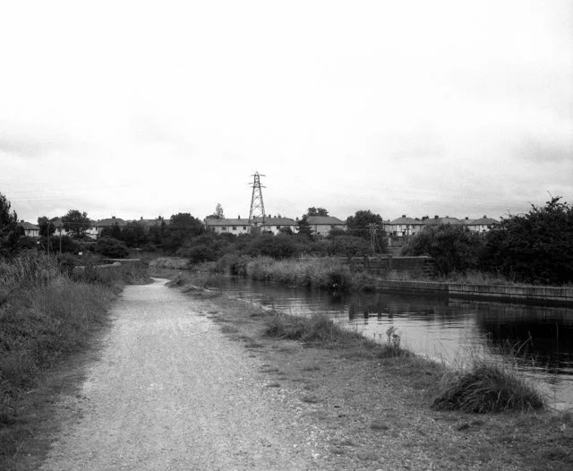
Leeds And Liverpool Canal Swinden Aqueduct
Aqueducts · 0.6 km

Leeds And Liverpool Canal Lock Number 51
Canal locks · 0.7 km

Leeds And Liverpool Canal Lock Number 50
Canal locks · 0.8 km

Leeds And Liverpool Canal Lock Number 48
Canal locks · 0.8 km

Leeds And Liverpool Canal Lock Number 49
Canal locks · 0.9 km

Leeds And Liverpool Canal Lock Number 47
Canal locks · 0.9 km

Nelson and Colne College
Natural landmarks · 1.0 km

Leeds And Liverpool Canal Lock Number 46
Canal locks · 1.0 km

Nelson Palace Theatre
Theatres · 1.2 km
Nearby
📷 3Museums · North West England
Pendle Heritage Centre
Pendle Heritage Centre — a museum in england-north-west, United Kingdom.
📷 3Historic bridges · North West England
Barrowford Bridge
Barrowford Bridge — Grade II listed building-listed bridge in england-north-west, United Kingdom.
📷 5Towns & cities · North West England
Barrowford
Barrowford — village and civil parish in Lancashire, England.
📷 3Aqueducts · North West England
Leeds And Liverpool Canal Swinden Aqueduct
Leeds And Liverpool Canal Swinden Aqueduct — aqueduct in Barrowford, Pendle, Lancashire, England, UK.
📷 3Canal locks · North West England
Leeds And Liverpool Canal Lock Number 51
Leeds And Liverpool Canal Lock Number 51 — lock in Barrowford, Pendle, Lancashire, England, UK.
📷 3Canal locks · North West England
Leeds And Liverpool Canal Lock Number 50
Leeds And Liverpool Canal Lock Number 50 — lock in Barrowford, Pendle, Lancashire, England, UK.
Where to eat & stay near Barrowford Cemetery
Places to stay
 📷 5
📷 5Campsites · North West England
Lower Greenhill Holiday Park
Lower Greenhill Holiday Park — a campsite in england north west.
 📷 5
📷 5Hotels · North West England
Travelodge
Travelodge — a hotel in england north west.
 📷 5
📷 5Caravan parks · North West England
Stubbins Vale Caravan Park
Stubbins Vale Caravan Park — a caravan park in england north west.
 📷 5
📷 5Caravan parks · North West England
Holgates Ribble Valley
Holgates Ribble Valley — a caravan park in england north west.
 📷 5
📷 5Campsites · North West England
Bridge Holme Caravan Site
Bridge Holme Caravan Site — a campsite in england north west.
 📷 5
📷 5Hostels · North West England
Earby Holiday Hostel
Earby Holiday Hostel — a hostel in england north west.
Places to eat & drink
 📷 5
📷 5Historic pubs · North West England
Cross Gaits Inn
Cross Gaits Inn in England North West, United Kingdom.
 📷 5
📷 5Restaurants · North West England
Fence Gate Inn
Fence Gate Inn — a restaurant in england north west.
📷 5 📷 5
📷 5Historic pubs · North West England
Duke Of York Hotel
Duke Of York Hotel in England North West, United Kingdom.
 📷 5
📷 5 📷 5
📷 5Historic pubs · North West England
The Churchill Public House
The Churchill Public House in England North West, United Kingdom.
More cemeteries in this region
 📷 5
📷 5Cemeteries · North West England
Brooklands Cemetery
Brooklands Cemetery is a cemetery in the United Kingdom.
 📷 4
📷 4Cemeteries · North West England
Congleton Cemetery
Congleton Cemetery is a cemetery in the United Kingdom.
 📷 5
📷 5Cemeteries · North West England
Coppenhall Cemetery
Coppenhall Cemetery is a cemetery in the United Kingdom.
 📷 3
📷 3Cemeteries · North West England
Former site of St. Saviour's Church
Former site of St. Saviour's Church is a cemetery in the United Kingdom.
Frequently asked questions
- Where is Barrowford Cemetery?
- Barrowford Cemetery is in Lancashire, North-West England, United Kingdom (postcode BB9 6EL), in the parish of Barrowford.
- What is Barrowford Cemetery?
- Barrowford Cemetery is a cemetery in the United Kingdom.
- How do I get to Barrowford Cemetery?
- The nearest railway station is Nelson, about 1.9 km away. The nearest town is Barrowford. Drivers can use postcode BB9 6EL.
- Is Barrowford Cemetery free to visit?
- Yes, Barrowford Cemetery is free to enter.
- How do I get to Barrowford Cemetery?
- The nearest railway station is Nelson, about 1.9 km away. Drivers can navigate to postcode BB9 6EL.