Historic bridges · North East England
Barrow Burn
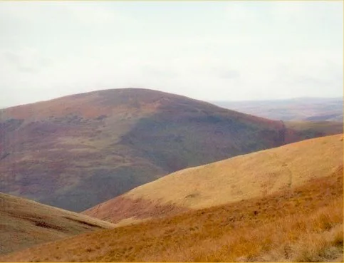
In or near Alwinton.
Barrow Burn in England North East, United Kingdom.

Michael Graham — CC BY-SA 2.0 via Wikimedia Commons licence
Plan your visit
- Typical visit
- 15 min–30 min
- Free entry
- Dog-friendly
About
Barrow Burn is a place of interest in England North East, United Kingdom — drawn from open-data sources for visitor reference. See the linked Wikipedia article for the full description.
Photo gallery
Protected designations
- Site of Special Scientific Interest: River Coquet and Coquet Valley Woodlands SSSI
Designations sourced from Natural England open data under OGL v3.
From the Wikipedia article
Barrowburn is a hamlet in Upper Coquetdale in the county of Northumberland, England. It comprises a working farm with associated buildings and two holiday lets. One of the holiday lets is the Old School House, which closed as a school in the 1970s. The settlement is situated by the River Coquet, at its confluence with Barrow Burn (stream), after which the settlement is named. There is a road bridge over the Coquet and a ford over the burn here.
Excerpt from Wikipedia under CC BY-SA 4.0. See the source article linked in Sources below.
- Coordinates
- 55.3880, -2.2140
- District
- Northumberland
- Parish
- Alwinton
- Postcode
- NE65 7BP
- Parliamentary constituency
- North Northumberland
Sources
- wikidata: Q4863867 (CC0)
- wikipedia: Barrow Burn (CC BY-SA 4.0)
Other places nearby
Wedder Leap Picnic Area
Natural landmarks · 0.1 km

Barrow Burn Meadows
Wildlife reserves · 0.5 km

Tindale Law
Mountains & hills · 0.7 km
Shillhope Law
Natural landmarks · 1.1 km

Shillhope Law
Mountains & hills · 1.1 km

Barrow Law
Mountains & hills · 1.2 km

Kyloe Shin
Mountains & hills · 1.5 km

Bell Hill
Mountains & hills · 2.3 km

Middle Hill
Mountains & hills · 2.3 km

Saughy Hill
Mountains & hills · 2.6 km
Saughy Hill
Mountains & hills · 2.7 km

Whar Moor
Mountains & hills · 2.8 km
Nearby
📷 3Natural landmarks · North East England
Wedder Leap Picnic Area
Wedder Leap Picnic Area — a other in scotland-lowlands, United Kingdom.
📷 3Wildlife reserves · North East England
Barrow Burn Meadows
Barrow Burn Meadows in England North East, United Kingdom.
📷 5Mountains & hills · North East England
Tindale Law
Tindale Law — a hill or mountain in scotland lowlands.
📷 3📷 3📷 5Mountains & hills · North East England
Barrow Law
Barrow Law — mountain in scotland lowlands. Elevation: 419 m.
Where to eat & stay near Barrow Burn
Places to stay
 📷 5
📷 5Campsites · North East England
Firing Point - Farm
Firing Point - Farm — a campsite in scotland lowlands.
 📷 5
📷 5Hostels · North East England
Mounthooly Bunk House
Mounthooly Bunk House — a hostel in scotland lowlands.
 📷 5
📷 5Caravan parks · North East England
Border Forest Caravan Park
Border Forest Caravan Park — a caravan park in scotland lowlands.
 📷 5
📷 5 📷 5
📷 5 📷 7
📷 7Places to eat & drink
 📷 5
📷 5Historic pubs · North East England
The Redesdale Arms
The Redesdale Arms in Scotland Lowlands, United Kingdom.
 📷 7
📷 7Historic pubs · North East England
Plough Inn With Outbuilding To North
Plough Inn With Outbuilding To North in Scotland Lowlands, United Kingdom.
 📷 7
📷 7 📷 7
📷 7Historic pubs · North East England
Bridge Of Aln Hotel
Bridge Of Aln Hotel in Scotland Lowlands, United Kingdom.
 📷 7
📷 7More bridges in this region
 📷 3
📷 3Historic bridges · North East England
Bridge About 30 Metres South Of The Manor House
Bridge About 30 Metres South Of The Manor House — Grade II listed building-listed bridge in england-yorkshire, United Kingdom.
 📷 3
📷 3Historic bridges · North East England
Old Bridge Over Nor Beck, On East Side Of Road
Old Bridge Over Nor Beck, On East Side Of Road — Grade II listed building-listed bridge in england-yorkshire, United Kingdom.
 📷 3
📷 3Historic bridges · North East England
Barnard Castle Bridge
Barnard Castle Bridge is a historic bridge in the United Kingdom.
 📷 3
📷 3Historic bridges · North East England
Blandswath Bridge
Blandswath Bridge is a historic bridge in the United Kingdom.
Frequently asked questions
- Where is Barrow Burn?
- Barrow Burn is in North-East England, United Kingdom (postcode NE65 7BP), in the parish of Alwinton.
- What is Barrow Burn?
- Barrow Burn in England North East, United Kingdom.
- How do I get to Barrow Burn?
- Drivers can use postcode NE65 7BP.
- Is Barrow Burn a protected site?
- Yes — Barrow Burn is part of the River Coquet and Coquet Valley Woodlands SSSI Site of Special Scientific Interest.
- Is Barrow Burn free to visit?
- Yes, Barrow Burn is free to enter.
- How do I get to Barrow Burn?
- Drivers can navigate to postcode NE65 7BP. It sits within the North Northumberland parliamentary constituency.