
Historic houses · North East England
Barrack Road drill hall
In or near Newcastle upon Tyne.
Barrack Road drill hall in England North East, United Kingdom.

Bartolo Creations — CC BY-SA 2.0 via Wikimedia Commons licence

Plan your visit
- Typical visit
- 1 h–2 h
- Nearest railway station
- St James · 0.3 km
- Family-friendly
- Limited wheelchair access
About
Barrack Road drill hall is a place of interest in England North East, United Kingdom — drawn from open-data sources for visitor reference. See the linked Wikipedia article for the full description.
Photo gallery
From the Wikipedia article
The Barrack Road drill hall is a former military installation in Newcastle upon Tyne
Excerpt from Wikipedia under CC BY-SA 4.0. See the source article linked in Sources below.
Background
History
The drill hall was designed as the headquarters of the 1st Northumberland Artillery Volunteers and was completed around 1890. The site also accommodated a riding school and stabling for 14 horses. With the formation of the Territorial Force in 1908, the drill hall became the home of the 1st Northumbrian Brigade, Royal Field Artillery as well as two of its three batteries (the third was at Elswick Ordnance Works in Dunn Street). it saw action at the Battle of Flers–Courcelette in September 1916, the Battle of Morval also in September 1916 and the Battle of Le Transloy in October 1916. After the First World War the drill hall became home of 72 (Northumbrian) Regiment Royal Artillery, a…
Sourced from Wikipedia under CC BY-SA 4.0.
- Coordinates
- 54.9752, -1.6253
- District
- Newcastle upon Tyne
- Parish
- Newcastle upon Tyne, unparished area
- Postcode
- NE4 6BA
- Parliamentary constituency
- Newcastle upon Tyne Central and West
- Established
- 1890
- Nearest railway station
- St James — 0.3 km
Sources
- wikidata: Q30625274 (CC0)
- wikipedia: Barrack Road drill hall (CC BY-SA 4.0)
Other places nearby

Leazes Park Lion Sculture
Public art & sculpture · 0.2 km
Bust Of Alderman Hamond 50 Metres North East Of Lodge In Leazes Park
Public art & sculpture · 0.2 km

Leazes Park Stadium
Stadiums · 0.2 km
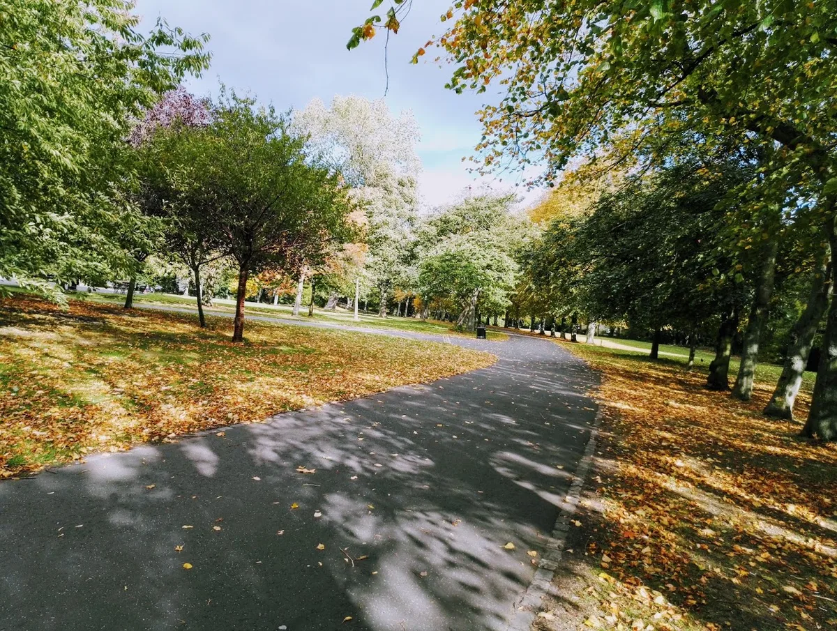
Leazes Park
Country parks · 0.2 km
Leazes Park Lion Statue
Public art & sculpture · 0.3 km

Shearer's Bar
Stadiums · 0.3 km

Policy, Ethics and Life Sciences Research Centre
Other places · 0.4 km

Climax Cinema Club
Theatres · 0.4 km

Chinatown Gateway
Natural landmarks · 0.4 km

Ever Tower
Historic houses · 0.4 km

Ever Tower
Archaeological sites · 0.4 km

The Town Wall
Memorials & monuments · 0.4 km
Nearby
📷 3Public art & sculpture · North East England
Leazes Park Lion Sculture
Leazes Park Lion Sculture — a public art in scotland-lowlands, United Kingdom.
📷 3Public art & sculpture · North East England
Bust Of Alderman Hamond 50 Metres North East Of Lodge In Leazes Park
Bust Of Alderman Hamond 50 Metres North East Of Lodge In Leazes Park in Scotland Lowlands, United Kingdom.
📷 3Stadiums · North East England
Leazes Park Stadium
Leazes Park Stadium in England North East, United Kingdom.
📷 3Country parks · North East England
Leazes Park
Leazes Park — park in Newcastle upon Tyne, England.
📷 3Public art & sculpture · North East England
Leazes Park Lion Statue
Leazes Park Lion Statue — a public art in scotland-lowlands, United Kingdom.
📷 3Stadiums · North East England
Shearer's Bar
Shearer's Bar in England North East, United Kingdom.
Where to eat & stay near Barrack Road drill hall
Places to stay
Hotels · North East England
Maldron Hotel Newcastle
Maldron Hotel Newcastle — a hotel in scotland lowlands. 4-star. Brand: Maldron Hotels.
 📷 5
📷 5 📷 5
📷 5Hostels · North East England
Heroes Bunkz
Heroes Bunkz — a hostel in scotland lowlands.
 📷 5
📷 5Hostels · North East England
Albatross Hostel
Albatross Hostel — a hostel in scotland lowlands.
 📷 5
📷 5Hotels · North East England
The County Hotel
The County Hotel — a hotel in scotland lowlands.
 📷 5
📷 5Hotels · North East England
Hampton by Hilton Newcastle
Hampton by Hilton Newcastle — a hotel in scotland lowlands. 3.5-star. Brand: Hampton.
Places to eat & drink
 📷 5
📷 5Historic pubs · North East England
The Balmoral Public House
The Balmoral Public House in Scotland Lowlands, United Kingdom.
 📷 5
📷 5Historic pubs · North East England
The Cordwainers' Public House
The Cordwainers' Public House in Scotland Lowlands, United Kingdom.
 📷 5
📷 5Historic pubs · North East England
Theatre Royal Lounge And Restaurant; The Royal Public House
Theatre Royal Lounge And Restaurant; The Royal Public House in Scotland Lowlands, United Kingdom.
 📷 5
📷 5Historic pubs · North East England
Liberty House
Liberty House in Scotland Lowlands, United Kingdom.
 📷 5
📷 5 📷 5
📷 5Restaurants · North East England
Cilantro
Cilantro — a restaurant in scotland lowlands.
More historic houses in this region
 📷 3
📷 3Historic houses · North East England
Wayside cross known as Jenny Bradley 1000m north west of Bloworth Crossing on Greenhow Moor
Wayside cross known as Jenny Bradley 1000m north west of Bloworth Crossing on Greenhow Moor — a Grade II*-listed historic house in england-yorkshire, United Kingdom.
 📷 3
📷 3Historic houses · North East England
Crackpot Hall
Crackpot Hall — a historic house in england-north-west, United Kingdom.
 📷 3
📷 3Historic houses · North East England
Bunton Mine shop
Bunton Mine shop — a historic house in england-north-west, United Kingdom.
 📷 3
📷 3Historic houses · North East England
Blakethwaite Mine
Blakethwaite Mine — a historic house in england-north-west, United Kingdom.
Frequently asked questions
- Where is Barrack Road drill hall?
- Barrack Road drill hall is in North-East England, United Kingdom (postcode NE4 6BA), in the parish of Newcastle upon Tyne, unparished area.
- What is Barrack Road drill hall?
- Barrack Road drill hall in England North East, United Kingdom.
- How do I get to Barrack Road drill hall?
- The nearest railway station is St James, about 0.3 km away. Drivers can use postcode NE4 6BA.
- When was Barrack Road drill hall built?
- Built or established in 1890.
- Who owns Barrack Road drill hall?
- Barrack Road drill hall is owned by |built =c.1890.
- How do I get to Barrack Road drill hall?
- The nearest railway station is St James, about 0.3 km away. Drivers can navigate to postcode NE4 6BA.