
Archaeological sites · South East England
Bardown Roman bloomery and iron pits
In or near Etchingham.
Bardown Roman bloomery and iron pits — a archaeological in england-south-east, United Kingdom.

Oast House Archive — CC BY-SA 2.0 via Wikimedia Commons licence

Plan your visit
- Typical visit
- 45 min–1.5 h
- Nearest railway station
- Stonegate · 2.3 km
- Free entry
- Dog-friendly
About
Bardown Roman bloomery and iron pits is a archaeological located in england-south-east, United Kingdom. Sourced from OpenStreetMap (ODbL licence); see local listings for visitor information, opening hours and admission details.
Photo gallery
Official information
Bardown Roman bloomery and iron pits is an archaeological site in East Sussex, showcasing remnants of a Roman bloomery and iron production from the late 1st to 2nd centuries AD. Excavations have uncovered industrial quarters, including timber structures and a high-temperature hearth, indicating the site's historical significance in ironworking.
Protected designations
- Area of Outstanding Natural Beauty: High Weald
Designations sourced from Natural England open data under OGL v3.
Place summary
Bardown Roman bloomery and iron pits are archaeological remains located in South-East England. This site provides insight into Roman iron production techniques, showcasing the historical significance of metallurgy in the region.
AI-generated from the structured facts on this page (operator, designation, listing, era). Not a substitute for visiting.
- Coordinates
- 51.0401, 0.3717
- County
- East Sussex
- District
- Rother
- Parish
- Ticehurst
- Postcode
- TN5 7EL
- Parliamentary constituency
- Bexhill and Battle
- Nearest railway station
- Stonegate — 2.3 km
- Official site
- www.pastscape.org.uk
Sources
- osm: node/6901418449 (ODbL)
Other places nearby
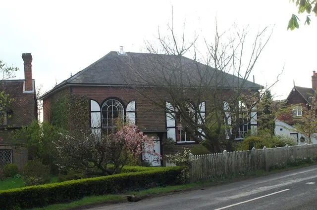
Shover's Green Baptist Chapel
Historic churches · 1.5 km

Caird's Camping and Caravan Site
Campsites · 2.4 km
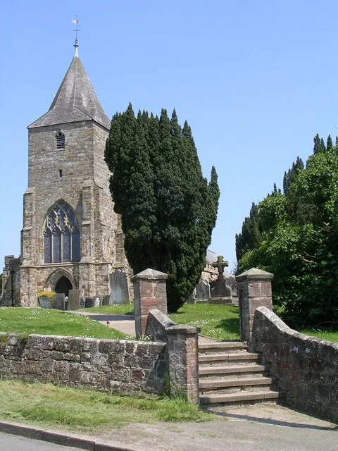
St Mary's Church, Ticehurst
Historic churches · 2.6 km

Ticehurst War Memorial and Second World War Commemorative Stone
Memorials & monuments · 2.7 km

Ticehurst
Villages · 2.7 km

Grebe Corner, Bewl Water
Viewpoints · 3.2 km

Wadhurst
Villages · 3.4 km

Stone Bay, water taxi pick up point, Bewl Water
Piers · 3.5 km

The Cherry Tree Public House
Historic pubs · 3.5 km

Bewl Water
Reservoirs & lochs · 3.6 km

Bell Water
Lakes · 3.6 km

Franchise Manor
Manor houses · 3.7 km
Nearby
📷 5Historic churches · South East England
Shover's Green Baptist Chapel
Shover's Green Baptist Chapel — chapel in Shover's Green, Wadhurst, East Sussex, England, UK.
📷 5Campsites · South East England
Caird's Camping and Caravan Site
Caird's Camping and Caravan Site — a campsite in england south east.
📷 5Historic churches · South East England
St Mary's Church, Ticehurst
St Mary's Church, Ticehurst — church in Ticehurst, East Sussex, England, UK.
📷 5Memorials & monuments · South East England
Ticehurst War Memorial and Second World War Commemorative Stone
Ticehurst War Memorial and Second World War Commemorative Stone — Grade II listed building-listed memorial in england-south-east, United Kingdom.
📷 5📷 5Viewpoints · South East England
Grebe Corner, Bewl Water
Grebe Corner, Bewl Water is a viewpoint in the United Kingdom.
Where to eat & stay near Bardown Roman bloomery and iron pits
Places to stay
📷 5Campsites · South East England
Caird's Camping and Caravan Site
Caird's Camping and Caravan Site — a campsite in england south east.
 📷 5
📷 5Campsites · South East England
Cedar Gables Campsite
Cedar Gables Campsite — a campsite in england south east.
 📷 5
📷 5 📷 5
📷 5Campsites · South East England
Bedgebury Camping
Bedgebury Camping — a campsite in england south east.
 📷 5
📷 5Campsites · South East England
Glottenham Farm Glamping
Glottenham Farm Glamping — a campsite in england south east.
 📷 5
📷 5Places to eat & drink
📷 5Historic pubs · South East England
The Cherry Tree Public House
The Cherry Tree Public House in England South East, United Kingdom.
 📷 5
📷 5Historic pubs · South East England
Elephants Head Public House
Elephants Head Public House in England South East, United Kingdom.
 📷 7
📷 7Historic pubs · South East England
The Old Bull Inn
The Old Bull Inn in England South East, United Kingdom.
 📷 7
📷 7Restaurants · South East England
The Royal George
The Royal George — a restaurant in england south east.
 📷 5
📷 5Historic pubs · South East England
The Rose And Crown Inn
The Rose And Crown Inn in England South East, United Kingdom.
 📷 5
📷 5Historic pubs · South East England
The Seven Stars Inn
The Seven Stars Inn is a 14th-century public house in Robertsbridge, East Sussex, a well-preserved example of a medieval building and a typical Sussex village pub. It is associated with historical eve
More archaeological sites in this region
 📷 5
📷 5Archaeological sites · South East England
Chatham Dockyard, site of South Mast Pond
Chatham Dockyard, site of South Mast Pond — archaeological site in Medway, Kent, England, UK.
 📷 5
📷 5Archaeological sites · South East England
Open areas within Roman, Saxon and medieval town
Open areas within Roman, Saxon and medieval town — archaeological site in Medway, Kent, England, UK.
 📷 5
📷 5Archaeological sites · South East England
Oxmoor Copse
Oxmoor Copse — woodland in Surrey, England.
 📷 5
📷 5Frequently asked questions
- Where is Bardown Roman bloomery and iron pits?
- Bardown Roman bloomery and iron pits is in East Sussex, South-East England, United Kingdom (postcode TN5 7EL), in the parish of Ticehurst.
- What is Bardown Roman bloomery and iron pits?
- Bardown Roman bloomery and iron pits — a archaeological in england-south-east, United Kingdom.
- How do I get to Bardown Roman bloomery and iron pits?
- The nearest railway station is Stonegate, about 2.3 km away. Drivers can use postcode TN5 7EL.
- Is Bardown Roman bloomery and iron pits a protected site?
- Yes — Bardown Roman bloomery and iron pits is part of the High Weald National Landscape (AONB).
- Is Bardown Roman bloomery and iron pits free to visit?
- Yes, Bardown Roman bloomery and iron pits is free to enter.
- How do I get to Bardown Roman bloomery and iron pits?
- The nearest railway station is Stonegate, about 2.3 km away. Drivers can navigate to postcode TN5 7EL.