
Natural landmarks · Northern Ireland
Ballylumford power station
In or near Glynn.
Ballylumford power station in Northern Ireland, United Kingdom.

Mike Faherty — CC BY-SA 2.0 via Wikimedia Commons licence

Plan your visit
- Typical visit
- 1 h–2 h
- Nearest railway station
- Larne Harbour · 0.8 km
- Free entry
- Dog-friendly
About
Ballylumford power station is a place of interest in Northern Ireland, United Kingdom — drawn from open-data sources for visitor reference. See the linked Wikipedia article for the full description.
Photo gallery
Official information
Ballylumford power station is part of TTEP UK&I's portfolio, which includes various power generation assets across the UK and Ireland. The facility contributes to the energy transition by providing flexible and reliable energy supply, supporting grid stability and security.
From the Wikipedia article
Ballylumford power station "C" station is a natural-gas-fired power station in County Antrim, Northern Ireland, UK. With its main plant generating almost 700 megawatts of electricity, it is Northern Ireland's largest power station and provides half its power. Overall the station can produce 693 MW. The plant is located at the tip of the Islandmagee peninsula, which separates Larne Lough from the Irish Sea. The lough is a Site of Special Scientific Interest. The 3 chimneys of the now decommissioned "B" station are 126 metres tall. East of the station is the Ballycronan More converter station, the Northern Ireland end of the Moyle Interconnector, a subsea HVDC interconnector connecting the NI electricity system to Great Britain.
Excerpt from Wikipedia under CC BY-SA 4.0. See the source article linked in Sources below.
Background
History
The first Ballylumford power station, the "A" station, was commissioned in 1943. It was a coal-fired generating station with an initial capacity of 30MW. Further equipment was installed to increase the capacity by 31.5MW (June 1945), another 31.5MW (November 1948), and 31.5MW (January 1951). By 1958 the generating capacity was 124.5MW. The plant comprised: Each boiler had a steam capacity of 150,000lb/hr (18.9kg/s). The boilers fed steam to four turbo-alternators: In 1991 the nationalised power company, Northern Ireland Electricity, was incorporated as a government owned public limited company. In 1992 the four power stations at Belfast Harbour, Ballylumford, Derry (Coolkeeragh) and…
Sourced from Wikipedia under CC BY-SA 4.0.
- Coordinates
- 54.8450, -5.7870
- District
- Mid and East Antrim
- Postcode
- BT40 3RS
- Parliamentary constituency
- East Antrim
- Nearest railway station
- Larne Harbour — 0.8 km
- Official site
- www.epuki.co.uk
Sources
- wikidata: Q2944652 (CC0)
- wikipedia: Ballylumford Power Station (CC BY-SA 4.0)
Other places nearby
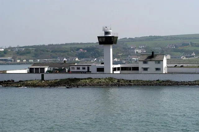
Ferris Point Lighthouse
Lighthouses · 0.7 km

Larne Port
Marinas · 0.8 km

Larne Harbour railway station
Harbours & ports · 0.8 km

Larne Lifeboat Station
Natural landmarks · 0.9 km

Ballylumford Dolmen
Burial mounds & barrows · 0.9 km

Olderfleet Castle
Archaeological sites · 0.9 km

The Stern
Public art & sculpture · 0.9 km

MV Princess Victoria Memorial
Memorials & monuments · 1.0 km
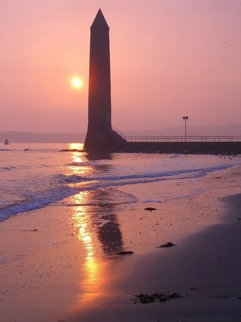
Chaine Memorial
Lighthouses · 1.2 km

Ballycronan More
Natural landmarks · 1.2 km

Curran Caravan Park
Campsites · 1.3 km

The Friends' Goodwill Memorial
Public art & sculpture · 1.4 km
Nearby
📷 3Lighthouses · Northern Ireland
Ferris Point Lighthouse
Ferris Point Lighthouse — lighthouse in Antrim, Northern Ireland.
📷 5📷 5Harbours & ports · Northern Ireland
Larne Harbour railway station
Larne Harbour railway station in Northern Ireland, United Kingdom.
📷 4Natural landmarks · Northern Ireland
Larne Lifeboat Station
Larne Lifeboat Station in Northern Ireland, United Kingdom.
📷 4Burial mounds & barrows · Northern Ireland
Ballylumford Dolmen
Ballylumford Dolmen in Northern Ireland, United Kingdom.
📷 5Archaeological sites · Northern Ireland
Olderfleet Castle
Olderfleet Castle — a archaeological site in northern ireland.
Where to eat & stay near Ballylumford power station
Places to stay
📷 5Campsites · Northern Ireland
Curran Caravan Park
Curran Caravan Park — a campsite in northern ireland.
 📷 5
📷 5Hostels · Northern Ireland
Simon Community Northern Ireland
Simon Community Northern Ireland — a hostel in northern ireland.
 📷 5
📷 5Caravan parks · Northern Ireland
Carnfunnock Caravan Park
Carnfunnock Caravan Park — a caravan park in northern ireland.
 📷 5
📷 5 📷 5
📷 5Hotels · Northern Ireland
The Pink Cottage
The Pink Cottage — a hotel in northern ireland.
 📷 5
📷 5Campsites · Northern Ireland
Glenarm Castle Ocean View Pods
Glenarm Castle Ocean View Pods — a campsite in northern ireland.
More natural landmarks in this region
 Flagship📷 4
Natural landmarks · Northern Ireland
Lough Erne
Lough Erne — lake in County Fermanagh, Northern Ireland, UK.
 Flagship📷 4
Natural landmarks · Northern Ireland
Lough Neagh
Lough Neagh — large lake in Northern Ireland.
 📷 3
📷 3Natural landmarks · Northern Ireland
Ballysaggart Lough
Ballysaggart Lough — lake in the United Kingdom.
 📷 5
📷 5Natural landmarks · Northern Ireland
Belmore Mountain
Belmore Mountain — mountain in the United Kingdom.
Frequently asked questions
- Where is Ballylumford power station?
- Ballylumford power station is in Northern Ireland, United Kingdom (postcode BT40 3RS).
- What is Ballylumford power station?
- Ballylumford power station in Northern Ireland, United Kingdom.
- How do I get to Ballylumford power station?
- The nearest railway station is Larne Harbour, about 0.8 km away. Drivers can use postcode BT40 3RS.
- Who owns Ballylumford power station?
- Ballylumford power station is owned by EP UK Investments.
- Is Ballylumford power station free to visit?
- Yes, Ballylumford power station is free to enter.
- How do I get to Ballylumford power station?
- The nearest railway station is Larne Harbour, about 0.8 km away. Drivers can navigate to postcode BT40 3RS.