Natural landmarks · Northern Ireland
Ballycassidy
Also known as: Baile Uí Chaiside
In or near Derrygonnelly.
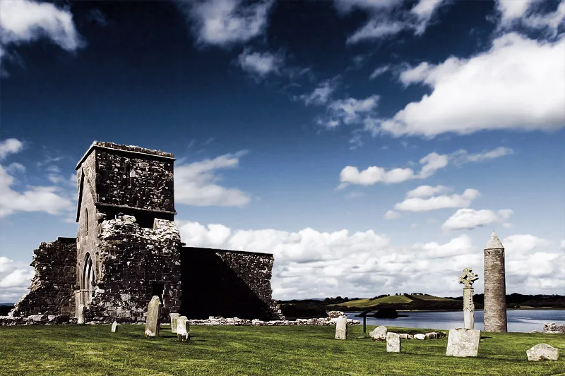
Ballycassidy in Northern Ireland, United Kingdom.

Kenneth Allen — CC BY-SA 2.0 via Wikimedia Commons licence
Plan your visit
- Typical visit
- 1 h–2 h
- Free entry
- Dog-friendly
About
Ballycassidy is a place of interest in Northern Ireland, United Kingdom — drawn from open-data sources for visitor reference. See the linked Wikipedia article for the full description.
Photo gallery
From the Wikipedia article
Ballycassidy (from Irish Baile Uí Chaiside, meaning 'O’Cassidy’s townland') is a small village and townland (of 83 acres) in County Fermanagh, Northern Ireland, 6.5 km north of Enniskillen on the eastern shore of Lower Lough Erne. It is situated in the civil parish of Trory and the historic barony of Tirkennedy. In the 2001 Census it had (with Laragh and Trory) a population of 315 people. It is situated within Fermanagh and Omagh district. Ballycassidy is a small rural community, consisting mainly of scattered homes, the Balcas Sawmill and rich farm land along the Ballycassidy River. There is no pub or grocery store, only a post office. The Ballycassidy River flows into Lower Lough Erne a short distance to the west.
Excerpt from Wikipedia under CC BY-SA 4.0. See the source article linked in Sources below.
Background
History
In the 14th century, there was a church in Ballycassidy. A holy well in the area was associated with Saint Molaise who founded the monastery on nearby Devinish. ==Ballycassidy racehorse
Sourced from Wikipedia under CC BY-SA 4.0.
- Coordinates
- 54.4000, -7.6500
- District
- Fermanagh and Omagh
- Postcode
- BT94 2LX
- Parliamentary constituency
- Fermanagh and South Tyrone
Sources
- wikidata: Q3876152 (CC0)
- wikipedia: Ballycassidy (CC BY-SA 4.0)
Other places nearby

Enniskillen/St Angelo Airport
Natural landmarks · 0.2 km
RAF St Angelo
Natural landmarks · 0.2 km

Laragh
Natural landmarks · 0.5 km

Trory
Natural landmarks · 1.5 km

Knockmanoul
Villages · 2.2 km

Lough Erne Golf Resort
Hotels · 2.8 km

39th G8 summit
Mountains & hills · 2.8 km

Enniskillen Lifeboat Station
Natural landmarks · 2.9 km

Drumgay Lough
Lakes · 3.0 km
Devenish Island
Islands · 3.1 km

Teampull Mór
Archaeological sites · 3.3 km

Saint Molaise's House
Archaeological sites · 3.3 km
Nearby
📷 3Natural landmarks · Northern Ireland
Enniskillen/St Angelo Airport
Enniskillen/St Angelo Airport in Northern Ireland, United Kingdom.
📷 3Natural landmarks · Northern Ireland
RAF St Angelo
RAF St Angelo in Northern Ireland, United Kingdom.
📷 3📷 5📷 5📷 5Hotels · Northern Ireland
Lough Erne Golf Resort
Lough Erne Golf Resort — a hotel in northern ireland.
Where to eat & stay near Ballycassidy
Places to stay
📷 5Hotels · Northern Ireland
Lough Erne Golf Resort
Lough Erne Golf Resort — a hotel in northern ireland.
 📷 4
📷 4Caravan parks · Northern Ireland
Riverside Farm, Marina & Caravan Park
Riverside Farm, Marina & Caravan Park — a caravan park in northern ireland.
 📷 5
📷 5Caravan parks · Northern Ireland
Drumhoney Holiday Park
Drumhoney Holiday Park — a caravan park in northern ireland.
 📷 5
📷 5 📷 5
📷 5Caravan parks · Northern Ireland
Clareview Caravan Park
Clareview Caravan Park — a caravan park in northern ireland.
 📷 5
📷 5Caravan parks · Northern Ireland
Edgewater Holiday Park & Marina
Edgewater Holiday Park & Marina — a caravan park in northern ireland.
More natural landmarks in this region
 Flagship📷 4
Natural landmarks · Northern Ireland
Lough Erne
Lough Erne — lake in County Fermanagh, Northern Ireland, UK.
 Flagship📷 4
Natural landmarks · Northern Ireland
Lough Neagh
Lough Neagh — large lake in Northern Ireland.
 📷 3
📷 3Natural landmarks · Northern Ireland
Ballysaggart Lough
Ballysaggart Lough — lake in the United Kingdom.
 📷 5
📷 5Natural landmarks · Northern Ireland
Belmore Mountain
Belmore Mountain — mountain in the United Kingdom.
Frequently asked questions
- Where is Ballycassidy?
- Ballycassidy is in Northern Ireland, United Kingdom (postcode BT94 2LX).
- What is Ballycassidy?
- Ballycassidy in Northern Ireland, United Kingdom.
- How do I get to Ballycassidy?
- Drivers can use postcode BT94 2LX.
- Is Ballycassidy free to visit?
- Yes, Ballycassidy is free to enter.
- How do I get to Ballycassidy?
- Drivers can navigate to postcode BT94 2LX. It sits within the Fermanagh and South Tyrone parliamentary constituency.