Natural landmarks · Northern Ireland
Ballybentragh
In or near Donegore.
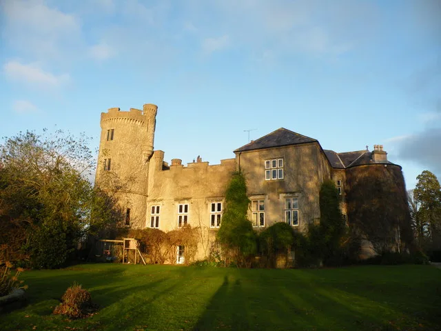
Ballybentragh in Northern Ireland, United Kingdom.

Wikimedia Commons licence
Plan your visit
- Typical visit
- 1 h–2 h
- Nearest railway station
- Antrim · 6.5 km
- Free entry
- Dog-friendly
About
Ballybentragh is a place of interest in Northern Ireland, United Kingdom — drawn from open-data sources for visitor reference. See the linked Wikipedia article for the full description.
Photo gallery
From the Wikipedia article
Ballybentragh (from Irish Baile Beanntrach, meaning 'townland of the hilly places') is a townland of 402 acres in County Antrim, Northern Ireland. It is situated in the civil parish of Grange of Nilteen and the historic barony of Antrim Upper.
Excerpt from Wikipedia under CC BY-SA 4.0. See the source article linked in Sources below.
- Coordinates
- 54.7114, -6.1108
- District
- Antrim and Newtownabbey
- Postcode
- BT39 0DE
- Parliamentary constituency
- South Antrim
- Nearest railway station
- Antrim — 6.5 km
Sources
- wikidata: Q4851993 (CC0)
- wikipedia: Ballybentragh (CC BY-SA 4.0)
Other places nearby

Parkgate
Natural landmarks · 0.6 km

DoubleTree by Hilton Belfast Templepatrick
Hotels · 1.1 km

Templeton Mausoleum
Memorials & monuments · 1.1 km

M2 motorway
Natural landmarks · 1.5 km
Castle Upton
Castles · 1.5 km

Templepatrick railway station
Natural landmarks · 1.6 km

The Landscape Centre
Museums · 1.9 km

Ballycushan
Natural landmarks · 2.0 km

Moyadam
Natural landmarks · 2.1 km

Islandreagh
Natural landmarks · 2.9 km

Donegore
Towns & cities · 3.1 km

Tobergill
Natural landmarks · 3.3 km
Nearby
📷 2📷 5Hotels · Northern Ireland
DoubleTree by Hilton Belfast Templepatrick
DoubleTree by Hilton Belfast Templepatrick — a hotel in northern ireland. 4-star. Brand: Hilton.
📷 5Memorials & monuments · Northern Ireland
Templeton Mausoleum
Templeton Mausoleum — a memorial in northern-ireland, United Kingdom.
📷 4Natural landmarks · Northern Ireland
M2 motorway
M2 motorway in Northern Ireland, United Kingdom.
📷 3📷 4Natural landmarks · Northern Ireland
Templepatrick railway station
Templepatrick railway station in Northern Ireland, United Kingdom.
Where to eat & stay near Ballybentragh
Places to stay
📷 5Hotels · Northern Ireland
DoubleTree by Hilton Belfast Templepatrick
DoubleTree by Hilton Belfast Templepatrick — a hotel in northern ireland. 4-star. Brand: Hilton.
 📷 3
📷 3 📷 5
📷 5Caravan parks · Northern Ireland
Six Mile Water Caravan Park
Six Mile Water Caravan Park — a caravan park in northern ireland.
 📷 5
📷 5Hotels · Northern Ireland
Maldron Hotel Belfast International
Maldron Hotel Belfast International — a hotel in northern ireland. 3-star. Brand: Maldron Hotels.
 📷 3
📷 3Caravan parks · Northern Ireland
Standing Stones Lodge Caravan Park
Standing Stones Lodge Caravan Park — a caravan park in northern ireland.
 📷 5
📷 5Hostels · Northern Ireland
Somerton Road Children's Home
Somerton Road Children's Home — a hostel in northern ireland.
Places to eat & drink
 📷 7
📷 7Historic pubs · Northern Ireland
Kelly's Cellars
Kelly's Cellars in Northern Ireland, United Kingdom.
 📷 5
📷 5 📷 7
📷 7Historic pubs · Northern Ireland
Crown Liquor Saloon
Crown Liquor Saloon in Northern Ireland, United Kingdom.
 📷 5
📷 5 📷 5
📷 5 📷 3
📷 3Historic pubs · Northern Ireland
Red Lion Pub bombing
Red Lion Pub bombing in Northern Ireland, United Kingdom.
More natural landmarks in this region
 Flagship📷 4
Natural landmarks · Northern Ireland
Lough Erne
Lough Erne — lake in County Fermanagh, Northern Ireland, UK.
 Flagship📷 4
Natural landmarks · Northern Ireland
Lough Neagh
Lough Neagh — large lake in Northern Ireland.
 📷 3
📷 3Natural landmarks · Northern Ireland
Ballysaggart Lough
Ballysaggart Lough — lake in the United Kingdom.
 📷 5
📷 5Natural landmarks · Northern Ireland
Belmore Mountain
Belmore Mountain — mountain in the United Kingdom.
Frequently asked questions
- Where is Ballybentragh?
- Ballybentragh is in Northern Ireland, United Kingdom (postcode BT39 0DE).
- What is Ballybentragh?
- Ballybentragh in Northern Ireland, United Kingdom.
- How do I get to Ballybentragh?
- The nearest railway station is Antrim, about 6.5 km away. Drivers can use postcode BT39 0DE.
- Is Ballybentragh free to visit?
- Yes, Ballybentragh is free to enter.
- How do I get to Ballybentragh?
- The nearest railway station is Antrim, about 6.5 km away. Drivers can navigate to postcode BT39 0DE.