Wildlife reserves · West Midlands
Badby Wood
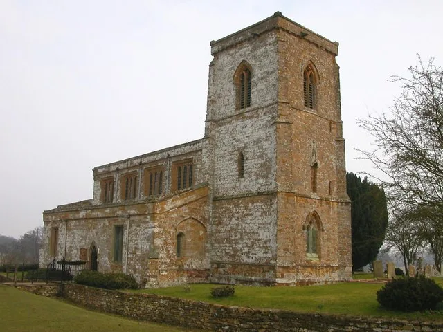
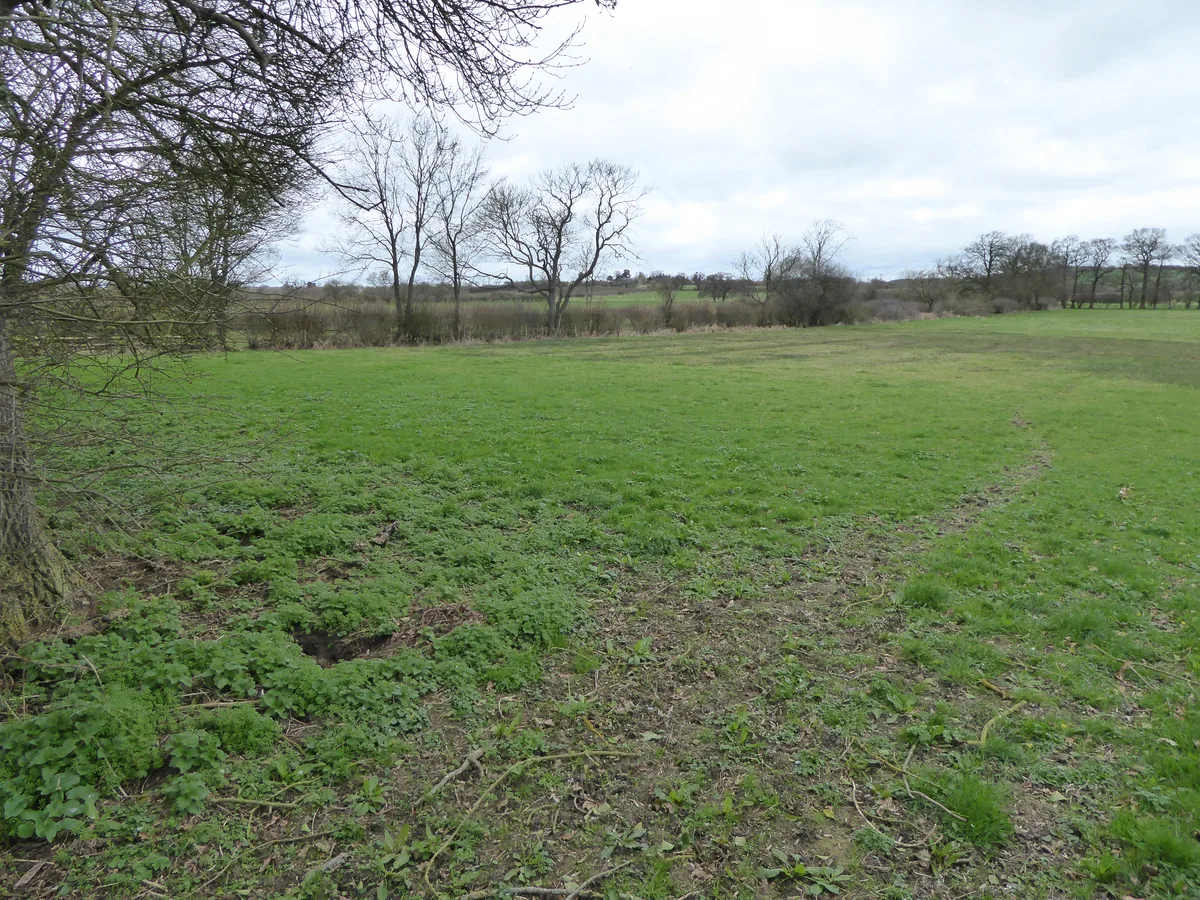
Badby Wood is a wildlife reserve in the United Kingdom.

Wikimedia Commons contributors — see linked file page for photographer and licence licence
Plan your visit
- Typical visit
- 2 h–4 h
- Best time of year
- Autumn & winter (migration & wildfowl)
- Free entry
- Dog-friendly
About
Badby Wood is a wildlife reserve in the United Kingdom. Coordinates: 52.2200°, -1.1770°. This entry is part of The Great Britain Guide, a free, ad-free, open-data tourist directory.
Photo gallery
Protected designations
- Site of Special Scientific Interest: Badby Wood SSSI
Designations sourced from Natural England open data under OGL v3.
From the Wikipedia article
Badby Wood is a 47.2-hectare (117-acre) biological Site of Special Scientific Interest (SSSI) south of Badby in Northamptonshire. This is ancient semi-natural woodland on acidic soils, and it has been forested for over 700 years. It is mainly pedunculate oak, with varied ground flora including creeping soft-grass, wood anemone, yellow archangel and bluebell. A small marsh has very diverse herbs. There is access by footpaths from Badby. Much of the eastern half of the wood falls outside the SSSI.
Excerpt from Wikipedia under CC BY-SA 4.0. See the source article linked in Sources below.
- Coordinates
- 52.2200, -1.1770
- District
- West Northamptonshire
- Parish
- Badby
- Postcode
- NN11 3AS
- Parliamentary constituency
- Daventry
Sources
- wikidata: Q29019738 (CC0)
- wikipedia: Badby Wood (CC BY-SA 4.0)
- commons: Badby Wood 3.jpg (CC BY-SA 4.0)
Other places nearby
Loading nearby places…
Nearby
 📷 3
📷 3Historic houses · West Midlands
Dower House
Dower House — a historic house in england-west-midlands, United Kingdom.
 📷 3
📷 3Historic churches · West Midlands
Church of St Mary the Virgin, Fawsley
Church of St Mary the Virgin, Fawsley — parish church in Fawsley, Northamptonshire, England, UK.
 📷 3
📷 3Historic houses · West Midlands
Fawsley Hall
Fawsley Hall — Grade I listed building in Fawsley, Northamptonshire, England, UK.
Hotels · West Midlands
Fawsley Hall Hotel & Spa
Fawsley Hall Hotel & Spa — a hotel in england west midlands. 4-star. Brand: Handpicked Hotels.
 📷 3
📷 3Historic churches · West Midlands
Church of St Michael and All Angels
Church of St Michael and All Angels — historic church in Newnham, Daventry, Northamptonshire, England, United Kingdom.
Vineyards · West Midlands
Arbury Hill, Badby
Arbury Hill, Badby — a UK vineyard in england west midlands, producing English or Welsh wine from cool-climate grape varieties.
More places in this region
 Flagship📷 3
Wildlife reserves · West Midlands
Abington Meadows
Abington Meadows — nature reserve in the United Kingdom.
 📷 5
📷 5Wildlife reserves · West Midlands
Brandon Marsh
Brandon Marsh — nature reserve in the United Kingdom.
 📷 5
📷 5Wildlife reserves · West Midlands
Bugbrooke Meadows
Bugbrooke Meadows — nature reserve in the United Kingdom.
 📷 5
📷 5Wildlife reserves · West Midlands
Chorleywood Common
Chorleywood Common — nature reserve in Hertfordshire, England.
Frequently asked questions
- Where is Badby Wood?
- Badby Wood is in the West Midlands, United Kingdom (postcode NN11 3AS), in the parish of Badby.
- Is Badby Wood a protected site?
- Yes — Badby Wood is part of the Badby Wood SSSI Site of Special Scientific Interest.
- Is Badby Wood free to visit?
- Yes, Badby Wood is free to enter.
- How do I get to Badby Wood?
- Drivers can navigate to postcode NN11 3AS. It sits within the Daventry parliamentary constituency.
- Are dogs allowed at Badby Wood?
- Most wildlife reserves allow dogs on lead only, with restrictions during ground-nesting bird season (March-July). Check signage at the reserve.