
Historic bridges · Scottish Lowlands
Back Burn Road Bridge
In or near Wanlockhead.
Back Burn Road Bridge — category C listed building-listed bridge in scotland-lowlands, United Kingdom.

david johnston — CC BY-SA 2.0 via Wikimedia Commons licence

Plan your visit
- Typical visit
- 15 min–30 min
- Nearest railway station
- Sanquhar · 2.7 km
- Free entry
- Dog-friendly
Getting there & planning your visit
To visit Back Burn Road Bridge, the nearest railway station is Sanquhar, located 2.7 km away. The postcode for navigation is DG4 6LD, and entry to the bridge is free.
About
Back Burn Road Bridge is a category C listed building-listed bridge in scotland-lowlands, United Kingdom, registered on the Historic Environment Scotland register (entry LB17251). Listed status protects buildings and structures of special architectural or historic interest. See the linked Wikipedia article for further details.
Photo gallery
Heritage listing
Category C Date Added 26/06/1986 Local Authority Dumfries And Galloway Planning Authority Dumfries And Galloway Parish Sanquhar NGR NS 79579 07960 Coordinates 279579, 607960 — Built 1819. Small, single segmental-arch road bridge with ramped parapets, corniced square terminal piers with pyramidal caps. Rubble-built with ashlar dressings.
From Historic Environment Scotland under OGL v3.
Place summary
Back Burn Road Bridge is a bridge located in the Scottish Lowlands. It is designated as a category C listed building, indicating its historical interest and contribution to the local heritage.
AI-generated from the structured facts on this page (operator, designation, listing, era). Not a substitute for visiting.
- Coordinates
- 55.3509, -3.9007
- District
- Dumfries and Galloway
- Postcode
- DG4 6LD
- Parliamentary constituency
- Dumfriesshire, Clydesdale and Tweeddale
- Nearest railway station
- Sanquhar — 2.7 km
Sources
- wikidata: Q56622754 (CC0)
Other places nearby

Eliock House Bridge
Historic bridges · 0.6 km

Ryehill Motte
Archaeological sites · 0.6 km

Eliock Bridge
Historic bridges · 0.9 km

Mennock
Villages · 1.3 km
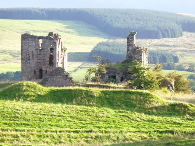
Sanquhar Castle
Castles · 1.7 km

St Ninian's Church, Sanquhar
Historic churches · 2.1 km

Sanquhar
Villages · 2.1 km

Monument, High Street, Sanquhar
Memorials & monuments · 2.2 km
Sanquhar declaration of 1680 and protestation of 1685 monument
Memorials & monuments · 2.2 km

Eliock
Villages · 2.2 km

Euchan Bridge
Historic bridges · 2.3 km

Sanquhar Tolbooth Museum
Museums · 2.4 km
Nearby
📷 5Historic bridges · Scottish Lowlands
Eliock House Bridge
Eliock House Bridge — category C listed building-listed bridge in scotland-lowlands, United Kingdom.
📷 3Archaeological sites · Scottish Lowlands
Ryehill Motte
Ryehill Motte — a archaeological in scotland-lowlands, United Kingdom.
📷 5Historic bridges · Scottish Lowlands
Eliock Bridge
Eliock Bridge — category B listed building-listed bridge in scotland-lowlands, United Kingdom.
📷 5📷 3Castles · Scottish Lowlands
Sanquhar Castle
Sanquhar Castle — castle in Dumfries and Galloway, Scotland, UK.
📷 5Historic churches · Scottish Lowlands
St Ninian's Church, Sanquhar
St Ninian's Church, Sanquhar — category B listed building-listed church in scotland-lowlands, United Kingdom.
Where to eat & stay near Back Burn Road Bridge
Places to stay
 📷 5
📷 5Campsites · Scottish Lowlands
Informal campsite- no facilities
Informal campsite- no facilities — a campsite in scotland lowlands.
 📷 5
📷 5Caravan parks · Scottish Lowlands
Penpont Caravan Site
Penpont Caravan Site — a caravan park in scotland lowlands.
 📷 5
📷 5Caravan parks · Scottish Lowlands
DL Tait Rural
DL Tait Rural — a caravan park in scotland lowlands.
 📷 5
📷 5Campsites · Scottish Lowlands
Oakbank Farm Campsite
Oakbank Farm Campsite — a campsite in scotland lowlands.
 📷 5
📷 5Caravan parks · Scottish Lowlands
Mount View Caravan Park
Mount View Caravan Park — a caravan park in scotland lowlands.
 📷 5
📷 5Hostels · Scottish Lowlands
Rivox Bunkhouse
Rivox Bunkhouse — a hostel in scotland lowlands.
Places to eat & drink
 📷 7
📷 7Historic pubs · Scottish Lowlands
Queensberry Arms Hotel
Queensberry Arms Hotel in Scotland Lowlands, United Kingdom.
 📷 7
📷 7Historic pubs · Scottish Lowlands
Hopetoun Arms Hotel, Leadhills
Hopetoun Arms Hotel, Leadhills in Scotland Lowlands, United Kingdom.
 📷 7
📷 7Historic pubs · Scottish Lowlands
Post Horn Hotel, Crawford
Post Horn Hotel, Crawford in Scotland Lowlands, United Kingdom.
 📷 7
📷 7Historic pubs · Scottish Lowlands
Douglas Arms Hotel, Douglas
Douglas Arms Hotel, Douglas in Scotland Central, United Kingdom.
 📷 7
📷 7More bridges in this region
 📷 5
📷 5 📷 3
📷 3Historic bridges · Scottish Lowlands
Spittal-on-Rule
Spittal-on-Rule in England North East, United Kingdom.
 📷 4
📷 4Historic bridges · Scottish Lowlands
Coldstream Bridge
Coldstream Bridge in England North East, United Kingdom.
 📷 3
📷 3Frequently asked questions
- Where is Back Burn Road Bridge?
- Back Burn Road Bridge is in the Scottish Lowlands, United Kingdom (postcode DG4 6LD).
- What is Back Burn Road Bridge?
- Back Burn Road Bridge — category C listed building-listed bridge in scotland-lowlands, United Kingdom.
- How do I get to Back Burn Road Bridge?
- The nearest railway station is Sanquhar, about 2.7 km away. The nearest town is Wanlockhead. Drivers can use postcode DG4 6LD.
- Is Back Burn Road Bridge a listed building?
- Back Burn Road Bridge is officially recognised as category C listed building listed.
- Is Back Burn Road Bridge free to visit?
- Yes, Back Burn Road Bridge is free to enter.
- How do I get to Back Burn Road Bridge?
- The nearest railway station is Sanquhar, about 2.7 km away. Drivers can navigate to postcode DG4 6LD.