
Caves · North West England
Aygill Caverns
In or near Whittington.
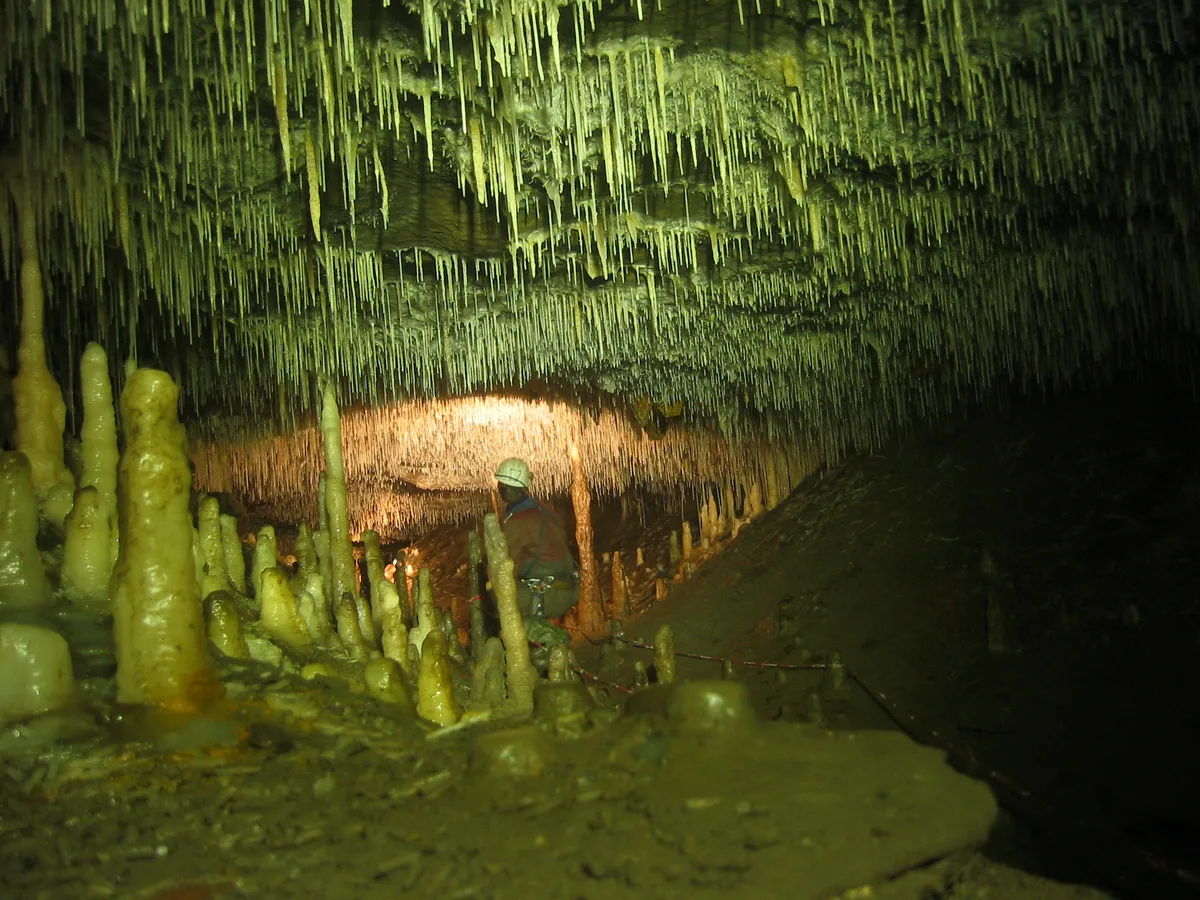
Aygill Caverns — cave in england north west.

Peter Wood — CC BY-SA 2.0 via Wikimedia Commons licence

Plan your visit
- Typical visit
- 45 min–1.5 h
About
Aygill Caverns is a cave located in england north west. A British cave recorded in OpenStreetMap. Most are in carboniferous limestone country.
Photo gallery
Protected designations
- Site of Special Scientific Interest: Leck Beck Head Catchment Area SSSI
Designations sourced from Natural England open data under OGL v3.
Place summary
Aygill Caverns is a cave located in North-West England. It features a series of underground passages and chambers, offering a glimpse into the geological formations of the region. Visitors can explore the unique rock formations and learn about the cave's natural history. The site provides a fascinating environment for those interested in geology and subterranean landscapes.
AI-generated from the structured facts on this page (operator, designation, listing, era). Not a substitute for visiting.
- Coordinates
- 54.2311, -2.5178
- District
- Westmorland and Furness
- Parish
- Barbon
- Postcode
- LA6 2LQ
- Parliamentary constituency
- Morecambe and Lunesdale
Sources
- osm: n4772984270 (ODbL)
Other places nearby
Ayegill Caverns
Caves · 0.0 km

Casterton Pot
Caves · 0.2 km

Bull Pot of the Witches
Caves · 0.5 km

Ian David Plant
Memorials & monuments · 0.5 km
Hidden Pot
Caves · 0.6 km

Cow Pot
Caves · 1.0 km
Easegill System
Mountains & hills · 1.1 km

Lancaster Hole
Caves · 1.1 km

Blindbeck Bridge
Historic bridges · 1.1 km

Mistral Hole
Caves · 1.5 km
Mistral Hole
Caves · 1.5 km

Link Pot
Caves · 1.6 km
Nearby
📷 5Caves · North West England
Ayegill Caverns
Ayegill Caverns — a cave broad in england-north-west, United Kingdom.
📷 5Caves · North West England
Casterton Pot
Casterton Pot — a cave broad in england-north-west, United Kingdom.
📷 3Caves · North West England
Bull Pot of the Witches
Bull Pot of the Witches is a cave in the United Kingdom.
📷 3Memorials & monuments · North West England
Ian David Plant
Ian David Plant — a memorial in england-north-west, United Kingdom.
📷 3📷 3Where to eat & stay near Aygill Caverns
Places to stay
 📷 5
📷 5Caravan parks · North West England
Woodclose Park
Woodclose Park — a caravan park in england north west.
📷 5Caravan parks · North West England
Woodclose Park
Woodclose Park — a caravan park in england north west.
 📷 5
📷 5Caravan parks · North West England
Fell View Park
Fell View Park — a caravan park in england north west.
📷 5Caravan parks · North West England
Woodclose Park
Woodclose Park — a caravan park in england north west.
 📷 5
📷 5Campsites · North West England
New House Caravan Park
New House Caravan Park — a campsite in england north west.
 📷 5
📷 5Hotels · North West England
The Royal Hotel
The Royal Hotel — a hotel in england north west.
Places to eat & drink
 📷 5
📷 5Historic pubs · North West England
Punch Bowl Hotel
Punch Bowl Hotel in England North West, United Kingdom.
 📷 5
📷 5Cafés · North West England
Gun Dog Coffee Shop
Gun Dog Coffee Shop — a café in england north west.
 📷 5
📷 5 📷 5
📷 5Historic pubs · North West England
Horse And Farrier Inn
Horse And Farrier Inn in England North West, United Kingdom.
 📷 5
📷 5Cafés · North West England
Lakehouse Food & Drink
Lakehouse Food & Drink — a café in england north west.
 📷 5
📷 5Cafés · North West England
The Cross Keys Temperance Inn
The Cross Keys Temperance Inn — a café in england north west.
More caves in this region
 📷 3
📷 3 📷 3
📷 3 📷 3
📷 3 📷 3
📷 3Caves · North West England
Austwick Beck Head
Austwick Beck Head is a cave in the United Kingdom.
Frequently asked questions
- Where is Aygill Caverns?
- Aygill Caverns is in North-West England, United Kingdom (postcode LA6 2LQ), in the parish of Barbon.
- What is Aygill Caverns?
- Aygill Caverns — cave in england north west.
- How do I get to Aygill Caverns?
- The nearest town is Whittington. Drivers can use postcode LA6 2LQ.
- Is Aygill Caverns a protected site?
- Yes — Aygill Caverns is part of the Leck Beck Head Catchment Area SSSI Site of Special Scientific Interest.
- How do I get to Aygill Caverns?
- Drivers can navigate to postcode LA6 2LQ. It sits within the Morecambe and Lunesdale parliamentary constituency.