
Mountains & hills · Scottish Lowlands
Auld Hill
In or near West Kilbride.
Auld Hill — mountain in scotland highlands. Elevation: 42 m.

Raibeart MacAoidh — CC BY-SA 2.0 via Wikimedia Commons licence

Plan your visit
- Typical visit
- 3 h–8 h
- Best time of year
- Late spring – early autumn (May–Oct)
- Nearest railway station
- West Kilbride · 3.1 km
- Dog-friendly
About
Auld Hill is a mountain located in scotland highlands. Elevation: 42 m. A named British peak recorded in OpenStreetMap. Peaks are typically named on Ordnance Survey 1:50k mapping.
Photo gallery
Place summary
Auld Hill is a mountain located in the Scottish Highlands. This prominent geographical feature offers expansive views of the surrounding landscape. Visitors can expect a rugged terrain typical of the Highlands, suitable for various outdoor activities such as hiking and photography. The area is known for its natural beauty and remote atmosphere.
AI-generated from the structured facts on this page (operator, designation, listing, era). Not a substitute for visiting.
- Coordinates
- 55.7005, -4.9000
- District
- North Ayrshire
- Postcode
- KA23 9QA
- Parliamentary constituency
- North Ayrshire and Arran
- Nearest railway station
- West Kilbride — 3.1 km
Sources
- osm: n3054009265 (ODbL)
Other places nearby

Auld Hill, dun site
Archaeological sites · 0.1 km
Portencross, Auld Hill
Vineyards · 0.1 km
Portencross
Villages · 0.2 km

North Harbour, Portencross
Marinas · 0.3 km

Old Harbour, Portencross
Harbours & ports · 0.3 km

Portencross Castle
Castles · 0.3 km

Portencross Pier
Piers · 0.4 km

Roman Battle Ground 1216
Forts · 1.1 km

Ardneil Bay
Beaches · 1.1 km
Battlefield (1215)
Battlefields & battle sites · 1.2 km

Goldenberry Hill
Mountains & hills · 1.4 km
Goldenberry Hill
Mountains & hills · 1.4 km
Nearby
📷 3Archaeological sites · Scottish Lowlands
Auld Hill, dun site
Auld Hill, dun site — an archaeological site in Scottish Lowlands, United Kingdom.
📷 5Vineyards · Scottish Lowlands
Portencross, Auld Hill
Portencross, Auld Hill — a UK vineyard in scotland highlands, producing English or Welsh wine from cool-climate grape varieties.
📷 5📷 5Marinas · Scottish Lowlands
North Harbour, Portencross
North Harbour, Portencross — a marina in scotland highlands.
📷 3Harbours & ports · Scottish Lowlands
Old Harbour, Portencross
Old Harbour, Portencross — architectural structure in North Ayrshire, Scotland, UK.
📷 3Castles · Scottish Lowlands
Portencross Castle
Portencross Castle — castle in Portencross, Scotland.
Where to eat & stay near Auld Hill
Places to stay
 📷 5
Caravan parks · Scottish Lowlands
Waterside Caravan Park
Waterside Caravan Park — a caravan park in scotland highlands.
 📷 5
Caravan parks · Scottish Lowlands
Crosbie Towers
Crosbie Towers — a caravan park in scotland highlands.
 📷 5
Caravan parks · Scottish Lowlands
Glenview Caravan Park
Glenview Caravan Park — a caravan park in scotland highlands.
 📷 5
Caravan parks · Scottish Lowlands
Westbourne House Caravan Park
Westbourne House Caravan Park — a caravan park in scotland highlands.
 📷 5
Caravan parks · Central Scotland
Garrison Motorhome Site
Garrison Motorhome Site — a caravan park in scotland highlands.
 📷 5
Caravan parks · Central Scotland
Millport Holiday Park
Millport Holiday Park — a caravan park in scotland highlands.
Places to eat & drink
 📷 5
Historic pubs · Scottish Lowlands
Nichols Bar, 19 Harbour Street, 17, Ardrossan
Nichols Bar, 19 Harbour Street, 17, Ardrossan in Scotland Central, United Kingdom.
 📷 5
Restaurants · Scottish Lowlands
Braidwoods
Braidwoods — a restaurant in scotland highlands.
 📷 7
Historic pubs · Scottish Lowlands
Champion Shell Inn, 5 Schoolwell Street, Stevenston
Champion Shell Inn, 5 Schoolwell Street, Stevenston in Scotland Central, United Kingdom.
 📷 5
Historic pubs · Scottish Lowlands
The Auld Hoose Bar, 9 Main Street, Dalry
The Auld Hoose Bar, 9 Main Street, Dalry in Scotland Central, United Kingdom.
 📷 5
Historic pubs · Scottish Lowlands
Kingsway Bar, 26-28 Main Street, Kilwinning
Kingsway Bar, 26-28 Main Street, Kilwinning in Scotland Central, United Kingdom.
 📷 6
Historic pubs · Scottish Lowlands
Corrie Hotel
Corrie Hotel in Scotland Central, United Kingdom.
More mountains in this region
 📷 3
 📷 5
Mountains & hills · Scottish Lowlands
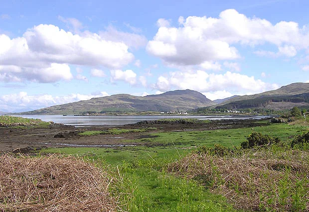
Aros Bay
Aros Bay — bay on Islay, Argyll and Bute, Scotland, UK.
 📷 3
Mountains & hills · Scottish Lowlands
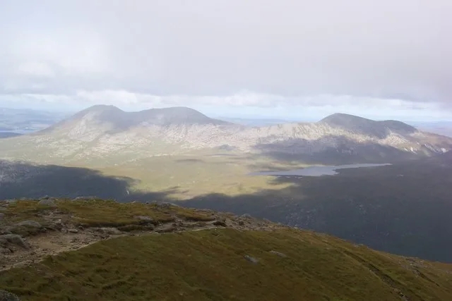
Beinn Bharrain
Beinn Bharrain — Named summit at 717 m.
 📷 5
Frequently asked questions
- Where is Auld Hill?
- Auld Hill is in the Scottish Lowlands, United Kingdom (postcode KA23 9QA).
- What is Auld Hill?
- Auld Hill — mountain in scotland highlands. Elevation: 42 m.
- How do I get to Auld Hill?
- The nearest railway station is West Kilbride, about 3.1 km away. The nearest town is West Kilbride. Drivers can use postcode KA23 9QA.
- How do I get to Auld Hill?
- The nearest railway station is West Kilbride, about 3.1 km away. Drivers can navigate to postcode KA23 9QA.