
Museums · East of England
Attleborough
In or near Great Ellingham.
Attleborough is a market town and civil parish located on the A11 road between Norwich and Thetford in Norfolk, England. The parish is in the district of Breckland and has an area of 21.9 square kilom

James Allan — CC BY-SA 2.0 via Wikimedia Commons licence

Plan your visit
- Typical visit
- 1.5 h–3 h
- Best time of year
- Year-round
- Nearest railway station
- Attleborough · 0.6 km
- Free entry
- Family-friendly
- Limited wheelchair access
Getting there & planning your visit
To visit Attleborough museum, the nearest railway station is Attleborough, located 0.6 km away. The postcode for the museum is NR17 2RB. Please note that wheelchair accessibility is limited.
About
Attleborough is a market town and civil parish located on the A11 road between Norwich and Thetford in Norfolk, England. The parish is in the district of Breckland and has an area of 21.9 square kilometres (8.5 sq mi). The 2001 Census recorded the town as having a population of 9,702 distributed between 4,185 households, increasing to a population of 10,482 in 4,481 households in the 2011 Census. In 2021 the population was 11,232 Attleborough is in the Mid-Norfolk constituency of the UK Parliament, represented since the 2010 general election by the Conservative MP George Freeman. Attleborough railway station provides a main line rail service to both Norwich and Cambridge.
Photo gallery
Official information
Attleborough is a market town in Breckland, known for its local governance by the Town Council. The town features various community facilities including the Town Hall and Archive Room, which hosts meetings and events.
From the Wikipedia article
Attleborough is a market town and civil parish located on the A11 road between Norwich and Thetford in Norfolk, England. The parish is in the district of Breckland and has an area of 21.9 square kilometres (8.5 sq mi). The 2001 Census recorded the town as having a population of 9,702 distributed between 4,185 households, increasing to a population of 10,482 in 4,481 households in the 2011 Census. In 2021 the population was 11,232 Attleborough is in the Mid-Norfolk constituency of the UK Parliament, represented since the 2010 general election by the Conservative MP George Freeman. Attleborough railway station provides a main line rail service to both Norwich and Cambridge.
Excerpt from Wikipedia under CC BY-SA 4.0. See the source article linked in Sources below.
Background
History
The Anglo-Saxon foundation of the settlement is unrecorded. A popular theory of the town's origin makes it a foundation of an Atlinge, and certainly burgh (or burh) indicates that it was fortified at an early date. According to the mid-12th century hagiographer of Saint Edmund, Geoffrey of Wells, Athla was the founder of the Ancient and royal town of Attleborough in Norfolk. In the Domesday Book of 1086 it is referred to as Attleburc. After the Danes swept across Norfolk and seized Thetford, it is believed that the Saxons rallied their forces at Attleborough and probably threw up some form of protection. Although the Saxons put up a vigorous resistance, they eventually capitulated to the…
Sourced from Wikipedia under CC BY-SA 4.0.
- Coordinates
- 52.5200, 1.0200
- County
- Norfolk
- District
- Breckland
- Parish
- Attleborough
- Postcode
- NR17 2RB
- Parliamentary constituency
- Mid Norfolk
- Nearest railway station
- Attleborough — 0.6 km
- Official site
- www.attleboroughtc.org.uk
Sources
- wikipedia: Attleborough (CC BY-SA 4.0)
Other places nearby

Attleborough Market
Farmers’ markets · 0.3 km

Griffin Hotel, Attleborough
Historic houses · 0.3 km

Griffin Hotel, Attleborough
Historic pubs · 0.3 km

Attleborough Village Sign
Public art & sculpture · 0.3 km

Attleborough War Memorial
Memorials & monuments · 0.4 km
Amoghasiddhi Buddhist Centre
Historic churches · 0.4 km

Attleborough Hall
Historic houses · 0.6 km

Oak Tree Touring Caravan Park
Caravan parks · 0.8 km

Besthorpe War Memorial
Memorials & monuments · 1.5 km

Besthorpe Village Sign
Public art & sculpture · 1.6 km
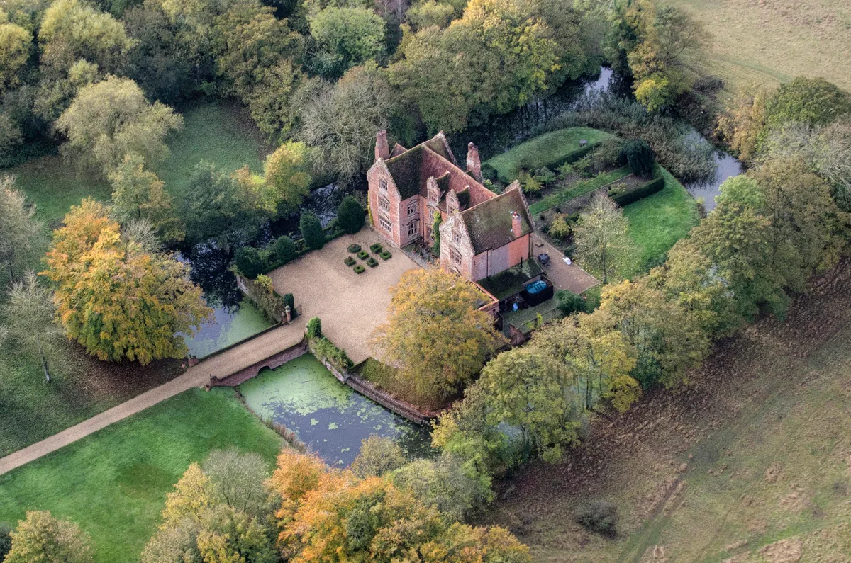
Morley Old Hall
Castles · 2.8 km

Mill Farm
Caravan parks · 3.3 km
Nearby
📷 5Farmers’ markets · East of England
Attleborough Market
Attleborough Market — a UK farmers' market in england east.
📷 4Historic houses · East of England
Griffin Hotel, Attleborough
Griffin Hotel, Attleborough — a Grade II-listed historic house in england-east, United Kingdom.
📷 5Historic pubs · East of England
Griffin Hotel, Attleborough
Griffin Hotel, Attleborough in England East, United Kingdom.
📷 3Public art & sculpture · East of England
Attleborough Village Sign
Attleborough Village Sign — a public art in East of England, United Kingdom.
📷 3Memorials & monuments · East of England
Attleborough War Memorial
Attleborough War Memorial — Grade II listed building-listed memorial in england-east, United Kingdom.
📷 5Historic churches · East of England
Amoghasiddhi Buddhist Centre
Amoghasiddhi Buddhist Centre — a church in East of England, United Kingdom.
Where to eat & stay near Attleborough
Places to stay
📷 5Caravan parks · East of England
Oak Tree Touring Caravan Park
Oak Tree Touring Caravan Park — a caravan park in england east.
📷 5 📷 5
📷 5Campsites · East of England
Old Buckenham Country Park
Old Buckenham Country Park — a campsite in england east.
 📷 5
📷 5 📷 5
📷 5 📷 5
📷 5Places to eat & drink
📷 5Historic pubs · East of England
Griffin Hotel, Attleborough
Griffin Hotel, Attleborough in England East, United Kingdom.
 📷 5
📷 5Historic pubs · East of England
Green Dragon Public House
Green Dragon Public House in England East, United Kingdom.
 📷 5
📷 5 📷 5
📷 5 📷 7
📷 7Historic pubs · East of England
The Fighting Cocks Public House
The Fighting Cocks Public House in England East, United Kingdom.
 📷 5
📷 5Historic pubs · East of England
The Countryman Public House
The Countryman Public House in England East, United Kingdom.
More museums in this region
 📷 5
📷 5Museums · East of England
American Air Museum
American Air Museum — museum at Imperial War Museum Duxford, Cambridgeshire, England, UK.
 📷 5
📷 5Museums · East of England
Ashwell Village Museum
Ashwell Village Museum — historic building museum in Ashwell, Hertfordshire, England, United Kingdom.
 📷 5
📷 5Museums · East of England
Barleylands Farm Museum
Barleylands Farm Museum — Farm museum in Billericay, England.
 📷 5
📷 5Museums · East of England
Cromwell Museum
Cromwell Museum — museum in Huntingdon, England, United Kingdom.
Frequently asked questions
- Where is Attleborough?
- Attleborough is in Norfolk, East of England, United Kingdom (postcode NR17 2RB), in the parish of Attleborough.
- What is Attleborough?
- Attleborough is a market town and civil parish located on the A11 road between Norwich and Thetford in Norfolk, England. The parish is in the district of Breckland and has an area of 21.9 square kilom
- How do I get to Attleborough?
- The nearest railway station is Attleborough, about 0.6 km away. The nearest town is Great Ellingham. Drivers can use postcode NR17 2RB.
- Is Attleborough free to visit?
- Yes, Attleborough is free to enter.
- How do I get to Attleborough?
- The nearest railway station is Attleborough, about 0.6 km away. Drivers can navigate to postcode NR17 2RB.