
Archaeological sites · South East England
Asthall Barrow: an Anglo-Saxon burial mound 100m SSW of Barrow Farm
In or near Westwell.
Asthall Barrow: an Anglo-Saxon burial mound 100m SSW of Barrow Farm — archaeological site in Asthall, West Oxfordshire, England, UK.

Wikimedia Commons contributors — see linked file page for photographer and licence licence
.jpg)
Plan your visit
- Typical visit
- 45 min–1.5 h
- Nearest railway station
- Shipton · 8.6 km
- Free entry
- Dog-friendly
Getting there & planning your visit
Asthall Barrow is located in the West Midlands, with the nearest railway station being Shipton, approximately 8.6 km away. The site is free to enter and is accessible for visitors. The postcode for navigation is OX18 4HJ.
About
Asthall Barrow: an Anglo-Saxon burial mound 100m SSW of Barrow Farm is an archaeological site in the United Kingdom. Heritage designation: scheduled monument. Wikidata describes it as: "archaeological site in Asthall, West Oxfordshire, England, UK". Coordinates: 51.7889°, -1.5811°.
Photo gallery
See it from the streetimagery from 2019
Imagery © Mapillary contributors, CC BY-SA 4.0
Protected designations
- Area of Outstanding Natural Beauty: Cotswolds
Designations sourced from Natural England open data under OGL v3.
From the Wikipedia article
Asthall barrow is a high-status Anglo-Saxon burial mound from the seventh century AD. It is located in Asthall, Oxfordshire, and was excavated in 1923 and 1924.
Excerpt from Wikipedia under CC BY-SA 4.0. See the source article linked in Sources below.
Background
Architecture
]] The barrow stands 2.4 m high, and is about 55 ft in diameter. It was recorded as 8 ft high around 1907, but, in 1923, as 12 ft high. It is surrounded by a 4 ft high dry stone retaining wall. Once covered in trees including beeches and firs, likely planted in the nineteenth century, the barrow is now topped by a single, prominent, sycamore; the remaining growth was removed during conservation work in 2017 or 2018. The presence of Romano–British grey wares in the barrow's soil, like the downward sloping surrounding land, suggests that the barrow may have been constructed by scraping up the surrounding topsoil. The land around the barrow is cultivated up to its edges, and in 1992 was…
Sourced from Wikipedia under CC BY-SA 4.0.
- Coordinates
- 51.7889, -1.5811
- County
- Oxfordshire
- District
- West Oxfordshire
- Parish
- Asthall
- Postcode
- OX18 4HJ
- Parliamentary constituency
- Witney
- Nearest railway station
- Shipton — 8.6 km
Sources
- wikidata: Q17648985 (CC0)
- wikipedia: Asthall barrow (CC BY-SA 4.0)
- commons: Asthall Barrow (geograph 6581641).jpg (CC BY-SA 4.0)
Other places nearby

Asthall Barrow
Burial mounds & barrows · 0.0 km

Asthall Manor
Historic houses · 1.3 km

Crocodiles of the World
Zoos & aquariums · 1.3 km

Bridge Over Windrush And Stone Stiles
Historic bridges · 1.4 km

Swinbrook
Villages · 2.2 km

Minster Lovell
Villages · 2.3 km

Widford Bridge
Historic bridges · 2.4 km

Bridge And Attached Retaining Wall
Historic bridges · 2.6 km

Medieval settlement of Widford immediately east of Manor Farm
Vineyards · 2.6 km

Minster Lovell War Memorial
Memorials & monuments · 2.6 km

Shilton Manor
Manor houses · 2.6 km

Church of St Britius
Historic churches · 2.7 km
Nearby
📷 3Burial mounds & barrows · South East England
Asthall Barrow
Asthall Barrow — a burial mound in england-west-midlands, United Kingdom.
📷 4Historic houses · South East England
Asthall Manor
Asthall Manor — a Grade II*-listed historic house in england-west-midlands, United Kingdom.
📷 3Zoos & aquariums · South East England
Crocodiles of the World
Crocodiles of the World — zoo in Oxfordshire, England.
📷 3Historic bridges · South East England
Bridge Over Windrush And Stone Stiles
Bridge Over Windrush And Stone Stiles — Grade II listed building-listed bridge in england-west-midlands, United Kingdom.
📷 5📷 5Where to eat & stay near Asthall Barrow: an Anglo-Saxon burial mound 100m SSW of Barrow Farm
Places to stay
 📷 5
📷 5Caravan parks · South East England
New Look Mobile Home Park
New Look Mobile Home Park — a caravan park in england west midlands.
 📷 5
📷 5Caravan parks · South East England
Wysdom Touring Park
Wysdom Touring Park — a caravan park in england west midlands.
 📷 7
📷 7Hotels · South East England
The Prince of Burford
The Prince of Burford — a hotel in england west midlands.
 📷 7
📷 7Hotels · South East England
Highway Burford
Highway Burford — a hotel in england west midlands.
 📷 7
📷 7 📷 7
📷 7Hotels · South East England
Burford House
Burford House — a hotel in england west midlands.
Places to eat & drink
 📷 7
📷 7Historic pubs · South East England
The Merry Horn Public House
The Merry Horn Public House in England South East, United Kingdom.
 📷 7
📷 7Restaurants · South East England
Spice lounge
Spice lounge — a restaurant in england west midlands.
 📷 7
📷 7 📷 7
📷 7Historic pubs · South East England
New Inn Public House
New Inn Public House in England South East, United Kingdom.
📷 7Historic pubs · South East England
The Butcher's Arms Public House
The Butcher's Arms Public House in England South East, United Kingdom.
 📷 7
📷 7Historic pubs · South East England
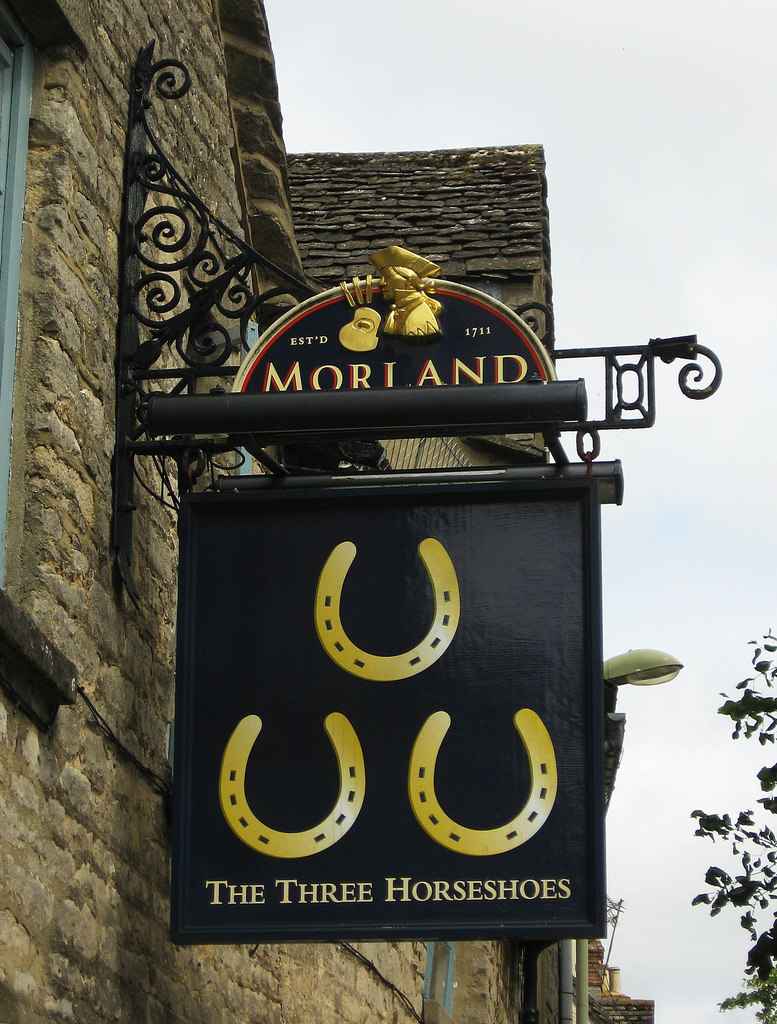
The Three Horseshoes Public House
The Three Horseshoes Public House in England South East, United Kingdom.
More archaeological sites in this region
 📷 5
📷 5Archaeological sites · South East England
Chatham Dockyard, site of South Mast Pond
Chatham Dockyard, site of South Mast Pond — archaeological site in Medway, Kent, England, UK.
 📷 5
📷 5Archaeological sites · South East England
Open areas within Roman, Saxon and medieval town
Open areas within Roman, Saxon and medieval town — archaeological site in Medway, Kent, England, UK.
 📷 5
📷 5Archaeological sites · South East England
Oxmoor Copse
Oxmoor Copse — woodland in Surrey, England.
 📷 5
📷 5Frequently asked questions
- Where is Asthall Barrow: an Anglo-Saxon burial mound 100m SSW of Barrow Farm?
- Asthall Barrow: an Anglo-Saxon burial mound 100m SSW of Barrow Farm is in Oxfordshire, the West Midlands, United Kingdom (postcode OX18 4HJ), in the parish of Asthall.
- What is Asthall Barrow: an Anglo-Saxon burial mound 100m SSW of Barrow Farm?
- Asthall Barrow: an Anglo-Saxon burial mound 100m SSW of Barrow Farm — archaeological site in Asthall, West Oxfordshire, England, UK.
- How do I get to Asthall Barrow: an Anglo-Saxon burial mound 100m SSW of Barrow Farm?
- The nearest railway station is Shipton, about 8.6 km away. Drivers can use postcode OX18 4HJ.
- Is Asthall Barrow: an Anglo-Saxon burial mound 100m SSW of Barrow Farm a listed building?
- Asthall Barrow: an Anglo-Saxon burial mound 100m SSW of Barrow Farm is officially recognised as scheduled monument listed.
- Is Asthall Barrow: an Anglo-Saxon burial mound 100m SSW of Barrow Farm a protected site?
- Yes — Asthall Barrow: an Anglo-Saxon burial mound 100m SSW of Barrow Farm is part of the Cotswolds National Landscape (AONB).
- Is Asthall Barrow: an Anglo-Saxon burial mound 100m SSW of Barrow Farm free to visit?
- Yes, Asthall Barrow: an Anglo-Saxon burial mound 100m SSW of Barrow Farm is free to enter.
- How do I get to Asthall Barrow: an Anglo-Saxon burial mound 100m SSW of Barrow Farm?
- Drivers can navigate to postcode OX18 4HJ. It sits within the Witney parliamentary constituency.