
Museums · North West England
Aspatria
In or near Crosby.
Aspatria is a town and civil parish in Cumberland, Cumbria, England. The town rests on the north side of the Ellen Valley, overlooking a panoramic view of the countryside, with Skiddaw to the South a

The Carlisle Kid — CC BY-SA 2.0 via Wikimedia Commons licence
_-_geograph.org.uk_-_5391592.jpg)
Plan your visit
- Typical visit
- 1.5 h–3 h
- Best time of year
- Year-round
- Nearest railway station
- Aspatria · 0.5 km
- Family-friendly
- Limited wheelchair access
Getting there & planning your visit
To visit Aspatria museum, the nearest railway station is Aspatria, located 0.5 km away. The postcode for sat-nav is CA7 3AQ. Entry is free, but wheelchair accessibility is limited.
About
Aspatria is a town and civil parish in Cumberland, Cumbria, England. The town rests on the north side of the Ellen Valley, overlooking a panoramic view of the countryside, with Skiddaw to the South and the Solway Firth to the North. Its developments are aligned approximately east–west along the A596 Carlisle to Workington road and these extend to approximately 2 miles (3.2 km) in length. It lies about 8 miles (13 km) northeast of Maryport, a similar distance to the Southwest of Wigton, about 9 miles (14 km) north of Cockermouth and 5 miles (8.0 km) from the coast and Allonby. A Roman road leading from "Old Carlisle" to Ellenborough passed through the hamlet. It is served by Aspatria railway station. Aspatria is located on the fringe of the English Lake District. The parish church of St Kentigern was rebuilt in 1848. Fragments of masonry and crosses from earlier structures on the same site are preserved there.
Photo gallery
Protected designations
- Area of Outstanding Natural Beauty: Solway Coast
Designations sourced from Natural England open data under OGL v3.
From the Wikipedia article
Aspatria is a town and civil parish in Cumberland, Cumbria, England. The town rests on the north side of the Ellen Valley, overlooking a panoramic view of the countryside, with Skiddaw to the South and the Solway Firth to the North. Its developments are aligned approximately east–west along the A596 Carlisle to Workington road and these extend to approximately 2 miles (3.2 km) in length. It lies about 8 miles (13 km) northeast of Maryport, a similar distance to the Southwest of Wigton, about 9 miles (14 km) north of Cockermouth and 5 miles (8.0 km) from the coast and Allonby. A Roman road leading from "Old Carlisle" to Ellenborough passed through the hamlet. It is served by Aspatria railway station. Aspatria is located on the fringe of the English Lake District. The parish church of St Kentigern was rebuilt in 1848. Fragments of masonry and crosses from earlier structures on the same site are preserved there.
Excerpt from Wikipedia under CC BY-SA 4.0. See the source article linked in Sources below.
Background
Description
The manor of Aspatria is part of the ancient barony of Allerdale below Derwent. Awarded by Ranulph de Meschines, grantee of the whole of Cumberland from William the Conqueror, to Waltheof, son of Gospatrick, Earl of Dunbar, from whom the obsolete name of Aspatrick, may have been derived. Upon the division of the estates of William Fitz Duncan, and his wife Alice de Romney, among their three daughters, the manor passed to Alice, the youngest. However, Alice died without issue and the estates passed to an elder sister who had married into the Lucy family. The latter family terminated in a female heir Maud de Lucy. She married Henry Percy, the first Earl of Northumberland, who received the…
Sourced from Wikipedia under CC BY-SA 4.0.
- Coordinates
- 54.7633, -3.3281
- District
- Cumberland
- Parish
- Aspatria
- Postcode
- CA7 3AQ
- Parliamentary constituency
- Penrith and Solway
- Nearest railway station
- Aspatria — 0.5 km
Sources
- wikipedia: Aspatria (CC BY-SA 4.0)
Other places nearby
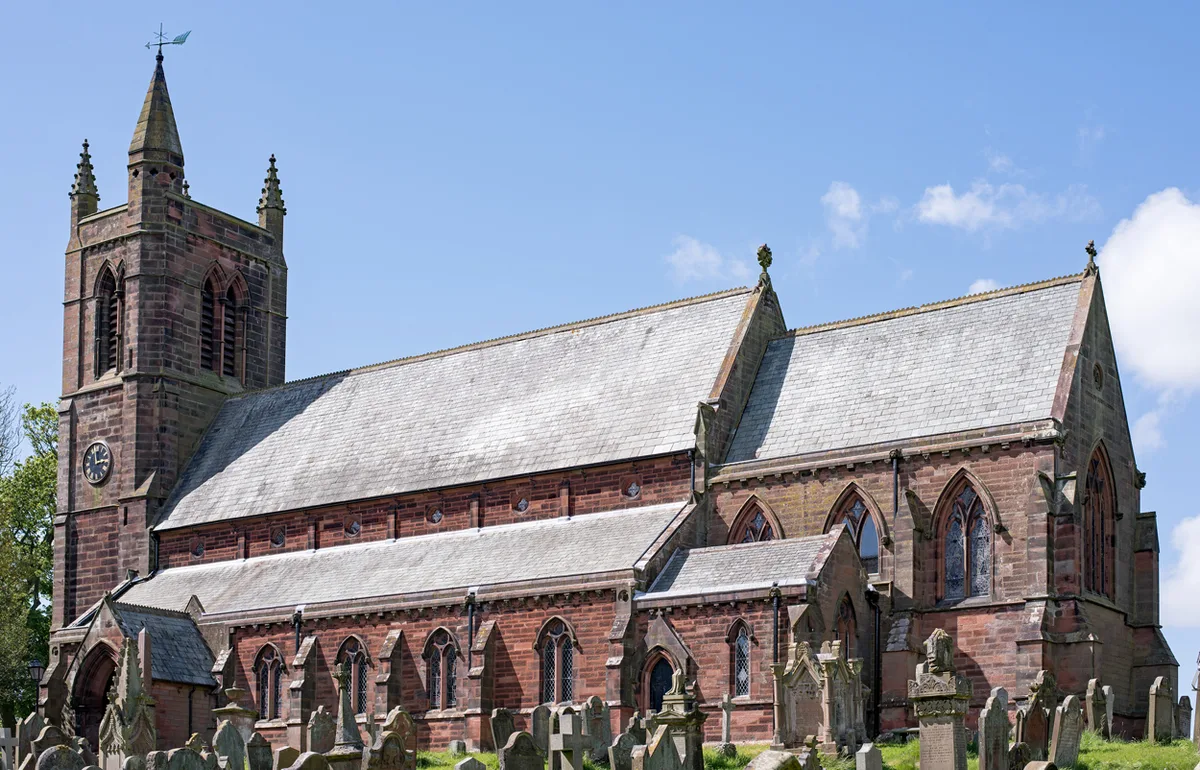
St. Kentigern's Church, Aspatria
Historic churches · 0.0 km

St Kentigern Cross
Memorials & monuments · 0.2 km

Queens Hall Cinema
Theatres · 0.4 km

Aspatria Castle
Literary houses · 1.2 km

Newton Castle
Castles · 2.6 km

Westnewton Castle
Castles · 2.6 km

Plumbland
Villages · 2.6 km

War Memorial on Village Green
Memorials & monuments · 3.2 km

Gallowbarrow Hill
Mountains & hills · 3.4 km
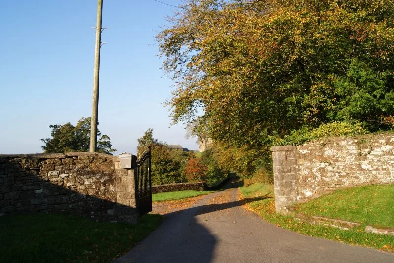
Hayton Castle
Castles · 3.6 km

Ellenhall Bridge
Historic bridges · 4.0 km

Former Congregational Chapel
Chapels · 4.1 km
Nearby
📷 3Historic churches · North West England
St. Kentigern's Church, Aspatria
St. Kentigern's Church, Aspatria — church in Aspatria, Cumberland, Cumbria , England, UK.
📷 3Memorials & monuments · North West England
St Kentigern Cross
St Kentigern Cross — a memorial in scotland-lowlands, United Kingdom.
📷 3Theatres · North West England
Queens Hall Cinema
Queens Hall Cinema in Scotland Lowlands, United Kingdom.
📷 5Literary houses · North West England
Aspatria Castle
Aspatria Castle — a literary house museum in scotland lowlands.
📷 5📷 3Castles · North West England
Westnewton Castle
Westnewton Castle — scheduled monument-listed castle in scotland-lowlands, United Kingdom.
Where to eat & stay near Aspatria
Places to stay
 📷 5
📷 5Caravan parks · North West England
Threapland Park
Threapland Park — a caravan park in scotland lowlands.
 📷 4
📷 4Caravan parks · North West England
Skiddaw View Holiday Park
Skiddaw View Holiday Park — a caravan park in scotland lowlands.
 📷 3
📷 3Caravan parks · North West England
Larches Caravan Park
Larches Caravan Park — a caravan park in scotland lowlands.
 📷 5
📷 5Caravan parks · North West England
Old Kiln Farm Caravan Club
Old Kiln Farm Caravan Club — a caravan park in scotland lowlands.
 📷 5
📷 5Campsites · North West England
Linskeldfield Farm Camping
Linskeldfield Farm Camping — a campsite in scotland lowlands.
 📷 5
📷 5Caravan parks · North West England
Keswick Lodge Retreat
Keswick Lodge Retreat — a caravan park in scotland lowlands.
Places to eat & drink
 📷 7
📷 7Historic pubs · North West England
The Pheasant Inn
The Pheasant Inn in Scotland Lowlands, United Kingdom.
 📷 5
📷 5Historic pubs · North West England
Kings Arms Walter Willsons
Kings Arms Walter Willsons in Scotland Lowlands, United Kingdom.
 📷 4
📷 4Historic pubs · North West England
Oddfellows Arms
Oddfellows Arms — Historic pub — listed building or notable heritage status.
 📷 5
📷 5 📷 5📷 5
More museums in this region
 📷 3
📷 3Museums · North West England
Cube Gallery
Cube Gallery — former architecture museum in Manchester, England.
 📷 3
📷 3Museums · North West England
Cuckooland Museum
Cuckooland Museum — horological museum in England, UK.
 📷 4
📷 4Museums · North West England
Elizabeth Gaskell's House
Elizabeth Gaskell's House — museum in Manchester.
 📷 3
📷 3Museums · North West England
Englesea Brook Chapel and Museum of Primitive Methodism
Englesea Brook Chapel and Museum of Primitive Methodism — Primitive Methodist chapel and museum, United Kingdom.
Frequently asked questions
- Where is Aspatria?
- Aspatria is in North-West England, United Kingdom (postcode CA7 3AQ), in the parish of Aspatria.
- What is Aspatria?
- Aspatria is a town and civil parish in Cumberland, Cumbria, England. The town rests on the north side of the Ellen Valley, overlooking a panoramic view of the countryside, with Skiddaw to the South a
- How do I get to Aspatria?
- The nearest railway station is Aspatria, about 0.5 km away. The nearest town is Crosby. Drivers can use postcode CA7 3AQ.
- Is Aspatria a protected site?
- Yes — Aspatria is part of the Solway Coast National Landscape (AONB).
- How do I get to Aspatria?
- The nearest railway station is Aspatria, about 0.5 km away. Drivers can navigate to postcode CA7 3AQ.