National parks · Central Scotland
Arrochar
Also known as: An t–Àrchar, An t-Arar, An Tairbeart Iar
In or near Tarbet.
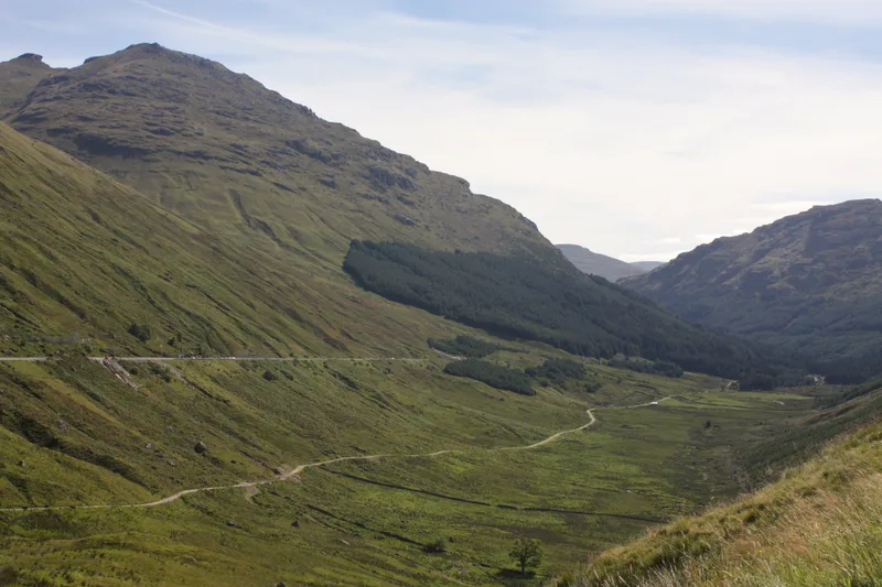
Arrochar in Scotland Islands, United Kingdom.

Christine Westerback — CC BY-SA 2.0 via Wikimedia Commons licence
Plan your visit
- Typical visit
- 4 h–8 h
- Best time of year
- Spring – autumn (Apr–Oct)
- Nearest railway station
- Arrochar and Tarbet · 1.7 km
- Free entry
- Family-friendly
- Dog-friendly
About
Arrochar is a place of interest in Scotland Islands, United Kingdom — drawn from open-data sources for visitor reference. See the linked Wikipedia article for the full description.
Photo gallery
See it from the streetimagery from 2023
Imagery © Mapillary contributors, CC BY-SA 4.0
From the Wikipedia article
Arrochar ( ARR-ə-khər; Scottish Gaelic: An t-Àrchar [ən̪ˠ t̪aːɾəɾ] or An Tairbeart an Iar) is a village at the head of Loch Long in Argyll and Bute, Scotland. The Arrochar Alps are named after the village. The village is within the Loch Lomond and The Trossachs National Park.
Excerpt from Wikipedia under CC BY-SA 4.0. See the source article linked in Sources below.
Background
History
Arrochar was Historically in the Dunbartonshire area, until boundary changes in 1996. For over five centuries this area, the feudal barony of Arrochar, was held by the chiefs of Clan MacFarlane and before them by their ancestors the barons of Arrochar. The family is Celtic in the male line. The settlement was a key target for Viking raiders who took their boats a further 2 mi overland to Tarbet to attack the unprotected inland settlements around the shores of Loch Lomond. In 1263 the Vikings were defeated at the battle of Largs.
Sourced from Wikipedia under CC BY-SA 4.0.
- Coordinates
- 56.1962, -4.7480
- District
- Argyll and Bute
- Postcode
- G83 7AD
- Parliamentary constituency
- Argyll, Bute and South Lochaber
- Nearest railway station
- Arrochar and Tarbet — 1.7 km
Sources
- wikidata: Q3778632 (CC0)
- wikipedia: Arrochar, Argyll (CC BY-SA 4.0)
Other places nearby

Fascadail
B&Bs · 0.1 km

Arrochar Church
Historic churches · 0.2 km

Old Parish Church, Arrochar
Historic churches · 0.2 km

Mansefield Studios
Galleries · 0.3 km

MacTavish Campsite
Campsites · 1.2 km

Monadh Tighe Na Laraich
Mountains & hills · 1.7 km

Ardmay
Reservoirs & lochs · 1.7 km

Succoth
Other places · 1.7 km

Arrochar and Tarbet railway station
Heritage railway stations · 1.7 km

Ballyhennan Church
Historic churches · 1.9 km

Tarbet
Towns & cities · 2.1 km

Ben Reoch
Mountains & hills · 2.1 km
Nearby
📷 5📷 5Historic churches · Central Scotland
Arrochar Church
Arrochar Church — category B listed building-listed church in scotland-highlands, United Kingdom.
📷 5Historic churches · Central Scotland
Old Parish Church, Arrochar
Old Parish Church, Arrochar — category B listed building-listed church in scotland-highlands, United Kingdom.
📷 3Galleries · Central Scotland
Mansefield Studios
Mansefield Studios — a gallery in scotland-highlands, United Kingdom.
📷 5Campsites · Central Scotland
MacTavish Campsite
MacTavish Campsite — a campsite in scotland highlands.
📷 5Mountains & hills · Central Scotland
Monadh Tighe Na Laraich
Monadh Tighe Na Laraich — mountain in scotland highlands. Elevation: 447 m.
Where to eat & stay near Arrochar
Places to stay
📷 5📷 5Campsites · Central Scotland
MacTavish Campsite
MacTavish Campsite — a campsite in scotland highlands.
 📷 7
📷 7Hotels · Central Scotland
Tarbet Hotel
Tarbet Hotel — a hotel in scotland highlands.
 📷 5
📷 5Caravan parks · Central Scotland
Stay the Night Ardgartan
Stay the Night Ardgartan — a caravan park in scotland highlands.
 📷 5
📷 5Campsites · Central Scotland
Tarbet isle camping permit area March-September
Tarbet isle camping permit area March-September — a campsite in scotland highlands.
 📷 3
📷 3Campsites · Central Scotland
Coilessan camping permit area March-September
Coilessan camping permit area March-September — a campsite in scotland highlands.
Places to eat & drink
 📷 5
📷 5Historic pubs · Central Scotland
The Drovers Inn
The Drovers Inn — Historic pub — listed building or notable heritage status.
 📷 7
📷 7Historic pubs · Central Scotland
Ardencaple Hotel Including Former Stables, Rhu Road Lower, Rhu
Ardencaple Hotel Including Former Stables, Rhu Road Lower, Rhu in Scotland Central, United Kingdom.
More national parks in this region
 Flagship📷 5
National parks · Central Scotland
Loch Lomond and The Trossachs National Park
Loch Lomond and The Trossachs National Park is a National park in Scotland.
 📷 5
📷 5National parks · Central Scotland
Whistlefield
Whistlefield in Scotland Islands, United Kingdom.
 📷 4
📷 4 📷 3
📷 3Frequently asked questions
- Where is Arrochar?
- Arrochar is in the Scottish Highlands, United Kingdom (postcode G83 7AD).
- What is Arrochar?
- Arrochar in Scotland Islands, United Kingdom.
- How do I get to Arrochar?
- The nearest railway station is Arrochar and Tarbet, about 1.7 km away. Drivers can use postcode G83 7AD.
- Is Arrochar free to visit?
- Yes, Arrochar is free to enter.
- How do I get to Arrochar?
- The nearest railway station is Arrochar and Tarbet, about 1.7 km away. Drivers can navigate to postcode G83 7AD.