Cathedrals · Central Scotland
Argyll
Also known as: Earra-Ghàidheal
In or near Furnace.
Argyll in Scotland Islands, United Kingdom.

Wikimedia Commons licence
Plan your visit
- Typical visit
- 1 h–2 h
- Best time of year
- Year-round
- Family-friendly
- Limited wheelchair access
About
Argyll is a place of interest in Scotland Islands, United Kingdom — drawn from open-data sources for visitor reference. See the linked Wikipedia article for the full description.
Photo gallery
From the Wikipedia article
Argyll (; archaically Argyle; Scottish Gaelic: Earra-Ghàidheal, pronounced [ɛrˠə ˈɣɛː.əl̪ˠ]), sometimes called Argyllshire, is a historic county and registration county of western Scotland. The county ceased to be used for local government purposes in 1975 and most of the area now forms part of the Argyll and Bute council area. Argyll is of ancient origin, and broadly corresponds to the ancient kingdom of Dál Riata less the parts which were in Ireland. Argyll was also a medieval bishopric with its cathedral at Lismore. During the Middle Ages, the area was divided into a number of provincial lordships. One of these, covering only the central part of the later county, was called Argyll. It was initially an earldom, elevated to become a dukedom in 1701 with the creation of the Duke of Argyll. Other lordships in the area included Cowal, Kintyre, Knapdale, and Lorn. From at least the 14th century there was a Sheriff of Argyll, whose jurisdiction was gradually extended; from 1633 the shire covered all these five provinces. Shires gradually eclipsed the old provinces in administrative importance, and also became known as counties. Between 1890 and 1975, Argyll had a county council. The county town was historically Inveraray, but from its creation in 1890 the county council was based at Lochgilphead. The county is sparsely populated, with many islands and sea lochs along its coast, and the inland parts are mountainous. Six towns in the county held burgh status: Campbeltown, Dunoon, Inveraray, Lochgilphead, Oban, and Tobermory. Argyll borders Inverness-shire to the north, Perthshire and Dunbartonshire to the east, and (separated by the Firth of Clyde) neighbours Renfrewshire and Ayrshire to the south-east, and the County of Bute to the south. Argyll ceased to be used for local government purposes in 1975. Most of the pre-1975 county was then included in the Argyll and Bute district of the Strathclyde region. The district created in 1975 excluded the Morvern and Ardnamurchan…
Excerpt from Wikipedia under CC BY-SA 4.0. See the source article linked in Sources below.
Background
History
The Kilmartin Glen has standing stones and other monuments dating back to around 3000BC, and is one of the most significant areas for Neolithic and Bronze Age remains in mainland Scotland. In 563AD Iona Abbey was founded, becoming one of the most important early Christian sites in Scotland. ]] The Gaelic kingdom of existed between the 5th and 9th centuries. Its territory covered north-eastern parts of Ireland in what later became County Antrim, part of the mainland of Great Britain in what is now western Scotland, and numerous islands in the Inner Hebrides. A fortress at Dunadd in the Kilmartin Glen, 4 mi northwest of the modern town of Lochgilphead, served as the main seat of the kingdom.…
Sourced from Wikipedia under CC BY-SA 4.0.
- Coordinates
- 56.2500, -5.2500
Sources
Other places nearby

Barr Mor, dun site
Archaeological sites · 1.1 km

Barr Mor
Vineyards · 1.1 km

Ardchonnell
Reservoirs & lochs · 1.3 km

Innis Chonnell
Islands · 1.3 km
Innes Chonnel Castle
Castles · 1.4 km

Innis Chonnel, Crannog
Archaeological sites · 1.4 km

Innis Chonnel, Crannog
Archaeological sites · 1.4 km

Newyork
Villages · 2.1 km
Loch Awe
Lakes · 2.1 km

Portinnisherrich
Villages · 2.1 km
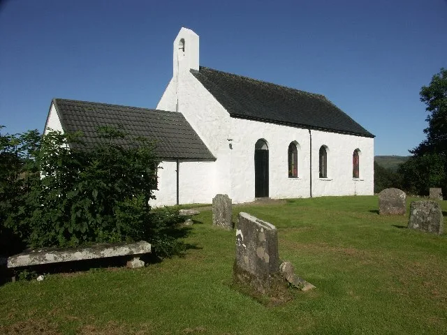
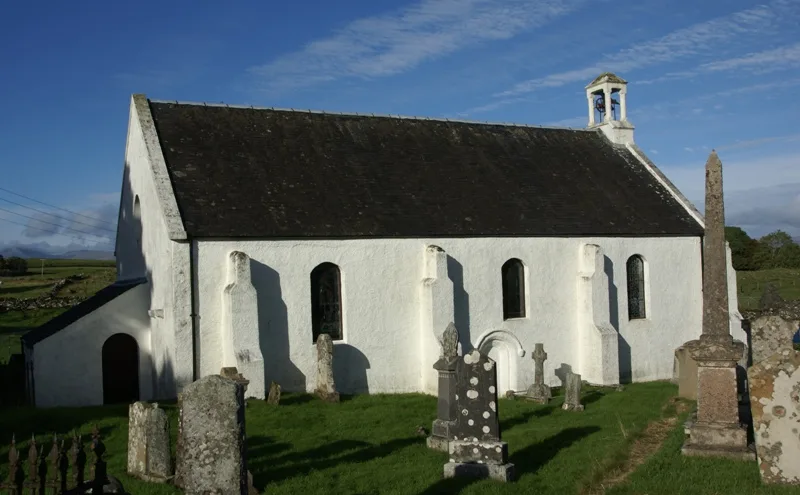
Dalavich Church
Historic churches · 2.3 km

Eas Chuil
Natural landmarks · 2.3 km
Nearby
📷 3Archaeological sites · Central Scotland
Barr Mor, dun site
Barr Mor, dun site — a archaeological in scotland-highlands, United Kingdom.
📷 5Vineyards · Central Scotland
Barr Mor
Barr Mor — a UK vineyard in scotland highlands, producing English or Welsh wine from cool-climate grape varieties.
📷 5Reservoirs & lochs · Central Scotland
Ardchonnell
Ardchonnell in Scotland Islands, United Kingdom.
📷 5Islands · Central Scotland
Innis Chonnell
Innis Chonnell — island and scheduled monument in Loch Awe, Argyll and Bute, Scotland, UK.
📷 3Castles · Central Scotland
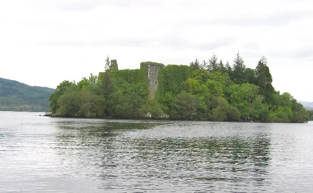
Innes Chonnel Castle
Innes Chonnel Castle — ruined castle on an island on Loch Awe near Dalavich, Scotland.
📷 3Archaeological sites · Central Scotland
Innis Chonnel, Crannog
Innis Chonnel, Crannog — a archaeological in scotland-highlands, United Kingdom.
Where to eat & stay near Argyll
Places to stay
 📷 5
📷 5Caravan parks · Central Scotland
Argyll Caravan Park
Argyll Caravan Park — a caravan park in scotland highlands.
 📷 5
📷 5Hostels · Central Scotland
Inveraray Hostel
Inveraray Hostel — a hostel in scotland highlands.
 📷 5
📷 5Campsites · Central Scotland
Stucreoch Caravan Park
Stucreoch Caravan Park — a campsite in scotland highlands.
 📷 5
📷 5Caravan parks · Central Scotland
St Catherine's Caravan Park
St Catherine's Caravan Park — a caravan park in scotland highlands.
 📷 5
📷 5Caravan parks · Central Scotland
Strathlachlan Caravan Park
Strathlachlan Caravan Park — a caravan park in scotland highlands.
 📷 5
📷 5Places to eat & drink
 📷 3
📷 3Historic pubs · Central Scotland
Ardbrecknish House
Ardbrecknish House — Historic pub — listed building or notable heritage status.
 📷 5
📷 5Historic pubs · Central Scotland
Tigh an Truish Inn
Tigh an Truish Inn — Historic pub — listed building or notable heritage status.
 📷 7
📷 7Historic pubs · Central Scotland
Caledonian Hotel, George Street, Oban
Caledonian Hotel, George Street, Oban in Scotland Central, United Kingdom.
 📷 7
📷 7Historic pubs · Central Scotland
King's Arms Flats, 28 George Street, Oban
King's Arms Flats, 28 George Street, Oban in Scotland Central, United Kingdom.
 📷 7
📷 7More cathedrals in this region
 📷 4
📷 4Cathedrals · Central Scotland
Dunkeld Cathedral
Dunkeld Cathedral — church in Perth and Kinross, Scotland, UK.
 📷 5
📷 5Cathedrals · Central Scotland
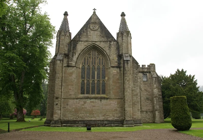
St Columba's Cathedral
St Columba's Cathedral — cathedral in Oban, Argyll, Scotland.
 📷 3
📷 3Cathedrals · Central Scotland
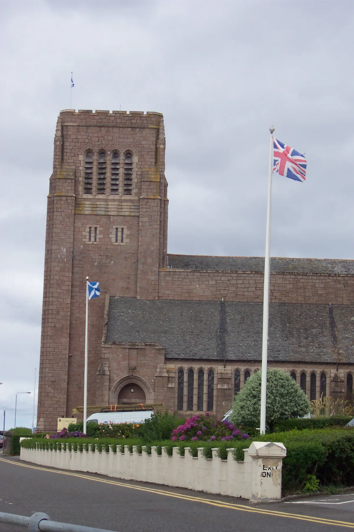
St Moluag's Cathedral, Lismore
St Moluag's Cathedral, Lismore — cathedral in Argyll and Bute, Scotland, UK.
 📷 4
📷 4Frequently asked questions
- Where is Argyll?
- Argyll is in the Scottish Highlands, United Kingdom.
- What is Argyll?
- Argyll in Scotland Islands, United Kingdom.
- How do I get to Argyll?
- Its coordinates are 56.2500°, -5.2500°.