
Bowling alleys · Central Scotland
Ardgoil peninsula
Also known as: Baile na Gréine
In or near Garelochhead.
Ardgoil peninsula in Scotland Islands, United Kingdom.

Chris Wimbush — CC BY-SA 2.0 via Wikimedia Commons licence

Plan your visit
- Typical visit
- 1 h–2 h
- Nearest railway station
- Garelochhead · 6.8 km
- Family-friendly
- Limited wheelchair access
About
Ardgoil peninsula is a place of interest in Scotland Islands, United Kingdom — drawn from open-data sources for visitor reference. See the linked Wikipedia article for the full description.
From the Wikipedia article
Argyll's Bowling Green (Scottish Gaelic: Baile na Grèine meaning "sunny hamlet" or "sunny cattle fold"), also known as the Ardgoil peninsula, is an area on the Ardgoil estate in Argyll and Bute, Scotland.
Excerpt from Wikipedia under CC BY-SA 4.0. See the source article linked in Sources below.
Background
Description
The area includes the most southerly part of the Arrochar Alps and lies between Loch Goil and Loch Long. It is part of the Argyll Forest Park and is within Loch Lomond and The Trossachs National Park. The name is marked on James Dorret's 1750 General Map of Scotland and Islands thereto belonging. In the 1834–1845 account by Rev John McDougal, minister of the area, he describes how people going to the low country (south) had to climb the “Duke of Argyle’s bowling green”. This was part of a route called the “Duke's Path” which started on the shore of Loch Goil and ended at a place called Mark on the shore of Loch Long where you crossed the loch by boat. The name is an anglicisation of the…
Sourced from Wikipedia under CC BY-SA 4.0.
- Coordinates
- 56.1390, -4.8560
- Nearest railway station
- Garelochhead — 6.8 km
Sources
- wikidata: Q4789845 (CC0)
- wikipedia: Argyll's Bowling Green (CC BY-SA 4.0)
Other places nearby
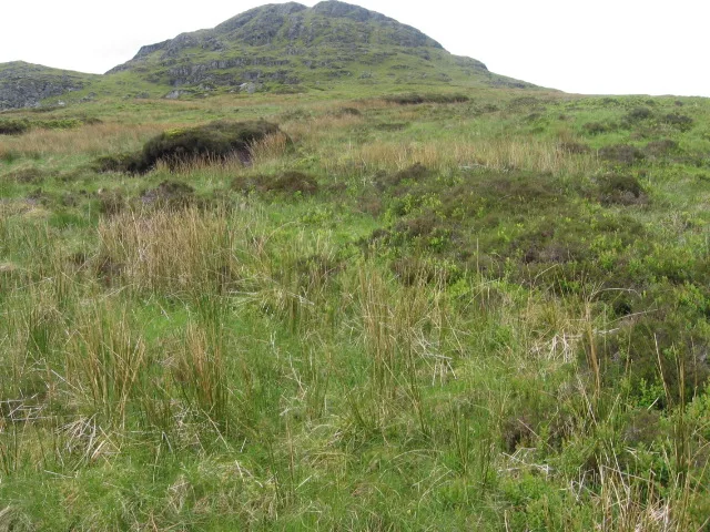
Beinn Reithe
Natural landmarks · 0.7 km

The Saddle
Mountains & hills · 0.8 km
The Saddle
Mountains & hills · 0.8 km
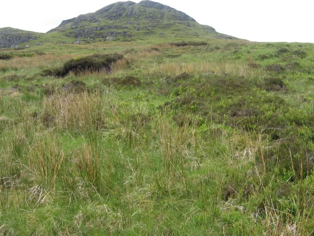
Beinn Reithe
Mountains & hills · 0.9 km

Ardgoil
National parks · 1.2 km

Tom Molach
Mountains & hills · 1.7 km

Carn Clas
Mountains & hills · 1.9 km

Càrn Glas
Mountains & hills · 1.9 km

Loch Goil
National parks · 2.6 km

Clach Bheinn
Mountains & hills · 2.8 km
Clach Bheinn
Mountains & hills · 2.9 km

Glenmallan
Reservoirs & lochs · 2.9 km
Nearby
📷 3Natural landmarks · Central Scotland
Beinn Reithe
Beinn Reithe — mountain in Argyll and Bute, Scotland, UK.
📷 5Mountains & hills · Central Scotland
The Saddle
The Saddle — a hill or mountain in scotland highlands.
📷 5Mountains & hills · Central Scotland
The Saddle
The Saddle — mountain in scotland highlands. Elevation: 521 m.
📷 3📷 4📷 3Where to eat & stay near Ardgoil peninsula
Places to stay
 📷 5
📷 5Campsites · Central Scotland
Lochgoilhead Scout Camp
Lochgoilhead Scout Camp — a campsite in scotland highlands.
 📷 5
📷 5Caravan parks · Central Scotland
Lochgoilhead Holiday Park
Lochgoilhead Holiday Park — a caravan park in scotland highlands.
 📷 3
📷 3Campsites · Central Scotland
Coilessan camping permit area March-September
Coilessan camping permit area March-September — a campsite in scotland highlands.
 📷 5
📷 5Caravan parks · Central Scotland
Honeymoon Bridge
Honeymoon Bridge — a caravan park in scotland highlands.
 📷 5
📷 5Caravan parks · Central Scotland
Stay the Night Ardgartan
Stay the Night Ardgartan — a caravan park in scotland highlands.
 📷 5
📷 5Places to eat & drink
 📷 7
📷 7Historic pubs · Central Scotland
Ardencaple Hotel Including Former Stables, Rhu Road Lower, Rhu
Ardencaple Hotel Including Former Stables, Rhu Road Lower, Rhu in Scotland Central, United Kingdom.
 📷 5
📷 5Historic pubs · Central Scotland
The James Watt
The James Watt in Scotland Central, United Kingdom.
 📷 5
📷 5Historic pubs · Central Scotland
The Drovers Inn
The Drovers Inn — Historic pub — listed building or notable heritage status.
More places in this region
 📷 3
📷 3Bowling alleys · Central Scotland
Murrayfield Indoor Sports Club
Murrayfield Indoor Sports Club — a bowling in scotland-central, United Kingdom.
 📷 3
📷 3Bowling alleys · Central Scotland
King Pins
King Pins — a bowling in scotland-central, United Kingdom.
 📷 3
📷 3Bowling alleys · Central Scotland
Holywood Bowl
Holywood Bowl — a bowling in scotland-central, United Kingdom.
Frequently asked questions
- Where is Ardgoil peninsula?
- Ardgoil peninsula is in the Scottish Highlands, United Kingdom.
- What is Ardgoil peninsula?
- Ardgoil peninsula in Scotland Islands, United Kingdom.
- How do I get to Ardgoil peninsula?
- The nearest railway station is Garelochhead, about 6.8 km away. Its coordinates are 56.1390°, -4.8560°.
- How do I get to Ardgoil peninsula?
- The nearest railway station is Garelochhead, about 6.8 km away.