
Memorials & monuments · South West England
Arch Approximately 10 Metres To South-West Of The Coach House
In or near Lydford.
Arch Approximately 10 Metres To South-West Of The Coach House — Grade II listed building-listed memorial in england-south-west, United Kingdom.

Andrew Hackney — CC BY-SA 2.0 via Wikimedia Commons licence

Plan your visit
- Typical visit
- 15 min–45 min
- Free entry
- Family-friendly
- Dog-friendly
About
Arch Approximately 10 Metres To South-West Of The Coach House is a Grade II listed building-listed memorial in england-south-west, United Kingdom, registered on the National Heritage List for England (NHLE entry 1170785). Listed status protects buildings and structures of special architectural or historic interest. See the linked Wikipedia article for further details.
Photo gallery
See it from the streetimagery from 2022
Imagery © Mapillary contributors, CC BY-SA 4.0
Heritage listing
Details LYDFORD LYDFORD SX 58 SW 5/49 Arch approximately 10 metres - to south-west of The Coach House GV II Former stable arch to Bayfield House (q.v.) 1870 probably by G E Street. Limestone with Bathstone dressings. Double 4-centred arch above which is gable rising to small turret with corbelled stringcourse. Shield bearing arms of the Inns of Court. Originally had clock at the top which has been turned into dovecote. Listing NGR: SX5098884738 Legacy The contents of this record have been generated from a legacy data system. Legacy System number: 92781 Legacy System: LBS
From the Historic England List Entry under OGL v3.
Place summary
The Arch Approximately 10 Metres To South-West Of The Coach House is a Grade II listed memorial located in Lydford, Devon, South-West England. It is a notable structure within the parish, reflecting the historical significance of the area.
AI-generated from the structured facts on this page (operator, designation, listing, era). Not a substitute for visiting.
- Coordinates
- 50.6432, -4.1089
- County
- Devon
- District
- West Devon
- Parish
- Lydford
- Postcode
- EX20 4BH
- Parliamentary constituency
- Torridge and Tavistock
Sources
- wikidata: Q26464450 (CC0)
Other places nearby

Ringwork, castle, town banks, site of Saxon town and defences
Archaeological sites · 0.0 km

Llanford Danish vs Saxon War
Memorials & monuments · 0.0 km
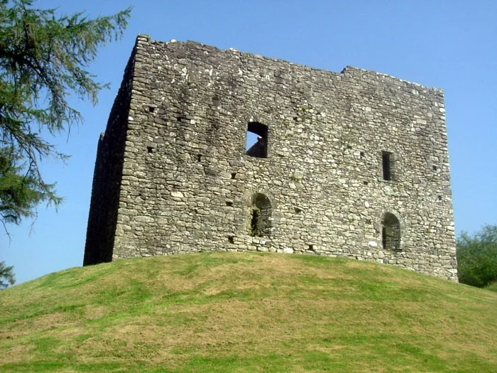
Lydford Castle
Castles · 0.1 km

Lydford Norman Ringwork
Literary houses · 0.2 km

Lydford Bridge
Historic bridges · 0.2 km

Devil's Cauldron
Waterfalls · 0.2 km

Lydford
Towns & cities · 0.3 km

Lydford War Memorial
Memorials & monuments · 0.5 km

Lydford Caravan & Camp Site
Campsites · 0.6 km

Kitt's Steps
Waterfalls · 0.9 km

West Devon
Museums · 1.3 km

White Lady Waterfall
Viewpoints · 1.5 km
Nearby
📷 3Archaeological sites · South West England
Ringwork, castle, town banks, site of Saxon town and defences
Ringwork, castle, town banks, site of Saxon town and defences — archaeological site in Lydford, West Devon, England, UK.
📷 3Memorials & monuments · South West England
Llanford Danish vs Saxon War
Llanford Danish vs Saxon War — a memorial in england-south-west, United Kingdom.
📷 5Castles · South West England
Lydford Castle
Lydford Castle — castle in Devon, England, UK.
📷 5Literary houses · South West England
Lydford Norman Ringwork
Lydford Norman Ringwork — a literary house museum in england south west.
📷 3Historic bridges · South West England
Lydford Bridge
Lydford Bridge — Grade II listed building-listed bridge in england-south-west, United Kingdom.
📷 5Where to eat & stay near Arch Approximately 10 Metres To South-West Of The Coach House
Places to stay
📷 5Campsites · South West England
Lydford Caravan & Camp Site
Lydford Caravan & Camp Site — a campsite in england south west.
 📷 5
📷 5Campsites · South West England
Fox and Hounds
Fox and Hounds — a campsite in england south west.
📷 5Hotels · South West England
Fox & Hounds Hotel
Fox & Hounds Hotel — a hotel in england south west.
 📷 5
📷 5Caravan parks · South West England
Bundu Camping and Caravan Park
Bundu Camping and Caravan Park — a caravan park in england south west.
 📷 5
📷 5Campsites · South West England
Harford Bridge Holiday Park
Harford Bridge Holiday Park — a campsite in england south west.
 📷 5
📷 5Caravan parks · South West England
Harford Bridge Holiday Park
Harford Bridge Holiday Park — a caravan park in england south west.
Places to eat & drink
 📷 5
📷 5Historic pubs · South West England
The Blue Lion Public House
The Blue Lion Public House in England South West, United Kingdom.
 📷 7
📷 7Historic pubs · South West England
Sportsmans Arms
Sportsmans Arms in England South West, United Kingdom.
 📷 6
📷 6Historic pubs · South West England
(White Hart Inn) Public House
(White Hart Inn) Public House in England South West, United Kingdom.
 📷 7
📷 7Historic pubs · South West England
Sir Francis Drake Public House
Sir Francis Drake Public House in England South West, United Kingdom.
 📷 7
📷 7Restaurants · South West England
The Cornish Arms
The Cornish Arms — a restaurant in england south west.
 📷 7
📷 7More memorials in this region
 📷 5
📷 5Memorials & monuments · South West England
Bath Cenotaph
Bath Cenotaph is a memorial in the United Kingdom.
 📷 5
📷 5Memorials & monuments · South West England
Cross of Sacrifice
Cross of Sacrifice is a memorial in the United Kingdom.
 📷 5
📷 5Memorials & monuments · South West England
Grange Arch
Grange Arch is a memorial in the United Kingdom.
.jpg?width=1200) 📷 5
📷 5Memorials & monuments · South West England
King Alfred Memorial
King Alfred Memorial is a memorial in the United Kingdom.
Frequently asked questions
- Where is Arch Approximately 10 Metres To South-West Of The Coach House?
- Arch Approximately 10 Metres To South-West Of The Coach House is in Devon, South-West England, United Kingdom (postcode EX20 4BH), in the parish of Lydford.
- What is Arch Approximately 10 Metres To South-West Of The Coach House?
- Arch Approximately 10 Metres To South-West Of The Coach House — Grade II listed building-listed memorial in england-south-west, United Kingdom.
- How do I get to Arch Approximately 10 Metres To South-West Of The Coach House?
- Drivers can use postcode EX20 4BH.
- Is Arch Approximately 10 Metres To South-West Of The Coach House a listed building?
- Arch Approximately 10 Metres To South-West Of The Coach House is officially recognised as Grade II listed building listed.
- Is Arch Approximately 10 Metres To South-West Of The Coach House free to visit?
- Yes, Arch Approximately 10 Metres To South-West Of The Coach House is free to enter.
- How do I get to Arch Approximately 10 Metres To South-West Of The Coach House?
- Drivers can navigate to postcode EX20 4BH. It sits within the Torridge and Tavistock parliamentary constituency.