
Towns & cities · East Midlands
Anstey
Anstey — large village in Leicestershire, England.

Wikimedia Commons contributors — see linked file page for photographer and licence licence

Plan your visit
- Typical visit
- 3 h–6 h
- Nearest railway station
- Leicester North · 4.2 km
- Free entry
- Family-friendly
- Dog-friendly
Getting there & planning your visit
To visit Anstey in the West Midlands, the nearest railway station is Leicester North, which is approximately 4.2 km away. Entry to the town is free.
About
Anstey is a town, city, village or settlement in the United Kingdom. It covers approximately 6 km². Recent population estimates put it at around 5,821 people. Address: LE7. Wikidata describes it as: "large village in Leicestershire, England". Coordinates: 52.6715°, -1.1955°.
Photo gallery
From the Wikipedia article
Anstey is a large village in Leicestershire, England, located north west of Leicester in the borough of Charnwood. Its population was 7,697 at the 2021 census. This figure is expected to increase due to the building of a new housing development off Groby Road. The village is separated from Leicester by the Rothley Brook, Castle Hill Park and the A46, and it borders the villages of Glenfield, Groby, Newtown Linford, Cropston and Thurcaston as well as the suburb of Beaumont Leys and Anstey Heights. To the north-west lies Bradgate Park. Anstey is known as the Gateway to Charnwood Forest. It is a combination of traditional English village (with two village greens - the top green and bottom green) and an industrial town (with several 19th-century hosiery factories, many of which are now being turned into apartments) which is made up mostly of a number of small estates, both council and private which are intertwined, often with no clear border.
Excerpt from Wikipedia under CC BY-SA 4.0. See the source article linked in Sources below.
Background
History
Anstey dates back to Angle origins, when it was known as Hanstige (later Anstige), meaning a narrow forest track (specifically the meaning is either 'one-way' or 'steep road'). Anstey was positioned between Charnwood Forest and Leicester Forest. Whilst developing the site for the new Co-op store in 2002 archaeologists were called in and found remains dating back to the 12th century. A plaque recording this has been placed on the wall of the new shop. The place-name of Anstey is first recorded in Domesday Book of 1086, when it was held by one of the county's largest landholders, Hugh de Grandmesnil, castellan of Leicester. Anstey appears to have had its origins in two distinct settlement…
Description
In March 2008, The Martin High was placed 10th best school in the country and 3rd best in the county for pupils' progress between the ages of 11 and 14.
Sourced from Wikipedia under CC BY-SA 4.0.
- Coordinates
- 52.6715, -1.1955
- County
- Leicestershire
- District
- Charnwood
- Parish
- Anstey
- Postcode
- LE7
- Parliamentary constituency
- Mid Leicestershire
- Population
- 5,821
- Nearest railway station
- Leicester North — 4.2 km
- Official site
- anstey.leicestershireparishcouncils.org
Sources
- wikidata: Q1613213 (CC0)
- wikipedia: Anstey, Leicestershire (CC BY-SA 4.0)
- commons: Anstey Church.jpg (CC BY-SA 4.0)
Other places nearby

Anstey War Memorial
Memorials & monuments · 0.4 km
Memorial Garden Cenotaph
Memorials & monuments · 0.4 km
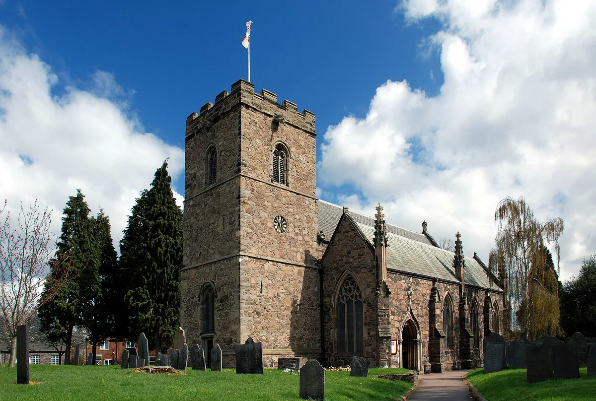
St Mary's Church, Anstey
Historic churches · 0.5 km

King William's Bridge
Historic bridges · 1.2 km

Leicestershire
Museums · 1.8 km

Bradgate House
Gardens · 2.0 km

Beaumont Shopping Centre
Historic shopping arcades · 2.0 km
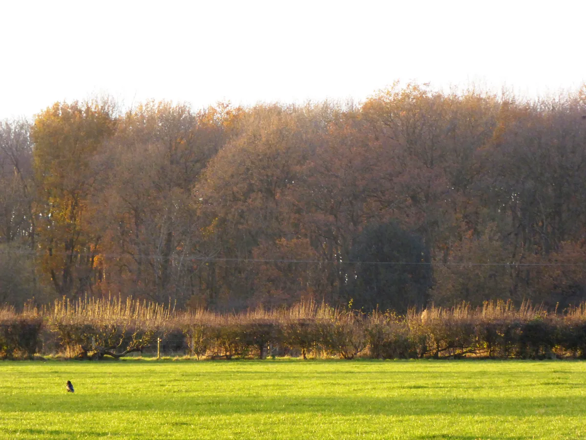
Sheet Hedges Wood
Wildlife reserves · 2.3 km

Stag
Public art & sculpture · 2.3 km

Groby Castle Hill
Castles · 2.3 km

Groby Castle
Hill forts · 2.3 km

Groby Old Hall
Historic houses · 2.3 km
Anstey is a town located in Leicestershire, in the West Midlands region of England, with a population of 5,821. Our guide lists nearby attractions within reach.
At a glance
- Population
- 5,821
- Administrative county
- Leicestershire
- Constituency
- Mid Leicestershire
Things to see in Anstey
8 attractions within 12 km. Full guide: things to do in Anstey →
📷 3Historic shopping arcades · East Midlands
Beaumont Shopping Centre
Beaumont Shopping Centre is in Beaumont Leys, on the edge of Leicester. The 301,099 sq ft (27,973.0 m2) shopping centre is owned by British Land and managed by GVA.
 📷 4
📷 4Reservoirs & lochs · East Midlands
Cropston Reservoir
Cropston Reservoir — reservoir in the United Kingdom.
📷 3Historic bridges · East Midlands
King William's Bridge
King William's Bridge is a historic bridge in the United Kingdom.
📷 4Historic churches · East Midlands
St Mary's Church, Anstey
St Mary's Church, Anstey — church building in Anstey, Charnwood, Leicestershire, England, UK.
📷 3Memorials & monuments · East Midlands
Anstey War Memorial
Anstey War Memorial — Grade II listed building-listed memorial in england-west-midlands, United Kingdom.
📷 3Memorials & monuments · East Midlands
Memorial Garden Cenotaph
Memorial Garden Cenotaph — a memorial in england-west-midlands, United Kingdom.
📷 5Museums · East Midlands
Leicestershire
Leicestershire — a museum in england-west-midlands, United Kingdom.
 📷 5
📷 5Caravan parks · East Midlands
Cropston Caravan Site
Cropston Caravan Site — a caravan park in england west midlands.
Nearby
📷 3Memorials & monuments · East Midlands
Anstey War Memorial
Anstey War Memorial — Grade II listed building-listed memorial in england-west-midlands, United Kingdom.
📷 3Memorials & monuments · East Midlands
Memorial Garden Cenotaph
Memorial Garden Cenotaph — a memorial in england-west-midlands, United Kingdom.
📷 4Historic churches · East Midlands
St Mary's Church, Anstey
St Mary's Church, Anstey — church building in Anstey, Charnwood, Leicestershire, England, UK.
📷 3Historic bridges · East Midlands
King William's Bridge
King William's Bridge is a historic bridge in the United Kingdom.
📷 5Museums · East Midlands
Leicestershire
Leicestershire — a museum in england-west-midlands, United Kingdom.
📷 4Gardens · East Midlands
Bradgate House
Bradgate House — a garden in england-west-midlands, United Kingdom.
Where to eat & stay near Anstey
Places to stay
📷 5Caravan parks · East Midlands
Cropston Caravan Site
Cropston Caravan Site — a caravan park in england west midlands.
 📷 5
📷 5Caravan parks · East Midlands
Charnwood Acres Park
Charnwood Acres Park — a caravan park in england west midlands.
 📷 5
📷 5Hotels · East Midlands
Winstanley House
Winstanley House — a hotel in england west midlands.
 📷 5
📷 5Caravan parks · East Midlands
Unicorn Mobile Home Park
Unicorn Mobile Home Park — a caravan park in england west midlands.
 📷 7
📷 7Hotels · East Midlands
Holiday Inn Express
Holiday Inn Express — a hotel in england west midlands. 3-star. Brand: Holiday Inn Express.
 📷 5
📷 5Caravan parks · East Midlands
Inglenook Park (Mobile Home Park)
Inglenook Park (Mobile Home Park) — a caravan park in england west midlands.
Places to eat & drink
 📷 7
📷 7Historic pubs · East Midlands
Rothley Court
Rothley Court in England East Midlands, United Kingdom.
 📷 5
📷 5Historic pubs · East Midlands
Market Tavern
Market Tavern in England East Midlands, United Kingdom.
 📷 5
📷 5 📷 5
📷 5Restaurants · East Midlands
Peter Pizzeria
Peter Pizzeria — a restaurant in england west midlands. Cuisine: sandwich;pizza.
 📷 5
📷 5Restaurants · East Midlands
Pepe's Piri Piri
Pepe's Piri Piri — a restaurant in england west midlands. Cuisine: burger;sandwich;indian;asian;chicken;ice cream. 5-star.
 📷 5
📷 5Historic pubs · East Midlands
Narborough Arms
Narborough Arms in England East Midlands, United Kingdom.
More towns in this region
 📷 5
📷 5 📷 5
📷 5Towns & cities · East Midlands
Marholm
Marholm — village and civil parish in Cambridgeshire, UK.
 📷 5
📷 5Towns & cities · East Midlands
Thornhaugh
Thornhaugh — village and civil parish in Cambridgeshire, UK.
 Flagship📷 4
Towns & cities · East Midlands
Austerfield
Austerfield — village and civil parish in South Yorkshire, England, UK.
Frequently asked questions
- Where is Anstey?
- Anstey is in Leicestershire, the West Midlands, United Kingdom (postcode LE7), in the parish of Anstey.
- What is Anstey?
- Anstey — large village in Leicestershire, England.
- How do I get to Anstey?
- The nearest railway station is Leicester North, about 4.2 km away. Drivers can use postcode LE7.
- Is Anstey free to visit?
- Yes, Anstey is free to enter.
- How do I get to Anstey?
- The nearest railway station is Leicester North, about 4.2 km away. Drivers can navigate to postcode LE7.