
Memorials & monuments · East Midlands
Andle Stone
In or near Stanton in Peak.
The Andle Stone is a large gritstone boulder on Stanton Moor in Derbyshire. The stone block is 6m long, 4m high and lies within a low, circular, dry stone wall enclosure. It is covered in cup and ring

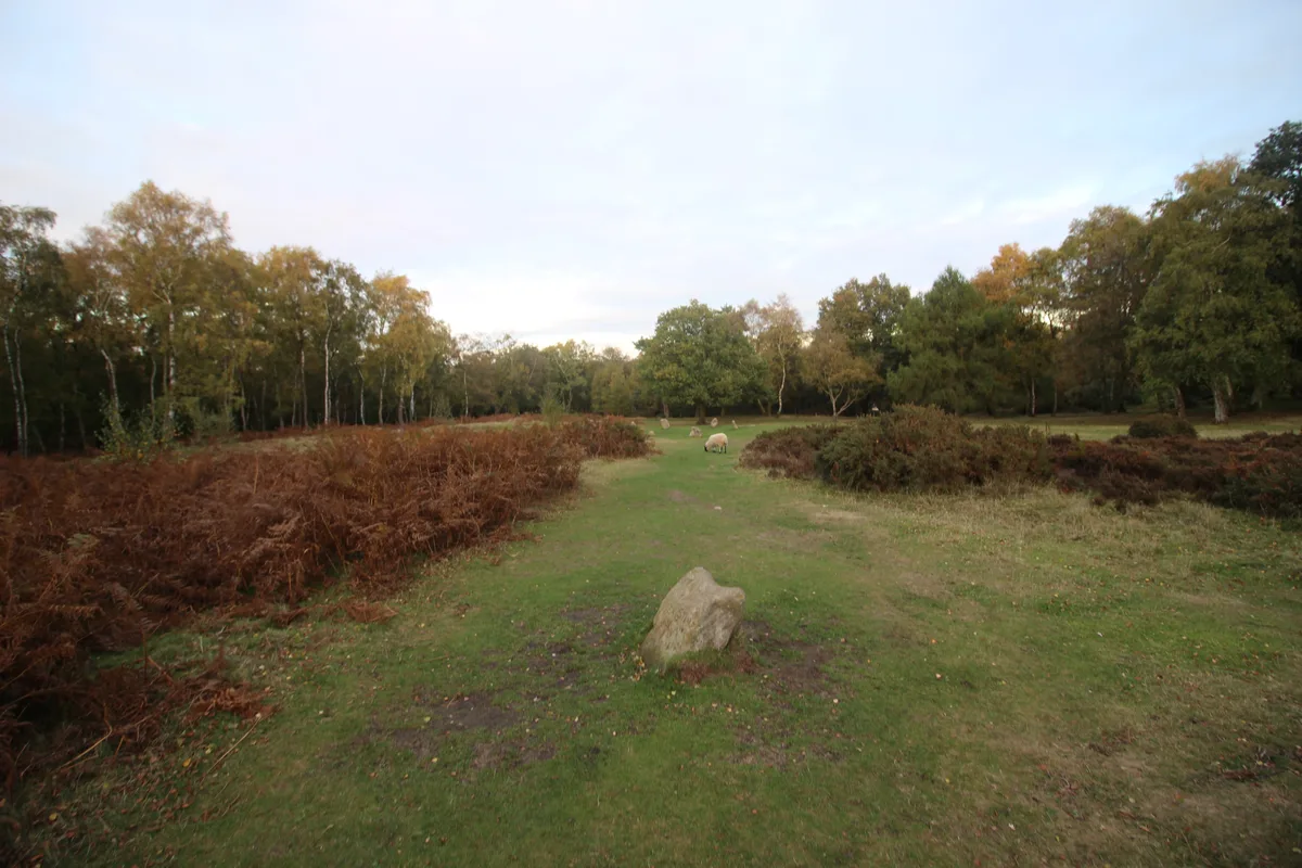
Alan Heardman — CC BY-SA 2.0 via Wikimedia Commons licence

Plan your visit
- Typical visit
- 15 min–45 min
- Nearest railway station
- Rowsley South · 2.5 km
- Free entry
- Family-friendly
- Dog-friendly
Getting there & planning your visit
To visit Andle Stone, the nearest railway station is Rowsley South, located 2.5 km away. The postcode for sat-nav is DE4 2LY, and entry to the memorial is free.
About
The Andle Stone is a large gritstone boulder on Stanton Moor in Derbyshire. The stone block is 6m long, 4m high and lies within a low, circular, dry stone wall enclosure. It is covered in cup and ring marks. It is also known as the Oundle Stone, the Anvil Stone or the Twopenny Loaf. There is a memorial inscription on the west-facing concave face of the boulder, commemorating the Duke of Wellington, Lieutenant Colonel William Thornhill (2nd son of Bache Thornhill of Stanton Hall) and the battles of Assaye and Waterloo. The inscription reads: The Andle Stone and the nearby Doll Tor stone circle are both on private farmland with no public access rights.
Photo gallery
From the Wikipedia article
The Andle Stone is a large gritstone boulder on Stanton Moor in Derbyshire. The stone block is 6m long, 4m high and lies within a low, circular, dry stone wall enclosure. It is covered in cup and ring marks. It is also known as the Oundle Stone, the Anvil Stone or the Twopenny Loaf. There is a memorial inscription on the west-facing concave face of the boulder, commemorating the Duke of Wellington, Lieutenant Colonel William Thornhill (2nd son of Bache Thornhill of Stanton Hall) and the battles of Assaye and Waterloo. The inscription reads: The Andle Stone and the nearby Doll Tor stone circle are both on private farmland with no public access rights.
Excerpt from Wikipedia under CC BY-SA 4.0. See the source article linked in Sources below.
- Coordinates
- 53.1636, -1.6420
- County
- Derbyshire
- District
- Derbyshire Dales
- Parish
- Birchover
- Postcode
- DE4 2LY
- Parliamentary constituency
- Derbyshire Dales
- Nearest railway station
- Rowsley South — 2.5 km
Sources
- wikipedia: Andle Stone (CC BY-SA 4.0)
Other places nearby

Doll Tor Stone Circle
Stone circles · 0.2 km

Doll Tor Stone Circle
Archaeological sites · 0.2 km

Cork Stone
Natural landmarks · 0.4 km

Stanton Moor
Mountains & hills · 0.5 km

Stanton Moor
Mountains & hills · 0.5 km

T25 Cairn
Burial mounds & barrows · 0.6 km

Stanton in Peak
Towns & cities · 0.6 km

T2 Bronze age cairn
Burial mounds & barrows · 0.7 km
T43 Ring cairn
Burial mounds & barrows · 0.7 km
Bronze Age burial, ceremonial and settlement remains on Stanton Moor, and evidence for medieval, post-medieval and 19th to early
Archaeological sites · 0.8 km

Barn Farm Campsite & Bunk Barns
Campsites · 0.8 km
Barn Farm Campsite & Bunk Barns
Hostels · 0.8 km
Nearby
📷 3Stone circles · East Midlands
Doll Tor Stone Circle
Doll Tor Stone Circle — a stone circle in england-east-midlands, United Kingdom.
📷 5Archaeological sites · East Midlands
Doll Tor Stone Circle
Doll Tor Stone Circle — archaeological in england east midlands. Operated by English Heritage.
📷 3Natural landmarks · East Midlands
Cork Stone
Cork Stone — a other in england-east-midlands, United Kingdom.
📷 5Mountains & hills · East Midlands
Stanton Moor
Stanton Moor — a hill or mountain in england east midlands.
📷 5Mountains & hills · East Midlands
Stanton Moor
Stanton Moor — mountain in england east midlands. Elevation: 323 m.
📷 3Burial mounds & barrows · East Midlands
T25 Cairn
T25 Cairn — a burial mound in england-east-midlands, United Kingdom.
Where to eat & stay near Andle Stone
Places to stay
📷 5Campsites · East Midlands
Barn Farm Campsite & Bunk Barns
Barn Farm Campsite & Bunk Barns — a campsite in england east midlands.
📷 5Hostels · East Midlands
Barn Farm Campsite & Bunk Barns
Barn Farm Campsite & Bunk Barns — a hostel in england east midlands.
 📷 5
📷 5Caravan parks · East Midlands
Peak Pods
Peak Pods — a caravan park in england east midlands.
 📷 5
📷 5Caravan parks · East Midlands
Broadmeadow CL
Broadmeadow CL — a caravan park in england east midlands.
 📷 5
📷 5Campsites · East Midlands
Square and Compass
Square and Compass — a campsite in england east midlands.
 📷 5
📷 5Places to eat & drink
 📷 5
📷 5Historic pubs · East Midlands
Duke of York Inn
Duke of York Inn in England East Midlands, United Kingdom.
 📷 7
📷 7 📷 5
📷 5Historic pubs · East Midlands
Three Stags Heads Public House
Three Stags Heads Public House in England East Midlands, United Kingdom.
 📷 7
📷 7Historic pubs · East Midlands
The Peacock Hotel
The Peacock Hotel in England East Midlands, United Kingdom.
 📷 5
📷 5Historic pubs · East Midlands
The Square House
The Square House in England West Midlands, United Kingdom.
 📷 5
📷 5More memorials in this region
 📷 5
📷 5Memorials & monuments · East Midlands
Bainton Buttercross
Bainton Buttercross is a memorial in the United Kingdom.
 📷 5
📷 5Memorials & monuments · East Midlands
clock tower and war memorial
clock tower and war memorial is a memorial in the United Kingdom.
 📷 5
📷 5Memorials & monuments · East Midlands
John Clare Memorial
John Clare Memorial is a memorial in the United Kingdom.
 📷 5
📷 5Memorials & monuments · East Midlands
The Butter Cross
The Butter Cross is a memorial in the United Kingdom.
Frequently asked questions
- Where is Andle Stone?
- Andle Stone is in Derbyshire, the East Midlands, United Kingdom (postcode DE4 2LY), in the parish of Birchover.
- What is Andle Stone?
- The Andle Stone is a large gritstone boulder on Stanton Moor in Derbyshire. The stone block is 6m long, 4m high and lies within a low, circular, dry stone wall enclosure. It is covered in cup and ring
- How do I get to Andle Stone?
- The nearest railway station is Rowsley South, about 2.5 km away. Drivers can use postcode DE4 2LY.
- Who owns Andle Stone?
- Andle Stone is owned by | designation1 =.
- Is Andle Stone free to visit?
- Yes, Andle Stone is free to enter.
- How do I get to Andle Stone?
- The nearest railway station is Rowsley South, about 2.5 km away. Drivers can navigate to postcode DE4 2LY.