Mountains & hills · Scottish Highlands
An Tunna
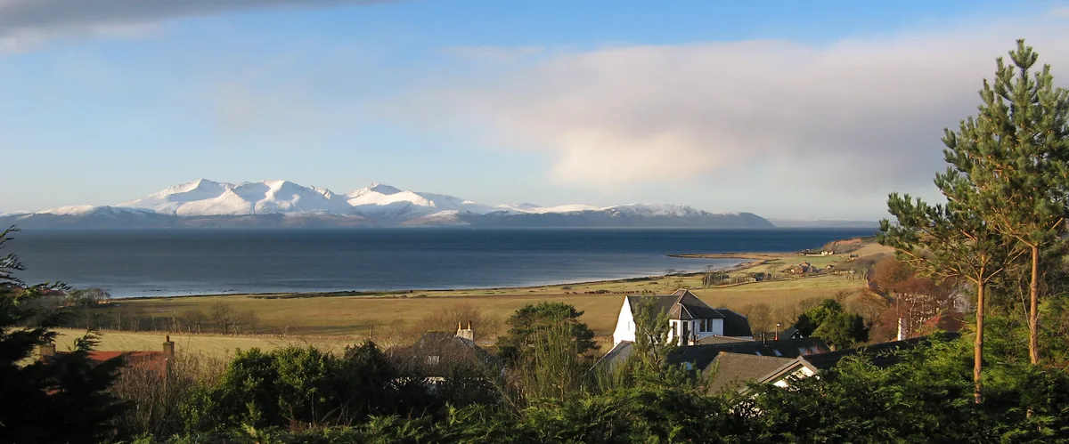
An Tunna — mountain in scotland highlands. Elevation: 361 m.

Brian Robertson — CC BY-SA 2.0 via Wikimedia Commons licence
Plan your visit
- Typical visit
- 3 h–8 h
- Best time of year
- Late spring – early autumn (May–Oct)
About
An Tunna is a mountain located in scotland highlands. Elevation: 361 m. A named British peak recorded in OpenStreetMap. Peaks are typically named on Ordnance Survey 1:50k mapping.
Photo gallery
Place summary
An Tunna is a mountain located in the Scottish Highlands. It is noted for its rugged terrain and striking natural beauty. The area offers various outdoor activities, including hiking and climbing, appealing to those interested in exploring Scotland's mountainous landscapes. Visitors can expect a remote and tranquil environment, typical of the Highlands.
AI-generated from the structured facts on this page (operator, designation, listing, era). Not a substitute for visiting.
- Coordinates
- 55.5765, -5.2250
Sources
- osm: n1132414342 (ODbL)
Other places nearby
Loading nearby places…
Nearby
📷 5Mountains & hills · Scottish Highlands
An Tunna
An Tunna — a hill or mountain in scotland highlands.
 Flagship📷 5
Islands · Scottish Highlands
Isle of Arran
Isle of Arran — the largest island in the Firth of Clyde, Scotland.
 📷 5
📷 5Military museums · Scottish Highlands
Arran Coastal Way
Arran Coastal Way — a military museum in scotland highlands.
 📷 5
📷 5Mountains & hills · Scottish Highlands
Cnoc Dubh
Cnoc Dubh — mountain in scotland highlands. Elevation: 425 m.
📷 5Vineyards · Scottish Highlands
Arran, Cnoc A' Chlochair
Arran, Cnoc A' Chlochair — a UK vineyard in scotland highlands, producing English or Welsh wine from cool-climate grape varieties.
 📷 5
📷 5Mountains & hills · Scottish Highlands
Torrnam Freumh
Torrnam Freumh — mountain in scotland highlands. Elevation: 360 m.
Where to eat & stay near An Tunna
Places to stay
 📷 5
📷 5Campsites · Scottish Highlands
Glen Rosa Campsite
Glen Rosa Campsite — a campsite in scotland highlands.
 📷 5
📷 5Hostels · Scottish Highlands
Shore Lodge
Shore Lodge — a hostel in scotland highlands.
 📷 5
📷 5Hostels · Scottish Highlands
Brodick Bunkhouse
Brodick Bunkhouse — a hostel in scotland highlands.
 📷 5
📷 5Campsites · Scottish Highlands
Balmichael Glamping
Balmichael Glamping — a campsite in scotland highlands.
 📷 5
📷 5Caravan parks · Scottish Highlands
Park Avenue Caravan Site
Park Avenue Caravan Site — a caravan park in scotland highlands.
 📷 5
📷 5Campsites · Scottish Highlands
Bridgend Campsite
Bridgend Campsite — a campsite in scotland highlands.
More mountains in this region
 📷 3
📷 3Mountains & hills · Scottish Highlands
A' Bhuidheanach Bheag
A' Bhuidheanach Bheag — Named summit at 936 m.
 📷 3
📷 3Mountains & hills · Scottish Highlands
A' Chailleach
A' Chailleach — Named summit at 997 m.
 📷 3
📷 3Mountains & hills · Scottish Highlands
A' Chailleach
A' Chailleach — Named summit at 930 m.
 📷 3
📷 3Mountains & hills · Scottish Highlands
A' Chaoirnich
A' Chaoirnich — Named summit at 875 m.
Frequently asked questions
- Where is An Tunna?
- An Tunna is in the Scottish Highlands, United Kingdom.
- What is An Tunna?
- An Tunna — mountain in scotland highlands. Elevation: 361 m.
- How do I get to An Tunna?
- Its coordinates are 55.5765°, -5.2250°.