
Islands · Scottish Islands
An t-Iasgair
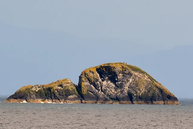
An t-Iasgair — skerry in the Little Minch, to the north of the Trotternish peninsula of Skye, Scotland.

Wikimedia Commons contributors — see linked file page for photographer and licence licence

Plan your visit
- Typical visit
- 4 h–12 h
- Free entry
- Dog-friendly
About
An t-Iasgair is a island in the United Kingdom. Wikidata describes it as: "skerry in the Little Minch, to the north of the Trotternish peninsula of Skye, Scotland". Coordinates: 57.6852°, -6.4335°.
Photo gallery
From the Wikipedia article
An t-Iasgair (Scottish Gaelic for the Fisherman) is a skerry in the Little Minch, to the north of the Trotternish peninsula of Skye. It lies 1.5 miles north north west of Ru Bornesketaig and is marked by a navigation light. It is the largest and highest in a group of three rocks, with smaller neighbours of Sgeir nan Ruideag and An Dubh Sgeir.
Excerpt from Wikipedia under CC BY-SA 4.0. See the source article linked in Sources below.
- Coordinates
- 57.6852, -6.4335
Sources
- wikidata: Q4750288 (CC0)
- wikipedia: An t-Iasgair (CC BY-SA 4.0)
- commons: An t-Iasgair rocks - geograph.org.uk - 1492854.jpg (CC BY-SA 4.0)
Other places nearby
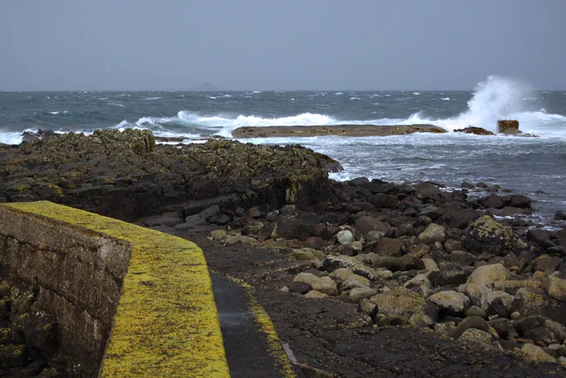
An t-Iasgair Light
Lighthouses · 0.0 km

Cave Of Gold
Viewpoints · 3.1 km

Skye, Dun Bornaskitaig
Vineyards · 3.5 km
Dun Bornaskitaig, Broch
Archaeological sites · 3.5 km

Camas Mòr
Natural landmarks · 4.0 km
Camas Mòr
Mountains & hills · 4.1 km

Bornesketaig
Islands · 4.2 km

Camus More Camping
Campsites · 4.2 km
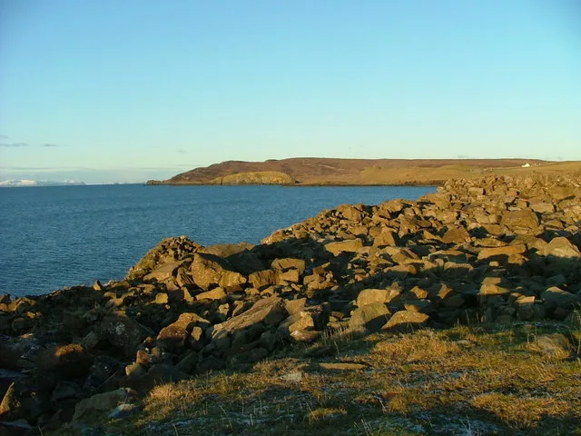
Lùb Score
Mountains & hills · 4.3 km

Rubh' a' Chairn Leith
Mountains & hills · 4.3 km

Kilvaxter
Villages · 4.4 km
Kilmuir
Villages · 4.4 km
Nearby
📷 2Lighthouses · Scottish Islands
An t-Iasgair Light
An t-Iasgair Light — lighthouse in Highland, Scotland, UK.
📷 3📷 5Vineyards · Scottish Islands
Skye, Dun Bornaskitaig
Skye, Dun Bornaskitaig — a UK vineyard in scotland highlands, producing English or Welsh wine from cool-climate grape varieties.
📷 3Archaeological sites · Scottish Islands
Dun Bornaskitaig, Broch
Dun Bornaskitaig, Broch — a archaeological in scotland-highlands, United Kingdom.
📷 5📷 3Where to eat & stay near An t-Iasgair
Places to stay
📷 5Campsites · Scottish Islands
Camus More Camping
Camus More Camping — a campsite in scotland highlands.
 📷 5
📷 5Campsites · Scottish Islands
Uig Bay Campsite
Uig Bay Campsite — a campsite in scotland highlands.
 📷 7
📷 7Hotels · Scottish Islands
Uig Hotel
Uig Hotel — a hotel in scotland highlands.
 📷 5
📷 5Campsites · Scottish Highlands
Staffin Campsite
Staffin Campsite — a campsite in scotland highlands.
 📷 5
📷 5 📷 5
📷 5Hotels · Scottish Islands
Greshornish House
Greshornish House — a hotel in scotland highlands.
More places in this region
 📷 5
📷 5Islands · Scottish Islands
Bac Beag
Bac Beag — Scottish island, part of the Treshnish Isles in the Inner Hebrides.
 📷 5
📷 5Islands · Scottish Islands
Bac Mòr
Bac Mòr — island in Argyll and Bute, Scotland, UK, one of the Treshnish Isles.
 Flagship📷 3
Islands · Scottish Islands
Baleshare
Baleshare — flat tidal island in the Outer Hebrides, Scotland, UK.
 Flagship📷 5
Islands · Scottish Islands
Barra
Barra — island in Outer Hebrides, Scotland, UK.
Frequently asked questions
- Where is An t-Iasgair?
- An t-Iasgair is in the Scottish Highlands, United Kingdom.
- What is An t-Iasgair?
- An t-Iasgair — skerry in the Little Minch, to the north of the Trotternish peninsula of Skye, Scotland.
- How do I get to An t-Iasgair?
- Its coordinates are 57.6852°, -6.4335°.
- Is An t-Iasgair free to visit?
- Yes, An t-Iasgair is free to enter.