
Manor houses · South East England
Ambley Manor
In or near Appleshaw.
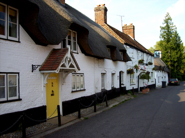
Ambley Manor — a manor in South East England, United Kingdom.

Trish Steel — CC BY-SA 2.0 via Wikimedia Commons licence

Plan your visit
- Typical visit
- 1 h–2 h
- Nearest railway station
- Andover · 7.4 km
- Limited wheelchair access
About
Ambley Manor is a manor located in South East England, United Kingdom. Sourced from OpenStreetMap (ODbL licence); see local listings for visitor information, opening hours and admission details.
Photo gallery
Protected designations
- Area of Outstanding Natural Beauty: North Wessex Downs
Designations sourced from Natural England open data under OGL v3.
Place summary
Ambley Manor is a historic manor located in South-East England. Its architectural features and historical significance reflect the region's cultural heritage.
AI-generated from the structured facts on this page (operator, designation, listing, era). Not a substitute for visiting.
- Coordinates
- 51.2778, -1.4958
- County
- Hampshire
- District
- Test Valley
- Parish
- Tangley
- Postcode
- SP11 0SB
- Parliamentary constituency
- North West Hampshire
- Nearest railway station
- Andover — 7.4 km
Sources
- osm: way/1153701397 (ODbL)
Other places nearby

Sheep Down
Mountains & hills · 0.4 km

Rushmore Down
Mountains & hills · 0.9 km

John Lywood memorial signpost
Memorials & monuments · 1.1 km

Vernham Dean Off-Road cycle trail
Mountain bike trails · 1.3 km

Cow Down
Mountains & hills · 1.5 km

Tangley
Villages · 2.4 km

Ibthorpe House
Historic houses · 2.4 km

Ibthorpe
Villages · 2.5 km

Upton Manor
Manor houses · 2.5 km

The Cricketer's Arms
Historic pubs · 2.6 km

Tangley House
Manor houses · 2.8 km

Bevisbury
Vineyards · 2.8 km
Nearby
📷 5Mountains & hills · South East England
Sheep Down
Sheep Down — mountain in england south east. Elevation: 216.4 m.
📷 5Mountains & hills · South East England
Rushmore Down
Rushmore Down — mountain in england south east. Elevation: 228 m.
📷 5Memorials & monuments · South East England
John Lywood memorial signpost
John Lywood memorial signpost — a memorial in South East England, United Kingdom.
📷 3Mountain bike trails · South East England
Vernham Dean Off-Road cycle trail
Vernham Dean Off-Road cycle trail — a mtb trail in england south east.
📷 5Mountains & hills · South East England
Cow Down
Cow Down — mountain in england south east. Elevation: 230.7 m.
📷 5Where to eat & stay near Ambley Manor
Places to stay
 📷 5
Campsites · South East England
Spring Hill Wild Camping
Spring Hill Wild Camping — a campsite in england south east.
 📷 5
Caravan parks · South East England
Wyke Down Caravan & Camping Park
Wyke Down Caravan & Camping Park — a caravan park in england south east.
 📷 5
Hotels · South East England
Star and Garter Hotel
Star and Garter Hotel — a hotel in england south east.
 📷 5
Caravan parks · South East England
Mullenscote Mobile Home Park
Mullenscote Mobile Home Park — a caravan park in england south east.
 📷 7
B&Bs · South East England
White Horse
White Horse — a bed-and-breakfast in england south east.
 📷 5
Caravan parks · South East England
Elmstead Park
Elmstead Park — a caravan park in england south east.
Places to eat & drink
📷 5Historic pubs · South East England
The Cricketer's Arms
The Cricketer's Arms in England South East, United Kingdom.
 📷 5
 📷 5
 📷 5
Historic pubs · South East England
The Black Swan Public House
The Black Swan Public House in England South East, United Kingdom.
 📷 5
Historic pubs · South East England
The Old Craven Arms
The Old Craven Arms in England South East, United Kingdom.
 📷 7
Historic pubs · South East England
The Kings Arms Public House
The Kings Arms Public House in England South East, United Kingdom.
More places in this region
 📷 5
Manor houses · South East England
Albury Manor
Albury Manor — a manor in South East England, United Kingdom.
 📷 5
Manor houses · South East England
Weardale Manor
Weardale Manor — a manor in South East England, United Kingdom.
 📷 5
Manor houses · South East England
Rowbarns Manor
Rowbarns Manor — a manor in South East England, United Kingdom.
 📷 5
Manor houses · South East England
Sutton Place
Sutton Place — a manor in South East England, United Kingdom.
Frequently asked questions
- Where is Ambley Manor?
- Ambley Manor is in Hampshire, South-East England, United Kingdom (postcode SP11 0SB), in the parish of Tangley.
- What is Ambley Manor?
- Ambley Manor — a manor in South East England, United Kingdom.
- How do I get to Ambley Manor?
- The nearest railway station is Andover, about 7.4 km away. The nearest town is Appleshaw. Drivers can use postcode SP11 0SB.
- Is Ambley Manor a protected site?
- Yes — Ambley Manor is part of the North Wessex Downs National Landscape (AONB).
- How do I get to Ambley Manor?
- The nearest railway station is Andover, about 7.4 km away. Drivers can navigate to postcode SP11 0SB.