
Reservoirs & lochs · Central Scotland
Allt na Lairige Dam
In or near Cairndow.
Allt na Lairige Dam in Scotland Islands, United Kingdom.

David P Howard — CC BY-SA 2.0 via Wikimedia Commons licence

Plan your visit
- Typical visit
- 1 h–2.5 h
- Nearest railway station
- Ardlui · 6.7 km
- Free entry
- Dog-friendly
Getting there & planning your visit
To visit Allt na Lairige Dam in the Scottish Highlands, the nearest railway station is Ardlui, located 6.7 km away. Entry to the site is free.
About
Allt na Lairige Dam is a place of interest in Scotland Islands, United Kingdom — drawn from open-data sources for visitor reference. See the linked Wikipedia article for the full description.
Photo gallery
From the Wikipedia article
Allt na Lairige Dam (Burn of the Pass), is a pre-stressed concrete dam in Argyll and Bute, Scotland at grid reference NN25251745. It creates an impounding reservoir which serves Allt na Lairige hydro-electric power station, which is part of the Shira Hydro-Electric Scheme, and is located on the River Fyne just before it discharges into Loch Fyne. The dam was designed by William George Nicholson Geddes, as directed by James Arthur Banks of Babtie, Shaw and Morton of Glasgow. Construction was carried out by Marples Ridgway. It was completed in 1956 and has a height of 22 metres (72 ft). It is the only large pre-stressed concrete dam in Britain.
Excerpt from Wikipedia under CC BY-SA 4.0. See the source article linked in Sources below.
- Coordinates
- 56.3172, -4.8271
- Nearest railway station
- Ardlui — 6.7 km
Sources
- wikidata: Q112875100 (CC0)
- wikipedia: Allt na Lairige Dam (CC BY-SA 4.0)
Other places nearby

Allt na Lairige Reservoir
Reservoirs & lochs · 0.3 km

Maol Breac
Mountains & hills · 1.7 km
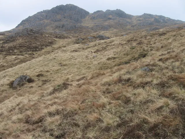
Meall an Fhudair
Mountains & hills · 2.5 km

Maol Meadhonach
Mountains & hills · 2.9 km

Beinn Damhain
Mountains & hills · 2.9 km
Maol Meadhonach
Mountains & hills · 3.0 km

Glen Fyne
Gorges · 3.1 km

Newton Hill
Mountains & hills · 3.3 km

Lochan Srath Dubh-uisge
Lakes · 3.3 km

Lochan Beinn Damhain
Lakes · 3.8 km

Meall nan Caora
Mountains & hills · 3.9 km

Eagle's Fall
Natural landmarks · 4.1 km
Nearby
📷 3Reservoirs & lochs · Central Scotland
Allt na Lairige Reservoir
Allt na Lairige Reservoir — 1956 artificial lake in Argyll and Bute, Scotland, UK, on and outflowing west to Allt na Lairige.
📷 4Mountains & hills · Central Scotland
Maol Breac
Maol Breac — a mountain in scotland-highlands, United Kingdom.
📷 3Mountains & hills · Central Scotland
Meall an Fhudair
Meall an Fhudair — Named summit at 764 m.
📷 5Mountains & hills · Central Scotland
Maol Meadhonach
Maol Meadhonach — a hill or mountain in scotland highlands.
📷 3Mountains & hills · Central Scotland
Beinn Damhain
Beinn Damhain — a mountain in scotland-highlands, United Kingdom.
📷 5Mountains & hills · Central Scotland
Maol Meadhonach
Maol Meadhonach — mountain in scotland highlands. Elevation: 604 m.
Where to eat & stay near Allt na Lairige Dam
Places to stay
 📷 5
📷 5Campsites · Central Scotland
Ardlui Holiday Home Park
Ardlui Holiday Home Park — a campsite in scotland highlands.
 📷 5
📷 5 📷 5
📷 5Campsites · Central Scotland
Inveruglas camping permit area March-September
Inveruglas camping permit area March-September — a campsite in scotland highlands.
 📷 7
📷 7 📷 7
📷 7Hotels · Central Scotland
Inversnaid Bunkhouse
Inversnaid Bunkhouse — a hotel in scotland highlands.
 📷 5
📷 5Caravan parks · Central Scotland
Honeymoon Bridge
Honeymoon Bridge — a caravan park in scotland highlands.
Places to eat & drink
 📷 5
📷 5Historic pubs · Central Scotland
The Drovers Inn
The Drovers Inn — Historic pub — listed building or notable heritage status.
 📷 3
📷 3Historic pubs · Central Scotland
Ardbrecknish House
Ardbrecknish House — Historic pub — listed building or notable heritage status.
More places in this region
 📷 5📷 3
Reservoirs & lochs · Central Scotland
Allt na Lairige Reservoir
Allt na Lairige Reservoir — 1956 artificial lake in Argyll and Bute, Scotland, UK, on and outflowing west to Allt na Lairige.
.jpg?width=1200) 📷 3
📷 3Reservoirs & lochs · Central Scotland
Ardlussa Fishing Loch
Ardlussa Fishing Loch — 1900 artificial lake on Jura, Argyll and Bute, Scotland, UK, on the Lussa River.
 📷 3
📷 3Reservoirs & lochs · Central Scotland
Asgog Loch
Asgog Loch — lake dammed as a reservoir in Argyll and Bute, Scotland, UK, outflows east via a watercourse to Allt Osda.
Frequently asked questions
- Where is Allt na Lairige Dam?
- Allt na Lairige Dam is in the Scottish Highlands, United Kingdom.
- What is Allt na Lairige Dam?
- Allt na Lairige Dam in Scotland Islands, United Kingdom.
- How do I get to Allt na Lairige Dam?
- The nearest railway station is Ardlui, about 6.7 km away. Its coordinates are 56.3172°, -4.8271°.
- Is Allt na Lairige Dam free to visit?
- Yes, Allt na Lairige Dam is free to enter.
- How do I get to Allt na Lairige Dam?
- The nearest railway station is Ardlui, about 6.7 km away.