
Historic churches · South East England
All Saints Church, Patcham
In or near Stanmer.
All Saints Church, Patcham — church in Brighton and Hove, East Sussex, England, UK.

Wikimedia Commons contributors — see linked file page for photographer and licence licence
.JPG)
Plan your visit
- Typical visit
- 30 min–1 h
- Nearest railway station
- Preston Park · 2.3 km
- Free entry
Getting there & planning your visit
To visit All Saints Church in Patcham, you can take a train to Preston Park station, which is 2.3 km away. The postcode for the church is BN1 8YU. Entry to the church is free.
About
All Saints Church, Patcham is a historic church in the United Kingdom. Heritage designation: Grade II* listed building. Affiliated with Anglicanism. Wikidata describes it as: "church in Brighton and Hove, East Sussex, England, UK". Coordinates: 50.8666°, -0.1507°.
Photo gallery
Heritage listing
All Saints Church is the Anglican parish church of Patcham, an ancient Sussex village which is now part of the English city of Brighton and Hove. A place of worship has existed on the hilltop site for about 1,000 years, but the present building has Norman internal features and a 13th-century exterior. Several rounds of restoration in the Victorian era included some structural additions. A wide range of monuments and wall paintings survive inside, including one commemorating Richard Shelley—owner of nearby Patcham Place and one of the most important noblemen in the early history of Brighton.
From the Historic England List Entry under OGL v3.
Official information
All Saints Church in Patcham is a community-focused church that offers services and events for local residents. Visitors can join in worship and participate in various church activities throughout the week.
Protected designations
- Area of Outstanding Natural Beauty: High Weald
Designations sourced from Natural England open data under OGL v3.
From the Wikipedia article
All Saints Church is the Anglican parish church of Patcham, an ancient Sussex village which is now part of the English city of Brighton and Hove. A place of worship has existed on the hilltop site for about 1,000 years, but the present building has Norman internal features and a 13th-century exterior. Several rounds of restoration in the Victorian era included some structural additions. A wide range of monuments and wall paintings survive inside, including one commemorating Richard Shelley—owner of nearby Patcham Place and one of the most important noblemen in the early history of Brighton. The church, which is Grade II* listed, continues to serve as the Anglican place of worship for residents of Patcham, which 20th-century residential development has transformed from a vast rural parish into a large outer suburb of Brighton. Patcham's first church served a large rural area north of the fishing village of Brighthelmston—the ancient predecessor of Brighton. A nucleated settlement developed around this building, which was reconstructed during the Norman era. A wide-ranging series of alterations were carried out by Victorian church restorers to improve the building's structural condition and provide more space to cater for the growing population. As Patcham developed into a suburb in the 20th century, more churches opened in the area and were administered from All Saints Church. The building's plain exterior contrasts with its well-preserved and, in parts, ancient interior whose features include wall paintings and stone memorials. The churchyard has a set of Grade II-listed tombs.
Excerpt from Wikipedia under CC BY-SA 4.0. See the source article linked in Sources below.
Background
History
The Anglo-Saxon Chronicle records that the area now covered by the county of Sussex was reached by Saxon forces in 477. Within a few years, they controlled land along the English Channel coast as far as Pevensey. By the 10th century, the Kingdom of the South Saxons was fully established; its boundaries match those of the present county. The area was divided into smaller administrative areas called hundreds. Patcham and its neighbouring village of Preston were part of Preston Hundred, one of four hundreds covering present-day Brighton and Hove. The lowest administrative level was the parish, based around a church. The parish, which covered 4325 acre, and its 11th-century population of about…
Architecture
tablets on the west wall.]] The plan of All Saints Church comprises a west tower with heavy buttresses and a broach spire, a three-bay nave with a tall aisle on the north side (described by one historian as "quite out of proportion to the rest of the building, particularly in height"), The wall of the chancel retains a trefoil-arched piscina added during the 14th-century restoration work.
Sourced from Wikipedia under CC BY-SA 4.0.
- Coordinates
- 50.8666, -0.1507
- District
- Brighton and Hove
- Parish
- Brighton and Hove, unparished area
- Postcode
- BN1 8YU
- Parliamentary constituency
- Brighton Pavilion
- Nearest railway station
- Preston Park — 2.3 km
- Official site
- www.allsaintspatcham.org.uk
Sources
- wikidata: Q4729510 (CC0)
- wikipedia: All Saints Church, Patcham (CC BY-SA 4.0)
- commons: All Saints Church, Patcham (NHLE Code 1380264).JPG (CC BY-SA 4.0)
- osm: w111642636 (ODbL)
Other places nearby

Patcham
Villages · 0.3 km
.JPG?width=1200)
Southdown House
Historic houses · 0.3 km

Coney Hill
Mountains & hills · 1.0 km

Patcham Mill
Windmills · 1.2 km

Sweethill Barn
Historic houses · 1.3 km
.jpg?width=1200)
Withdean Woods
Forests & woodlands · 1.3 km

Ladies Mile Local Nature Reserve
Forests & woodlands · 1.4 km
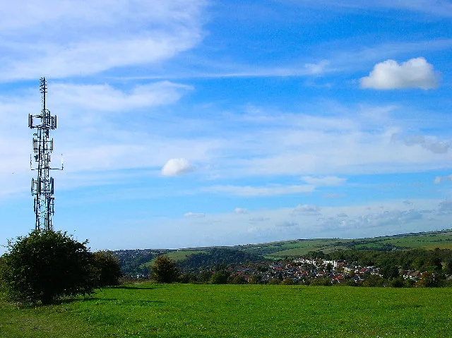
Ladies Mile, Brighton
Wildlife reserves · 1.5 km

A saucer barrow and three bowl barrows on Tegdown Hill
Archaeological sites · 1.5 km

Sweet Hill
Mountains & hills · 1.7 km

Varndean College
Natural landmarks · 1.7 km

East Pylon
Memorials & monuments · 1.9 km
Nearby
📷 5📷 5Historic houses · South East England
Southdown House
Southdown House — Listed building in Patcham, Brighton and Hove, East Sussex, England, UK.
📷 5Mountains & hills · South East England
Coney Hill
Coney Hill — mountain in england south east. Elevation: 118 m.
📷 5📷 5Historic houses · South East England
Sweethill Barn
Sweethill Barn — a historic house in england-south-east, United Kingdom.
📷 5Forests & woodlands · South East England
Withdean Woods
Withdean Woods is a forest or woodland in the United Kingdom.
Where to eat & stay near All Saints Church, Patcham
Places to stay
 📷 5
📷 5Campsites · South East England
Saddlescombe Campsite
Saddlescombe Campsite — a campsite in england south east.
 📷 5
📷 5Hotels · South East England
The Courtlands
The Courtlands — a hotel in england south east.
 📷 5
📷 5B&Bs · South East England
The Claremont
The Claremont — a bed-and-breakfast in england south east.
 📷 5
📷 5Hostels · South East England
Seadragons Backpackers
Seadragons Backpackers — a hostel in england south east.
 📷 5
📷 5 📷 5
📷 5Places to eat & drink
 📷 5
📷 5Cafés · South East England
Cowley Club Café
Cowley Club Café — a café in england south east.
 📷 5
📷 5Historic pubs · South East England
Kissing Coppers
Kissing Coppers — Public artwork (graffiti) by Banksy.
.jpg?width=1200) 📷 5
📷 5Historic pubs · South East England
Hangleton Manor
Hangleton Manor — Historic pub — listed building or notable heritage status.
 📷 5
📷 5Historic pubs · South East England
Freemasons Tavern
Freemasons Tavern in England South East, United Kingdom.
 📷 5
📷 5Historic pubs · South East England
King and Queen, Brighton
King and Queen, Brighton in England South East, United Kingdom.
 📷 5
📷 5Historic pubs · South East England
The Post and Telegraph
The Post and Telegraph in England South East, United Kingdom.
More places in this region
 📷 5
📷 5Historic churches · South East England
All Saints Church, Frindsbury
All Saints Church, Frindsbury — church in Medway, UK.
 📷 5
📷 5Historic churches · South East England
All Saints Church, Maidstone
All Saints Church, Maidstone — parish church associated with the Archbishop's Palace, Maidstone, Kent, England, UK.
 📷 5
📷 5Historic churches · South East England
All Saints Church, West Farleigh
All Saints Church, West Farleigh — Grade I listed church in West Farleigh, Maidstone, Kent, England, UK.
 📷 5
📷 5Historic churches · South East England
All Souls' Church, Sutton Green
All Souls' Church, Sutton Green — church in Guildford, England.
Frequently asked questions
- Where is All Saints Church, Patcham?
- All Saints Church, Patcham is in South-East England, United Kingdom (postcode BN1 8YU), in the parish of Brighton and Hove, unparished area.
- What is All Saints Church, Patcham?
- All Saints Church, Patcham — church in Brighton and Hove, East Sussex, England, UK.
- How do I get to All Saints Church, Patcham?
- The nearest railway station is Preston Park, about 2.3 km away. The nearest town is Stanmer. Drivers can use postcode BN1 8YU.
- Is All Saints Church, Patcham a listed building?
- All Saints Church, Patcham is officially recognised as Grade II* listed building listed.
- Is All Saints Church, Patcham a protected site?
- Yes — All Saints Church, Patcham is part of the High Weald National Landscape (AONB).
- Is All Saints Church, Patcham free to visit?
- Yes, All Saints Church, Patcham is free to enter.
- How do I get to All Saints Church, Patcham?
- The nearest railway station is Preston Park, about 2.3 km away. Drivers can navigate to postcode BN1 8YU.