Castles · North West England
Aldingham
In or near Swarthmoor.
Aldingham is a village and civil parish in the Westmorland and Furness Unitary Authority of Cumbria, England. Historically in Lancashire, it is situated on the east coast of the Furness peninsula, fac

Alexander P Kapp — CC BY-SA 2.0 via Wikimedia Commons licence
Plan your visit
- Typical visit
- 1.5 h–3 h
- Nearest railway station
- Dalton · 5.8 km
- Family-friendly
- Limited wheelchair access
Getting there & planning your visit
To visit Aldingham Castle, the nearest railway station is Dalton, located 5.8 km away. The postcode for sat-nav is LA12 9RT. Accessibility is limited for wheelchair users.
About
Aldingham is a village and civil parish in the Westmorland and Furness Unitary Authority of Cumbria, England. Historically in Lancashire, it is situated on the east coast of the Furness peninsula, facing into Morecambe Bay, and is about 8 miles (13 km) east of Barrow-in-Furness, and 6 miles (9.7 km) south of Ulverston. The parish includes the nearby villages of Baycliff, Dendron, Leece, Gleaston, Newbiggin, Roosebeck, Scales and a number of smaller hamlets. According to the 2001 census the parish had a population of 1,187, reducing to 1,105 at the 2011 Census.
Photo gallery
Protected designations
- Site of Special Scientific Interest: Morecambe Bay SSSI
- Ramsar wetland: Morecambe Bay
Designations sourced from Natural England open data under OGL v3.
From the Wikipedia article
Aldingham is a village and civil parish in the Westmorland and Furness Unitary Authority of Cumbria, England. Historically in Lancashire, it is situated on the east coast of the Furness peninsula, facing into Morecambe Bay, and is about 8 miles (13 km) east of Barrow-in-Furness, and 6 miles (9.7 km) south of Ulverston. The parish includes the nearby villages of Baycliff, Dendron, Leece, Gleaston, Newbiggin, Roosebeck, Scales and a number of smaller hamlets. According to the 2001 census the parish had a population of 1,187, reducing to 1,105 at the 2011 Census.
Excerpt from Wikipedia under CC BY-SA 4.0. See the source article linked in Sources below.
Background
History
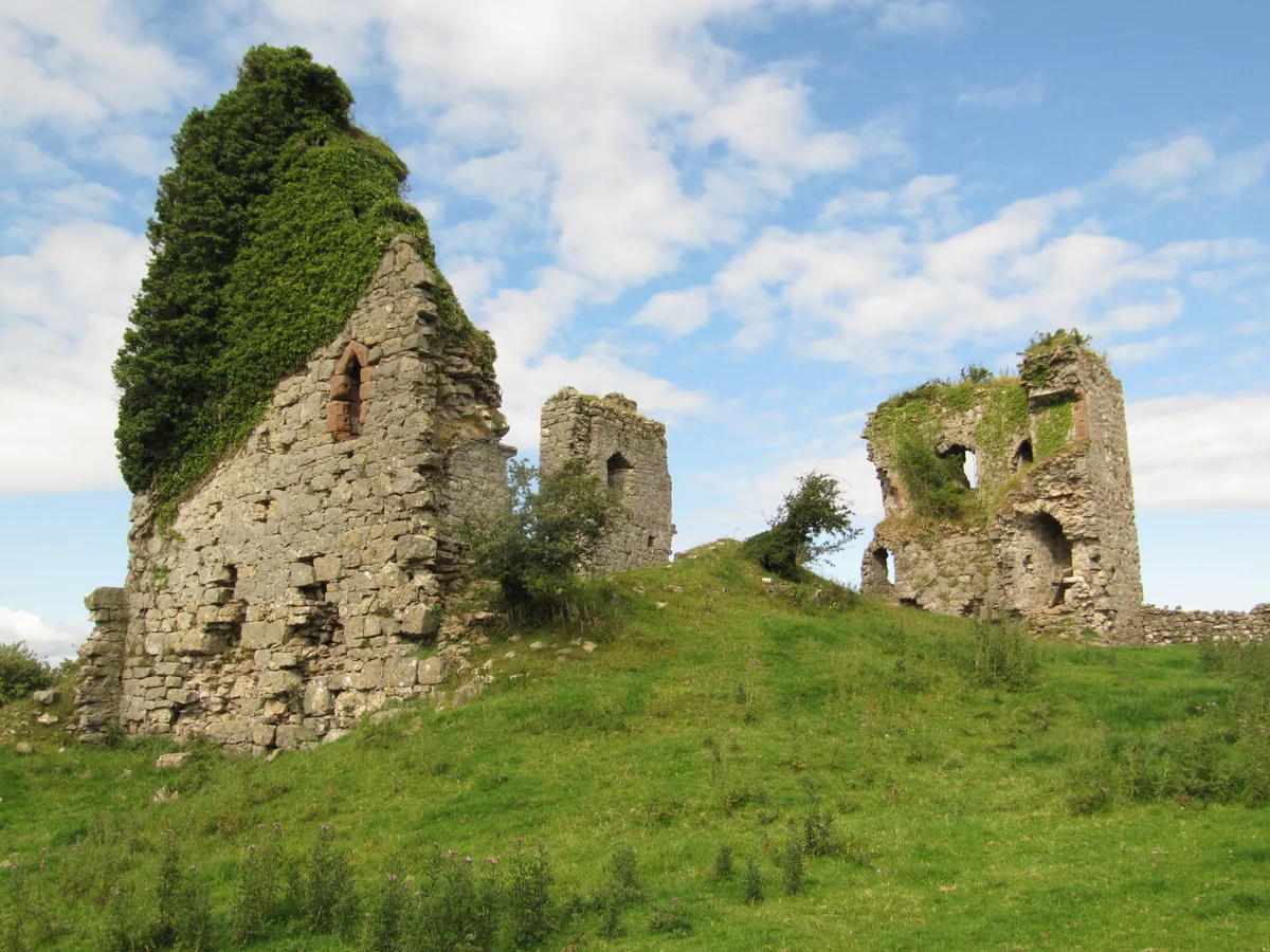
The village was mentioned in the Domesday Book as a separate manor belonging to a local man named Ernulf. The name is thought to be from the Old English meaning 'home of the family or followers of Alda'. Local folklore has it that the village was once much larger—almost a mile in length—but was washed away by the tide. From the early 12th century, Aldingham was the manorial seat of the Lords of Aldingham (later known as the manor of Muchland) and the sites of two early manor houses lie around a mile south of the present village. The first and most visible is Aldingham Motte, which was begun as a ringwork before 1102 by Roger the Poitevin and was later enlarged into a motte and bailey castle…
Sourced from Wikipedia under CC BY-SA 4.0.
- Coordinates
- 54.1300, -3.1000
- District
- Westmorland and Furness
- Parish
- Aldingham
- Postcode
- LA12 9RT
- Parliamentary constituency
- Barrow and Furness
- Nearest railway station
- Dalton — 5.8 km
Sources
- wikipedia: Aldingham (CC BY-SA 4.0)
Other places nearby

Stonard Monument Approximately 18 Metres To North Of St Cuthbert Church
Memorials & monuments · 0.1 km

Lime kiln and associated lime shed 680m south east of Scales Green Farm
Farms (open to visitors) · 0.8 km

Doe Wood Lodges
Caravan parks · 1.2 km

Aldingham Motte
Literary houses · 1.2 km

Aldingham Motte
Archaeological sites · 1.3 km
Moat Hill
Castles · 1.3 km

Lime kiln 100m east of Scales Green Farm
Farms (open to visitors) · 1.4 km

Scales
Villages · 1.5 km

Seacroft Caravan Park
Caravan parks · 1.7 km

Beacon Hill
Mountains & hills · 1.8 km
Gleaston Castle
Hill forts · 2.1 km

Gleaston Watermill
Watermills · 2.2 km
Nearby
📷 3Memorials & monuments · North West England
Stonard Monument Approximately 18 Metres To North Of St Cuthbert Church
Stonard Monument Approximately 18 Metres To North Of St Cuthbert Church — Grade II listed building-listed memorial in england-north-west, United Kingdom.
📷 3Farms (open to visitors) · North West England
Lime kiln and associated lime shed 680m south east of Scales Green Farm
Lime kiln and associated lime shed 680m south east of Scales Green Farm — a Grade II*-listed farm in england-north-west, United Kingdom.
📷 5Caravan parks · North West England
Doe Wood Lodges
Doe Wood Lodges — a caravan park in england north west.
📷 5Literary houses · North West England
Aldingham Motte
Aldingham Motte — a literary house museum in england north west.
📷 3Archaeological sites · North West England
Aldingham Motte
Aldingham Motte — a archaeological in england-north-west, United Kingdom.
📷 5Where to eat & stay near Aldingham
Places to stay
📷 5Caravan parks · North West England
Doe Wood Lodges
Doe Wood Lodges — a caravan park in england north west.
📷 5Caravan parks · North West England
Seacroft Caravan Park
Seacroft Caravan Park — a caravan park in england north west.
📷 5Caravan parks · North West England
High Farm Holiday Site
High Farm Holiday Site — a caravan park in england north west.
 📷 5
📷 5Caravan parks · North West England
Meadowlands Caravan Park
Meadowlands Caravan Park — a caravan park in england north west.
 📷 5
📷 5Caravan parks · North West England
White Hall Caravan Park Ltd
White Hall Caravan Park Ltd — a caravan park in england north west.
 📷 5
📷 5Caravan parks · North West England
Bardsea Leisure Park
Bardsea Leisure Park — a caravan park in england north west.
Places to eat & drink
 📷 5
📷 5Historic pubs · North West England
Crofters Public House
Crofters Public House in England North West, United Kingdom.
 📷 5
📷 5Historic pubs · North West England
Chappells Tavern
Chappells Tavern in England North West, United Kingdom.
 📷 5
📷 5Historic pubs · North West England
Furness Abbey Hotel
Furness Abbey Hotel in England North West, United Kingdom.
 📷 5
📷 5Historic pubs · North West England
The Concle Public House
The Concle Public House in England North West, United Kingdom.
 📷 5
📷 5Historic pubs · North West England
Hoppers Public House
Hoppers Public House in England North West, United Kingdom.
 📷 5
📷 5Historic pubs · North West England
The Lord Ramsden Public House
The Lord Ramsden Public House in England North West, United Kingdom.
More castles in this region
 📷 3
📷 3Castles · North West England
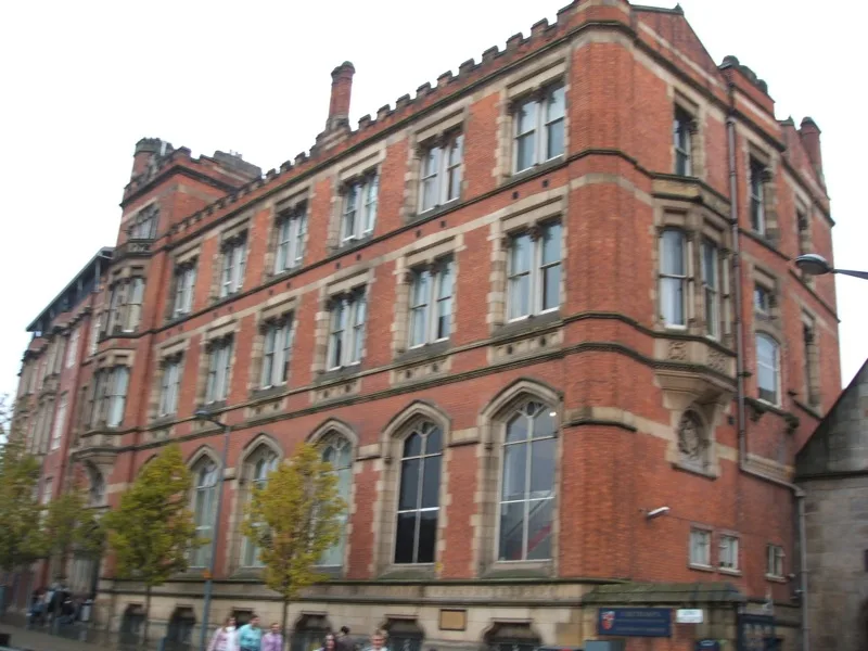
Manchester Castle
Manchester Castle — medieval fortified manor house in England.
 📷 5
📷 5Castles · North West England
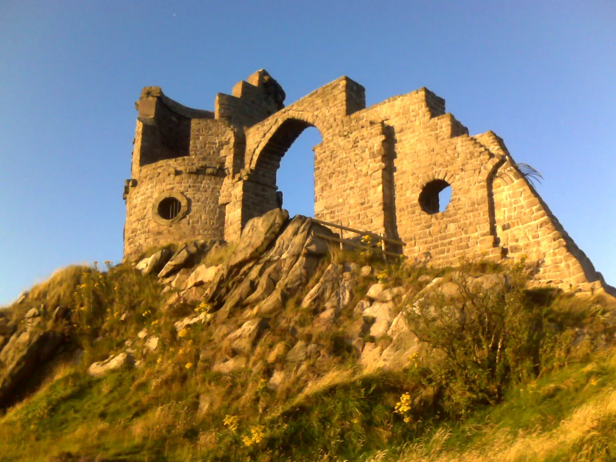
Mow Cop Castle
Mow Cop Castle — folly on the Cheshire and Staffordshire border, England, UK.
 📷 3
📷 3 📷 3
📷 3Castles · North West England
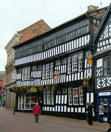
Ullerwood Castle
Ullerwood Castle — castle in Greater Manchester, England.
Frequently asked questions
- Where is Aldingham?
- Aldingham is in North-West England, United Kingdom (postcode LA12 9RT), in the parish of Aldingham.
- What is Aldingham?
- Aldingham is a village and civil parish in the Westmorland and Furness Unitary Authority of Cumbria, England. Historically in Lancashire, it is situated on the east coast of the Furness peninsula, fac
- How do I get to Aldingham?
- The nearest railway station is Dalton, about 5.8 km away. Drivers can use postcode LA12 9RT.
- Is Aldingham a protected site?
- Yes — Aldingham is part of the Morecambe Bay SSSI Site of Special Scientific Interest and the Morecambe Bay Ramsar wetland.
- Does Aldingham charge admission?
- Aldingham typically charges admission. Check the official site for current ticket prices and opening hours.
- How do I get to Aldingham?
- The nearest railway station is Dalton, about 5.8 km away. Drivers can navigate to postcode LA12 9RT.