
Historic houses · South Wales
Abergavenny town walls
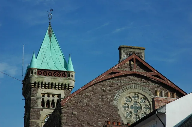
Abergavenny town walls — a Grade II*-listed historic house in wales-south, United Kingdom.

Colin Smith — CC BY-SA 2.0 via Wikimedia Commons licence

Plan your visit
- Typical visit
- 1 h–2 h
- Nearest railway station
- Abergavenny · 0.8 km
- Family-friendly
- Limited wheelchair access
Getting there & planning your visit
To visit Abergavenny town walls, the nearest railway station is Abergavenny, located 0.8 km away. The postcode for the site is NP7 5EH. Accessibility is limited for wheelchair users.
About
Abergavenny town walls is a Grade II*-listed building in wales-south, United Kingdom. Grade II* status is conferred by Historic England (or Cadw, Historic Environment Scotland or NIEA equivalents) on buildings of exceptional national interest. See the linked Wikipedia article for full historical and architectural details.
Photo gallery
See it from the streetimagery from 2024
Imagery © Mapillary contributors, CC BY-SA 4.0
Protected designations
- Site of Special Scientific Interest: River Wye SSSI
Designations sourced from Natural England open data under OGL v3.
From the Wikipedia article
Abergavenny's town walls are a sequence of defensive walls built around the town of Abergavenny in Monmouthshire, Wales.
Excerpt from Wikipedia under CC BY-SA 4.0. See the source article linked in Sources below.
Background
History
After the Norman invasion of Wales in the 11th century, a castle was built at Abergavenny; this included a relatively small, walled town. This town had a rectangle of wooden walls, protected by a V-shaped ditch, stopping just short of the modern Cross Street. In the 12th century this ditch was filled in, possibly because of a pressure on land in the town, and the town of Abergavenny then appears to have lacked any defences until the late 13th century. In the late 13th century a larger town wall was built around Abergavenny in stone, forming an oval shape, approximately 350 m by 215 m across. The wall was paid for and maintained by murage, by which the king allowed a city to raise taxes on…
Sourced from Wikipedia under CC BY-SA 4.0.
- Coordinates
- 51.8216, -3.0185
- District
- Monmouthshire
- Parish
- Abergavenny
- Postcode
- NP7 5EH
- Parliamentary constituency
- Monmouthshire
- Nearest railway station
- Abergavenny — 0.8 km
- Official site
- grokipedia.com
Sources
- wikidata: Q4667092 (CC0)
- wikipedia: Abergavenny town walls (CC BY-SA 4.0)
Other places nearby

Flannel Street
Memorials & monuments · 0.0 km

Borough Theatre
Open-air theatres · 0.0 km

Kings Head Hotel
Hotels · 0.0 km

Castle Street Congegational Chapel
Historic churches · 0.0 km
Borough Theatre
Theatres · 0.1 km
Gobannium
Vineyards · 0.1 km

King Henry VIII Grammar School 1542-1898
Memorials & monuments · 0.1 km
.jpg?width=1200)
Abergavenny Market
Memorials & monuments · 0.1 km

The Angel
Hotels · 0.1 km

Periwig Makers
Memorials & monuments · 0.1 km

Kings Arms Hotel
Hotels · 0.1 km

Castell Y Fenni
Castles · 0.2 km
Nearby
📷 3Memorials & monuments · South Wales
Flannel Street
Flannel Street — a memorial in wales-south, United Kingdom.
📷 5📷 5📷 5Historic churches · South Wales
Castle Street Congegational Chapel
Castle Street Congegational Chapel — Grade II listed building-listed church in wales-south, United Kingdom.
📷 3📷 5Vineyards · South Wales
Gobannium
Gobannium — a UK vineyard in wales south, producing English or Welsh wine from cool-climate grape varieties.
Where to eat & stay near Abergavenny town walls
Places to stay
📷 5📷 5📷 7Hotels · South Wales
Kings Arms Hotel
Kings Arms Hotel — a hotel in wales south.
 📷 7
📷 7Hotels · South Wales
Abergavenny Hotel
Abergavenny Hotel — a hotel in wales south.
 📷 5
📷 5Caravan parks · South Wales
Wernddu Caravan Park
Wernddu Caravan Park — a caravan park in wales south.
 📷 5
📷 5Caravan parks · South Wales
Blossom Touring Caravan Park
Blossom Touring Caravan Park — a caravan park in wales south.
Places to eat & drink

Restaurants · South Wales
The Walnut Tree
The Walnut Tree — a restaurant in wales south.
 📷 5
📷 5Historic pubs · South Wales
Skirrid Mountain Inn
Skirrid Mountain Inn — Historic pub — listed building or notable heritage status.
 📷 7
📷 7 📷 7
📷 7
Restaurants · South Wales
Little Crown
Little Crown — a restaurant in wales south.
 📷 5
📷 5Historic pubs · South Wales
Cornewall Arms
Cornewall Arms in Wales South, United Kingdom.
More historic houses in this region
 📷 3
📷 3Historic houses · South Wales
Agincourt House
Agincourt House — Grade II* listed building in Monmouth. Building in Monmouth, Wales.
 📷 3
📷 3Historic houses · South Wales
Big House, Landshipping
Big House, Landshipping — house in Martletwy, Pembrokeshire, Wales, UK.
 📷 3
📷 3Historic houses · South Wales
Boverton Place
Boverton Place — building in Llantwit Major, United Kingdom.
 📷 3
📷 3Historic houses · South Wales
Brynderi House
Brynderi House — house in Llantilio Crossenny, Monmouthshire, Wales.
Frequently asked questions
- Where is Abergavenny town walls?
- Abergavenny town walls is in South Wales, United Kingdom (postcode NP7 5EH), in the parish of Abergavenny.
- What is Abergavenny town walls?
- Abergavenny town walls — a Grade II*-listed historic house in wales-south, United Kingdom.
- How do I get to Abergavenny town walls?
- The nearest railway station is Abergavenny, about 0.8 km away. Drivers can use postcode NP7 5EH.
- Who owns Abergavenny town walls?
- Abergavenny town walls is owned by | open_to_public =.
- Is Abergavenny town walls a listed building?
- Abergavenny town walls is officially recognised as Grade II* listed.
- Is Abergavenny town walls a protected site?
- Yes — Abergavenny town walls is part of the River Wye SSSI Site of Special Scientific Interest.
- How do I get to Abergavenny town walls?
- The nearest railway station is Abergavenny, about 0.8 km away. Drivers can navigate to postcode NP7 5EH.