Quarries · Mid Wales
Abercwmeiddaw quarry
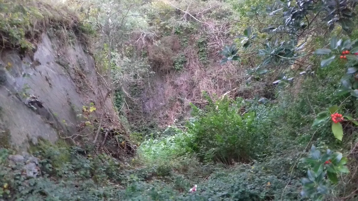
Abercwmeiddaw quarry — former Welsh slate quarry.
_-_geograph.org.uk_-_1166941.jpg?width=1200)
Wikimedia Commons contributors — see linked file page for photographer and licence licence
_-_geograph.org.uk_-_1166941.jpg)
Plan your visit
- Typical visit
- 45 min–1.5 h
- Nearest railway station
- Corris · 1.1 km
About
Abercwmeiddaw quarry is a quarry in the United Kingdom. Records date its origin to 1840. Wikidata describes it as: "former Welsh slate quarry". Coordinates: 52.6632°, -3.8453°.
Photo gallery
From the Wikipedia article
The Abercwmeiddaw quarry was a slate quarry that operated between the 1840s and 1938. It was located at Corris Uchaf about 5 miles (8.0 km) north of Machynlleth, in Gwynedd, north-west Wales. The quarry was connected to the Corris Railway via the Upper Corris Tramway which carried its products to the Cambrian Railways at Machynlleth for distribution.
Excerpt from Wikipedia under CC BY-SA 4.0. See the source article linked in Sources below.
Background
History
Quarrying at Abercwmeiddaw probably started in the 1840s. Certainly it was a large enterprise when it was recorded employing 80 workers in 1849. In 1869, a lease was granted for the property and there is an 1871 report by John Imray on the quarry which describes a well-developed concern, although it was not then connected to the Upper Corris Tramway. and acquired the lease to the quarry. By March 1877, all the equipment for the new quarry was installed and a large number of men were being hired to work there. The company quickly established the quarry and by 1883 was producing 2,875 tons of finished slate. and 200 men are recorded at work at the turn of the century. A new company, the…
Description
The main working at Abercwmeiddaw was a large pit on the north of the site. The first workings here were underground, and the binocular tunnels were driven into the hillside to reach the Broad Vein. Later working was restricted to the open pit, though in the 1920s and 1930s underground extraction was resumed. There were two mill buildings at the quarry. The original and larger mill stands to the south, above the Afon Deri. It had a 45 ft diameter waterwheel that was sited 15 ft below the mill level. This original mill is now demolished. The second mill is on the same level, but north of the original incline. It may never have been used as a mill, but the Robey steam engine was installed…
Sourced from Wikipedia under CC BY-SA 4.0.
- Coordinates
- 52.6632, -3.8453
- District
- Gwynedd
- Parish
- Corris
- Postcode
- SY20 9DB
- Parliamentary constituency
- Dwyfor Meirionnydd
- Established
- 1840
- Nearest railway station
- Corris — 1.1 km
Sources
- wikidata: Q85739420 (CC0)
- wikipedia: Abercwmeiddaw quarry (CC BY-SA 4.0)
- commons: Abercwmeiddaw Quarry (disused) - geograph.org.uk - 1166941.jpg (CC BY-SA 4.0)
Other places nearby
Loading nearby places…
Nearby
 📷 3
📷 3Mountains & hills · Mid Wales
Godre Fynydd
Godre Fynydd — a mountain in wales-mid, United Kingdom, 508 m.
 📷 5
📷 5Historic churches · Mid Wales
Corris Uchaf
Corris Uchaf — a church in wales-mid, United Kingdom.
 📷 3
📷 3Quarries · Mid Wales
Braichgoch Slate Mine
Braichgoch Slate Mine — mine in the United Kingdom.
 📷 3
📷 3Natural landmarks · Mid Wales
King Arthur's Labyrinth
King Arthur's Labyrinth — a other in wales-mid, United Kingdom.
 📷 3
📷 3Natural landmarks · Mid Wales
Corris Craft Centre
Corris Craft Centre — a other in wales-mid, United Kingdom.
📷 3Natural landmarks · Mid Wales
Corris Mine Explorers
Corris Mine Explorers — a other in wales-mid, United Kingdom.
Other places from this era
 📷 3
📷 3Quarries · North Wales
Deeside and Moelfferna quarries
Deeside and Moelfferna quarries — former quarries in Wales.
 📷 3
📷 3Quarries · North Wales
Gimlet quarry
Gimlet quarry — Granite quarry near Pwllheli. Quarried for stone paving sets by the Liverpool and Pwllheli Granite Company, which was established in 1867.
 📷 3
📷 3Quarries · North Wales
Llechwedd quarry
Llechwedd quarry — Slate quarry in North Wales.
_in_Cwm_Ebol_-_geograph.org.uk_-_594897.jpg?width=1200) 📷 3
📷 3Quarries · Mid Wales
Cwm Ebol quarry
Cwm Ebol quarry — former slate quarry in Mid-Wales.
More places in this region
 📷 3
📷 3Quarries · Mid Wales
Frongoch quarry
Frongoch quarry — Disused slate quarry near Aberdyfi, in Mid-Wales, UK.
 📷 3
📷 3Quarries · Mid Wales
Allt Goch quarry
Allt Goch quarry — Slate quarry near Cwrt-Newydd, Ceredigion (formerly Cardiganshire), Wales, United Kingdom.
📷 3Quarries · Mid Wales
Braichgoch Slate Mine
Braichgoch Slate Mine — mine in the United Kingdom.
 📷 3
📷 3Quarries · Mid Wales
Bronbyrfel quarry
Bronbyrfel quarry — Slate quarry near Llanddewi Brefi, Ceredigion, Wales, United Kingdom.
Frequently asked questions
- Where is Abercwmeiddaw quarry?
- Abercwmeiddaw quarry is in Mid Wales, United Kingdom (postcode SY20 9DB), in the parish of Corris.
- When was Abercwmeiddaw quarry built?
- Built or established in 1840.
- How do I get to Abercwmeiddaw quarry?
- The nearest railway station is Corris, about 1.1 km away. Drivers can navigate to postcode SY20 9DB.