
Holy wells · West Midlands
Abbey Wall South East Of Lilleshall Abbey
In or near Chadwell.
Abbey Wall South East Of Lilleshall Abbey — Grade I listed wall in Lilleshall, Telford and Wrekin, Shropshire, England, UK.

Wikimedia Commons contributors — see linked file page for photographer and licence licence

Plan your visit
- Typical visit
- 15 min–30 min
- Nearest railway station
- Oakengates · 5.3 km
- Free entry
- Dog-friendly
About
Abbey Wall South East Of Lilleshall Abbey is a place of interest in the West Midlands. Officially recognised as Grade I listed building. It sits within the The Wrekin parliamentary constituency. The nearest railway station is Oakengates, about 5.3 km away. Postcode area TF10.
Photo gallery
Official information
Lilleshall Abbey, founded around 1148, was originally an Augustinian abbey that later became a private residence. Visitors can explore the surviving church structure, a sculpted processional door, and other cloister buildings, all set in a tranquil environment.
Place summary
Abbey Wall South East of Lilleshall Abbey is a Grade I listed holy well located in the West Midlands, within the parish of Donnington and Muxton. The structure is notable for its historical significance and preservation status.
AI-generated from the structured facts on this page (operator, designation, listing, era). Not a substitute for visiting.
- Coordinates
- 52.7233, -2.3885
- District
- Telford and Wrekin
- Parish
- Donnington and Muxton
- Postcode
- TF10 9HW
- Parliamentary constituency
- The Wrekin
- Nearest railway station
- Oakengates — 5.3 km
- Opening
- Daily 10am–6pm from April to the end of September and 10am–4pm from October to the end of March
- Official site
- www.english-heritage.org.uk
Sources
- wikidata: Q17527901 (CC0)
- commons: Inside the ruins of Lilleshall Abbey - geograph.org.uk - 3128255.jpg (CC BY-SA 4.0)
Other places nearby

Former Canal Bridge Immediately South East Of Lilleshall Abbey
Historic bridges · 0.1 km
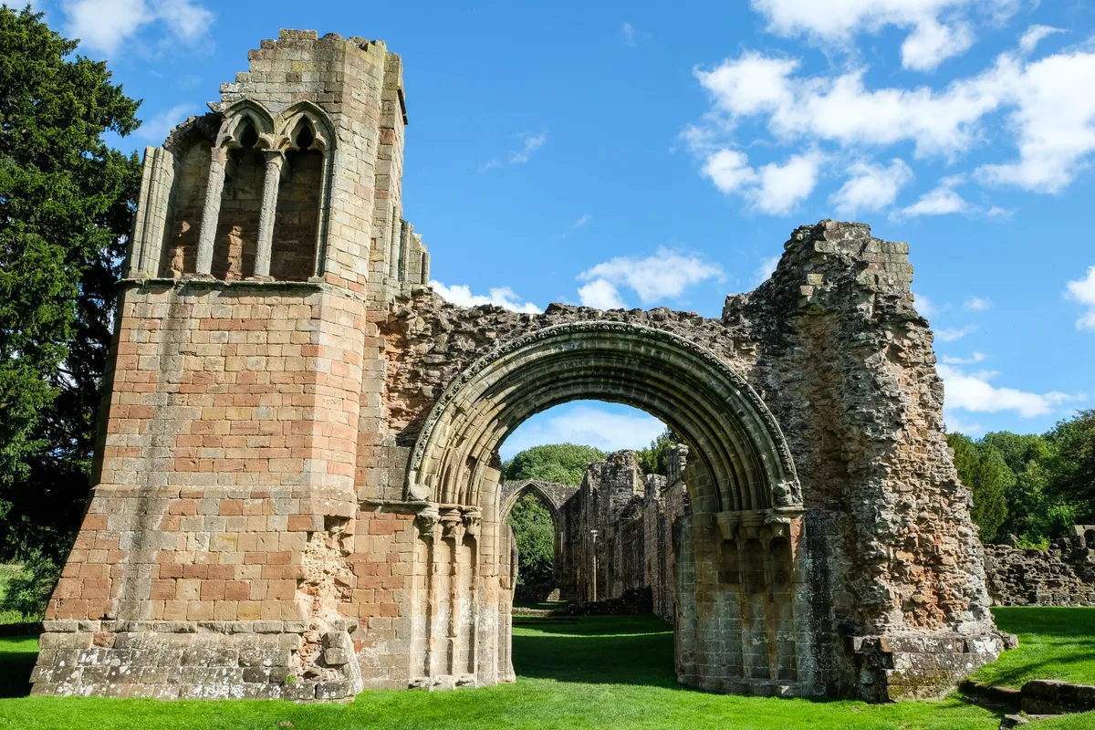
Lilleshall Abbey
Abbeys & priories · 0.2 km

Lilleshall Abbey
Cathedrals · 0.2 km

Ornamental arch
Archaeological sites · 1.1 km

Lilleshall
Villages · 1.6 km

Old Mine Building Ruins
Historic houses · 1.8 km

Lilleshall Hill
Mountains & hills · 1.8 km

Lilleshall Monument
Memorials & monuments · 1.8 km

Lilleshall Hill
Mountains & hills · 1.8 km

Muxton Manor
Manor houses · 2.1 km

Muxton
Villages · 2.3 km
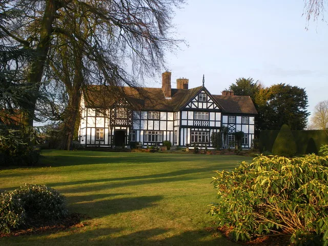
Sheriffhales Manor
Stately homes · 2.6 km
Nearby
📷 3Historic bridges · West Midlands
Former Canal Bridge Immediately South East Of Lilleshall Abbey
Former Canal Bridge Immediately South East Of Lilleshall Abbey — Grade II listed building-listed bridge in england-west-midlands, United Kingdom.
📷 5Abbeys & priories · West Midlands
Lilleshall Abbey
Lilleshall Abbey — monastery in Shropshire, England, UK.
Flagship📷 5Cathedrals · West Midlands
Lilleshall Abbey
Lilleshall Abbey is a cathedral in the United Kingdom.
📷 3Archaeological sites · West Midlands
Ornamental arch
Ornamental arch — a archaeological in england-west-midlands, United Kingdom.
📷 5📷 3Historic houses · West Midlands
Old Mine Building Ruins
Old Mine Building Ruins — a historic house in england-west-midlands, United Kingdom.
Where to eat & stay near Abbey Wall South East Of Lilleshall Abbey
Places to stay
 📷 5
📷 5Campsites · West Midlands
Ted's Caravan and Camp Site
Ted's Caravan and Camp Site — a campsite in england west midlands.
 📷 5
📷 5Hotels · West Midlands
Premier Inn (Telford Central)
Premier Inn (Telford Central) — a hotel in england west midlands. 3-star. Brand: Premier Inn.
 📷 7
📷 7Hotels · West Midlands
Travelodge
Travelodge — a hotel in england west midlands.
 📷 5
📷 5 📷 5
📷 5Campsites · West Midlands
Iron Gorge Camping
Iron Gorge Camping — a campsite in england west midlands.
 📷 5
📷 5Places to eat & drink
 📷 7
📷 7Historic pubs · West Midlands
Dun Cow Public House
Dun Cow Public House in England West Midlands, United Kingdom.
 📷 7
📷 7 📷 5
📷 5Historic pubs · West Midlands
All Nations Inn
All Nations Inn in England West Midlands, United Kingdom.
 📷 5
📷 5Historic pubs · West Midlands
The Beacon Public House
The Beacon Public House in England West Midlands, United Kingdom.
 📷 7
📷 7Historic pubs · West Midlands
The Coalbrookdale Inn
The Coalbrookdale Inn in England West Midlands, United Kingdom.
 📷 5
📷 5Historic pubs · West Midlands
The Golden Ball Public House
The Golden Ball Public House in England West Midlands, United Kingdom.
More places in this region
 📷 3
📷 3Holy wells · West Midlands
Boundary walls to east side of River Severn extending north from the Water Gate
Boundary walls to east side of River Severn extending north from the Water Gate — wall in Worcester, United Kingdom.
 📷 3
📷 3Holy wells · West Midlands
Forecourt Wall, Piers, Railings And Gates To Jordangate House
Forecourt Wall, Piers, Railings And Gates To Jordangate House — wall in Macclesfield, Cheshire East, England, UK.
 📷 3
📷 3Holy wells · West Midlands
Garden Wall And Gate Piers To Number 25
Garden Wall And Gate Piers To Number 25 — Grade I listed wall in Birmingham, West Midlands, England, UK.
 📷 3
📷 3Holy wells · West Midlands
Precinct Wall, 60 Metres Northwest of Old Rectory
Precinct Wall, 60 Metres Northwest of Old Rectory — wall in Maxstoke, Warwickshire, England, UK.
Frequently asked questions
- Where is Abbey Wall South East Of Lilleshall Abbey?
- Abbey Wall South East Of Lilleshall Abbey is in the West Midlands, United Kingdom (postcode TF10 9HW), in the parish of Donnington and Muxton.
- What is Abbey Wall South East Of Lilleshall Abbey?
- Abbey Wall South East Of Lilleshall Abbey — Grade I listed wall in Lilleshall, Telford and Wrekin, Shropshire, England, UK.
- How do I get to Abbey Wall South East Of Lilleshall Abbey?
- The nearest railway station is Oakengates, about 5.3 km away. The nearest town is Chadwell. Drivers can use postcode TF10 9HW.
- Is Abbey Wall South East Of Lilleshall Abbey a listed building?
- Abbey Wall South East Of Lilleshall Abbey is officially recognised as Grade I listed building listed.
- Is Abbey Wall South East Of Lilleshall Abbey free to visit?
- Yes, Abbey Wall South East Of Lilleshall Abbey is free to enter.
- How do I get to Abbey Wall South East Of Lilleshall Abbey?
- The nearest railway station is Oakengates, about 5.3 km away. Drivers can navigate to postcode TF10 9HW.