Harbours & ports · Scottish Islands
A961 road
In or near St Margaret's Hope.
A961 road in Orkney + Shetland, United Kingdom.

Des Colhoun — CC BY-SA 2.0 via Wikimedia Commons licence
Plan your visit
- Typical visit
- 45 min–1.5 h
- Family-friendly
- Dog-friendly
About
A961 road is a place of interest in Orkney + Shetland, United Kingdom — drawn from open-data sources for visitor reference. See the linked Wikipedia article for the full description.
Photo gallery
See it from the streetimagery from 2022
Imagery © Mapillary contributors, CC BY-SA 4.0
From the Wikipedia article
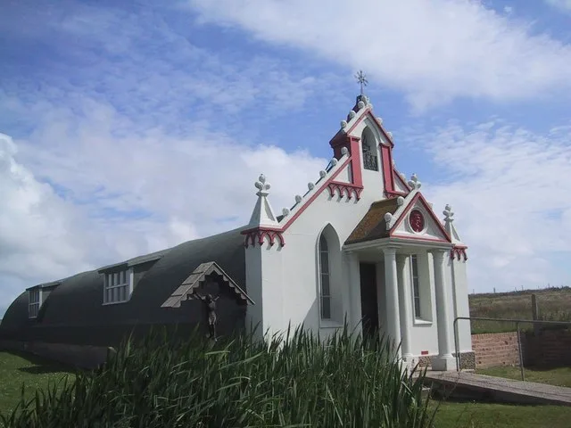
The A961 is a single-carriageway road on the eastern side of Scapa Flow in the Orkney Islands, connecting the town of Kirkwall on the Orkney Mainland to Burwick at the southern end of South Ronaldsay. The road links four islands to the mainland, crossing four causeways known collectively as the Churchill Barriers, which were built during World War II as naval defences to protect the natural harbour of Scapa Flow after a successful attack by a German U-boat. Proceeding southwards from Kirkwall, the road travels south to St Mary's, from where it crosses Kirk Sound on the first Churchill Barrier to the island of Lamb Holm, site of the Italian Chapel built by the Italian prisoners of war who built the barriers. The second barrier carries the road to the island of Glimps Holm, from where the third barrier connects to the larger island of Burray. From the southern shore of Burray, the fourth Churchill barrier (which has accumulated large sand dunes and no longer looks a barrier) passes onto the much larger South Ronaldsay, the southernmost island of Orkney. The road turns south-west to the village of St Margaret's Hope, from where it continues south to Burwick, near the southernmost point of Orkney.
Excerpt from Wikipedia under CC BY-SA 4.0. See the source article linked in Sources below.
- Coordinates
- 58.8820, -2.9029
- District
- Orkney Islands
- Postcode
- KW17 2SF
- Parliamentary constituency
- Orkney and Shetland
Sources
Other places nearby

Lamb Holm,settlement 450m WSW of Italian Chapel
Vineyards · 0.8 km

St Mary's Bay
Natural landmarks · 0.9 km

Churchill Barriers Memorial
Memorials & monuments · 0.9 km
J Gow Rum
Distilleries · 1.0 km

Italian Chapel Memorial
Memorials & monuments · 1.1 km

Ayresdale Broch aka West Broch of Burray
Archaeological sites · 1.1 km
Lamb Holm
Islands · 1.1 km

Italian Chapel
Chapels · 1.2 km

The Italian Chapel
Chapels · 1.2 km
Glimps Holm
Islands · 1.3 km

Churchill Barriers
Islands · 1.3 km

East Broch of Burray
Archaeological sites · 1.3 km
Nearby
📷 5Vineyards · Scottish Islands
Lamb Holm,settlement 450m WSW of Italian Chapel
Lamb Holm,settlement 450m WSW of Italian Chapel — a UK vineyard in scotland islands, producing English or Welsh wine from cool-climate grape varieties.
📷 5Natural landmarks · Scottish Islands
St Mary's Bay
St Mary's Bay — a natural feature in scotland islands.
📷 3Memorials & monuments · Scottish Islands
Churchill Barriers Memorial
Churchill Barriers Memorial — a memorial in scotland-islands, United Kingdom.
📷 3📷 3Memorials & monuments · Scottish Islands
Italian Chapel Memorial
Italian Chapel Memorial — a memorial in scotland-islands, United Kingdom.
📷 3Archaeological sites · Scottish Islands
Ayresdale Broch aka West Broch of Burray
Ayresdale Broch aka West Broch of Burray — a archaeological in scotland-islands, United Kingdom.
Where to eat & stay near A961 road
Places to stay
 📷 7
📷 7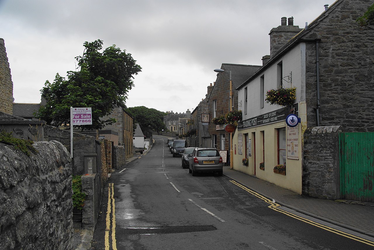 📷 5
📷 5 📷 5
📷 5 📷 5📷 5
 📷 5
📷 5Hostels · Scottish Islands
Lynnfield Hotel and Resturant
Lynnfield Hotel and Resturant — a hostel in scotland islands.
More places in this region
 📷 3
📷 3Harbours & ports · Scottish Islands
Eoligarry Harbour
Eoligarry Harbour — harbour at Eoligarry on the Kilbar Peninsula, Barra, Outer Hebrides, Scotland, UK.
 📷 3
📷 3Harbours & ports · Scottish Islands
Port of Ness harbour
Port of Ness harbour — harbour at Port of Ness, Lewis, Outer Hebrides, Scotland, UK.
 📷 3
📷 3Harbours & ports · Scottish Islands
Uig harbour
Uig harbour — harbor in Highland, Scotland, UK.
 📷 5
📷 5Harbours & ports · Scottish Islands
Stornoway Harbour
Stornoway Harbour — a harbour in scotland highlands.
Frequently asked questions
- Where is A961 road?
- A961 road is in the Scottish Islands, United Kingdom (postcode KW17 2SF).
- What is A961 road?
- A961 road in Orkney + Shetland, United Kingdom.
- How do I get to A961 road?
- Drivers can use postcode KW17 2SF.
- How do I get to A961 road?
- Drivers can navigate to postcode KW17 2SF. It sits within the Orkney and Shetland parliamentary constituency.