Other places · North East England
A183 road
In or near Hendon.
A183 road in England North East, United Kingdom.

Rude Health — CC BY-SA 2.0 via Wikimedia Commons licence
Plan your visit
- Typical visit
- 1 h–2 h
- Nearest railway station
- Stadium of Light · 1.3 km
- Free entry
- Family-friendly
About
A183 road is a place of interest in England North East, United Kingdom — drawn from open-data sources for visitor reference. See the linked Wikipedia article for the full description.
Photo gallery
See it from the streetimagery from 2021
Imagery © Mapillary contributors, CC BY-SA 4.0
Official information
The A183 road is located in Roker Park, Sunderland, and features a multi-gauge railway that offers rides to the public on weekends. In addition to the railway, there is a model boating lake and various engineering interests among the members.
Protected designations
- Site of Special Scientific Interest: Durham Coast SSSI
Designations sourced from Natural England open data under OGL v3.
From the Wikipedia article
The A183 road runs from South Shields in Tyne and Wear, through Sunderland and ends at Chester-le-Street in County Durham. It is a major route in South Tyneside, Sunderland and Chester-le-Street serving many areas and landmarks along its route.
Excerpt from Wikipedia under CC BY-SA 4.0. See the source article linked in Sources below.
- Coordinates
- 54.9242, -1.3662
- District
- Sunderland
- Parish
- Sunderland, unparished area
- Postcode
- SR6 9NB
- Parliamentary constituency
- Sunderland Central
- Nearest railway station
- Stadium of Light — 1.3 km
- Opening
- Saturdays and Sundays afternoons; closed weekdays
- Official site
- www.csmes.co.uk
Sources
- wikidata: Q4648927 (CC0)
- wikipedia: A183 road (England) (CC BY-SA 4.0)
Other places nearby
Roker Roundabout
Natural landmarks · 0.1 km

Roker
Other places · 0.1 km
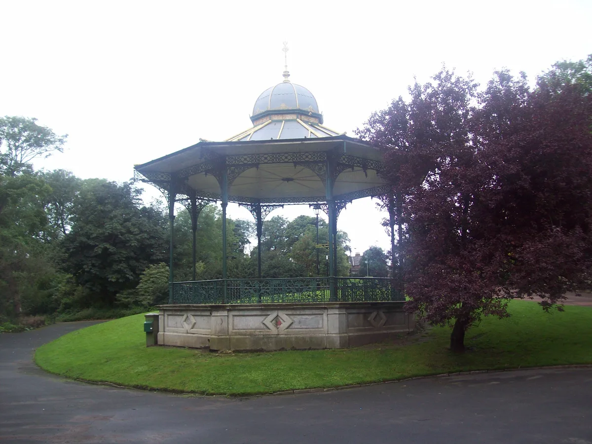
Roker Park
Parks · 0.2 km

Bede Memorial Cross
Memorials & monuments · 0.3 km

Roker Pier And Lighthouse With Railings, Lamp Standards And Part Of Promenade
Museums · 0.4 km
St Andrew's Church, Roker
Historic churches · 0.5 km

North Dock Tufa
Archaeological sites · 0.5 km

Paddle Gate
Public art & sculpture · 0.5 km
Sunderland Lifeboat Station
Other places · 0.5 km

Sunderland International Airshow
Other places · 0.6 km

Passing Through
Public art & sculpture · 0.6 km

Sunderland North
Other places · 0.6 km
Nearby
📷 3Natural landmarks · North East England
Roker Roundabout
Roker Roundabout — a other in scotland-lowlands, United Kingdom.
📷 5📷 4Parks · North East England
Roker Park
Roker Park — municipal space in the Roker area.
📷 3Memorials & monuments · North East England
Bede Memorial Cross
Bede Memorial Cross — a memorial in scotland-lowlands, United Kingdom.
📷 3Museums · North East England
Roker Pier And Lighthouse With Railings, Lamp Standards And Part Of Promenade
Roker Pier And Lighthouse With Railings, Lamp Standards And Part Of Promenade — Grade II listed building-listed museum in scotland-lowlands, United Kingdom.
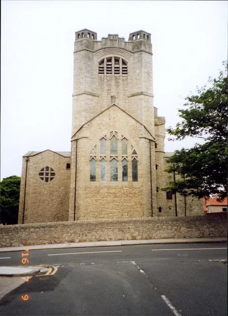
📷 3Historic churches · North East England
St Andrew's Church, Roker
St Andrew's Church, Roker — church in Sunderland, UK.
Where to eat & stay near A183 road
Places to stay
 📷 5
📷 5Hotels · North East England
Hilton Garden Inn Sunderland
Hilton Garden Inn Sunderland — a hotel in scotland lowlands. 3-star. Brand: Hilton Garden Inn.
 📷 5
📷 5Caravan parks · North East England
Lizard Lane Caravan Park
Lizard Lane Caravan Park — a caravan park in scotland lowlands.
 📷 5
📷 5Caravan parks · North East England
Sandhaven Caravan Site
Sandhaven Caravan Site — a caravan park in scotland lowlands.
 📷 5
📷 5B&Bs · North East England
Forest Guest House
Forest Guest House — a bed-and-breakfast in scotland lowlands.
📷 5B&Bs · North East England
The Clifton
The Clifton — a bed-and-breakfast in scotland lowlands.
 📷 5
📷 5Caravan parks · North East England
Showmen's Guild Site - Sunnyside Farm
Showmen's Guild Site - Sunnyside Farm — a caravan park in scotland lowlands.
Places to eat & drink
 📷 5
📷 5Historic pubs · North East England
The Londonderry Public House
The Londonderry Public House in England North East, United Kingdom.
 📷 5
📷 5Historic pubs · North East England
The Dun Cow Public House
The Dun Cow Public House in England North East, United Kingdom.
 📷 5
📷 5Historic pubs · North East England
Websters Public House
Websters Public House in England North East, United Kingdom.
 📷 5
📷 5Historic pubs · North East England
Greens Public House
Greens Public House in England North East, United Kingdom.
 📷 5
📷 5Historic pubs · North East England
Livingstone's Public House
Livingstone's Public House in England North East, United Kingdom.
 📷 6
📷 6Historic pubs · North East England
Fitzgerald's Public House
Fitzgerald's Public House in England North East, United Kingdom.
More places in this region
 📷 5
📷 5Other places · North East England
Appleby Horse Fair
The Appleby Horse Fair, previously known as Appleby New Fair, is an annual gathering of Romani people (Gypsies) and Travellers in Appleby-in-Westmorland in Cumbria, England. The horse fair is held eac
 📷 5
📷 5Other places · North East England
Crosby Garrett
Crosby Garrett in England North East, United Kingdom.
 📷 5
📷 5Other places · North East England
Ravenstonedale
Ravenstonedale in England North East, United Kingdom.
 📷 5
📷 5Frequently asked questions
- Where is A183 road?
- A183 road is in North-East England, United Kingdom (postcode SR6 9NB), in the parish of Sunderland, unparished area.
- What is A183 road?
- A183 road in England North East, United Kingdom.
- How do I get to A183 road?
- The nearest railway station is Stadium of Light, about 1.3 km away. Drivers can use postcode SR6 9NB.
- Is A183 road a protected site?
- Yes — A183 road is part of the Durham Coast SSSI Site of Special Scientific Interest.
- How do I get to A183 road?
- The nearest railway station is Stadium of Light, about 1.3 km away. Drivers can navigate to postcode SR6 9NB.