
Gardens · Yorkshire & the Humber
33, 33a and 35 High Petergate and 60 Stonegate
In or near York.
33, 33a and 35 High Petergate and 60 Stonegate — a garden in england-yorkshire, United Kingdom.

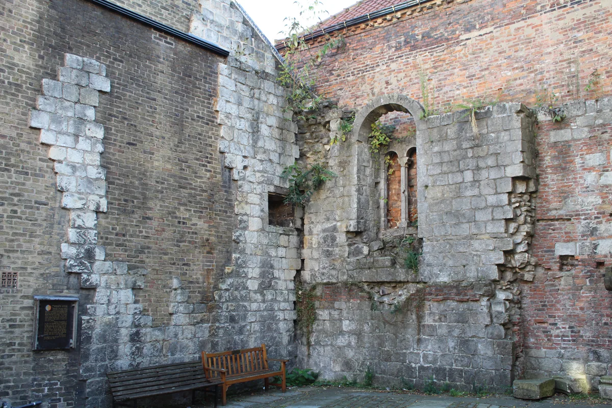
Richard Sutcliffe — CC BY-SA 2.0 via Wikimedia Commons licence

Plan your visit
- Typical visit
- 1 h–2.5 h
- Best time of year
- Spring & summer (Apr–Sep)
- Nearest railway station
- York · 0.8 km
- Family-friendly
- Dog-friendly
Getting there & planning your visit
To visit 33, 33a and 35 High Petergate and 60 Stonegate, the nearest railway station is York, which is 0.8 km away. The postcode for sat-nav is YO1 8AR. Please note that the site is not wheelchair accessible.
About
33, 33a and 35 High Petergate and 60 Stonegate is a garden of interest in england-yorkshire, United Kingdom — drawn from open-data sources for visitor reference. See the linked Wikipedia article for the full description.
Photo gallery
See it from the streetimagery from 2024
Imagery © Mapillary contributors, CC BY-SA 4.0
Official information
Barley Hall is a restored medieval townhouse in York that showcases the history of its former residents, including the Priors of Nostell and a former Mayor of York. Visitors can explore its stunning architecture, including high ceilings and exposed timber frames, while learning about life during the medieval period.
From the Wikipedia article
33–35 High Petergate is a mediaeval building in the city centre of York, in England. The oldest part of the building was constructed in the 14th century as part of a terrace facing Stonegate, this part is now known as 60 Stonegate. The main part of the building, two houses now numbered 33 and 35 High Petergate, is timber framed and was originally of two jettied storeys, built at an unknown date. Around 1600, a jettied second floor and attic were added, and 60 Stonegate was combined with the High Petergate row. At the corner of the building is a dragon post inscribed ":ANNO:DO:1646". In the early 18th century, an extension was added at the rear of the building, doubling its depth. 33 Petergate was altered in the early 19th century, and a small brick-built rear wing was added. Later in the century, shop fronts were inserted at ground level, and these survive. Inside, there are several early doors and the upper part of the staircase in No. 35 is also early, while the lower part is 18th century. The staircase in No. 33 is early 19th century. The building was Grade II* listed in 1954. It is currently divided into two shops, with flats above.
Excerpt from Wikipedia under CC BY-SA 4.0. See the source article linked in Sources below.
- Coordinates
- 53.9614, -1.0826
- District
- York
- Parish
- York, unparished area
- Postcode
- YO1 8AR
- Parliamentary constituency
- York Central
- Phone
- +44 1904 615505
- Nearest railway station
- York — 0.8 km
- Opening
- Daily 10am–4:30pm
- Official site
- barleyhall.co.uk
Sources
- wikidata: Q17549858 (CC0)
- wikipedia: 33–35 High Petergate (CC BY-SA 4.0)
Other places nearby
54, 56 and 58, Stonegate
Gardens · 0.0 km

Stonegate
Memorials & monuments · 0.0 km

52 Stonegate
Historic houses · 0.0 km

37–39 Low Petergate and 51 Stonegate
Gardens · 0.0 km

1 Minster Gates and 38 High Petergate
Gardens · 0.0 km

43, Stonegate
Gardens · 0.0 km

41 and 43 Low Petergate
Gardens · 0.0 km

48 and 50 Stonegate
Historic houses · 0.0 km
The Norman House
Archaeological sites · 0.0 km

35 Stonegate
Gardens · 0.0 km

9 Minster Gates
Gardens · 0.0 km

10, Minster Yard
Gardens · 0.0 km
Nearby
📷 4Gardens · Yorkshire & the Humber
54, 56 and 58, Stonegate
54, 56 and 58, Stonegate — a garden in england-yorkshire, United Kingdom.
📷 3Memorials & monuments · Yorkshire & the Humber
Stonegate
Stonegate — a memorial in england-yorkshire, United Kingdom.
📷 3Historic houses · Yorkshire & the Humber
52 Stonegate
52 Stonegate — Grade II* listed building in York, North Yorkshire, England, UK.
📷 4Gardens · Yorkshire & the Humber
37–39 Low Petergate and 51 Stonegate
37–39 Low Petergate and 51 Stonegate — a garden in england-yorkshire, United Kingdom.
📷 5Gardens · Yorkshire & the Humber
1 Minster Gates and 38 High Petergate
1 Minster Gates and 38 High Petergate — a garden in england-yorkshire, United Kingdom.
📷 4Gardens · Yorkshire & the Humber
43, Stonegate
43, Stonegate — a garden in england-yorkshire, United Kingdom.
Where to eat & stay near 33, 33a and 35 High Petergate and 60 Stonegate
Places to stay
 📷 5
📷 5 📷 5
📷 5Hotels · Yorkshire & the Humber
DoubleTree by Hilton York
DoubleTree by Hilton York — a hotel in england yorkshire. 4-star. Brand: DoubleTree.
 📷 5
📷 5Hotels · Yorkshire & the Humber
The Grand Hotel & Spa
The Grand Hotel & Spa — a hotel in england yorkshire.
 📷 5
📷 5 📷 5
📷 5Hotels · Yorkshire & the Humber
Watergate Inn
Watergate Inn — a hotel in england yorkshire.
 📷 5
📷 5Places to eat & drink
 📷 5
📷 5Restaurants · Yorkshire & the Humber
La Vecchia Scuola
La Vecchia Scuola — a restaurant in england yorkshire.
 📷 7
📷 7Historic pubs · Yorkshire & the Humber
The Roman Bath Public House
The Roman Bath Public House in England Yorkshire, United Kingdom.
 📷 5
📷 5Historic pubs · Yorkshire & the Humber
Eagle & Child
Eagle & Child in England Yorkshire, United Kingdom.
 📷 7
📷 7Historic pubs · Yorkshire & the Humber
The Snickleway Inn And Attached Buildings At Rear
The Snickleway Inn And Attached Buildings At Rear in England Yorkshire, United Kingdom.
 📷 5
📷 5Historic pubs · Yorkshire & the Humber
Golden Fleece Inn, York
Golden Fleece Inn, York in England Yorkshire, United Kingdom.
 📷 5
📷 5Historic pubs · Yorkshire & the Humber
The Black Swan Public House
The Black Swan Public House in England Yorkshire, United Kingdom.
More gardens in this region
 📷 3
📷 3Gardens · Yorkshire & the Humber
Clayton Vale
Clayton Vale — valley in Clayton, Manchester, England, UK.
 📷 4
📷 4Gardens · Yorkshire & the Humber
Houldsworth Working Men's Club
Houldsworth Working Men's Club — a garden in england-west-midlands, United Kingdom.
 📷 4
📷 4Gardens · Yorkshire & the Humber
Millennium House
Millennium House — a garden in england-west-midlands, United Kingdom.
 📷 4
📷 4Gardens · Yorkshire & the Humber
Millington Hall
Millington Hall — a garden in england-west-midlands, United Kingdom.
Frequently asked questions
- Where is 33, 33a and 35 High Petergate and 60 Stonegate?
- 33, 33a and 35 High Petergate and 60 Stonegate is in Yorkshire, United Kingdom (postcode YO1 8AR), in the parish of York, unparished area.
- What is 33, 33a and 35 High Petergate and 60 Stonegate?
- 33, 33a and 35 High Petergate and 60 Stonegate — a garden in england-yorkshire, United Kingdom.
- How do I get to 33, 33a and 35 High Petergate and 60 Stonegate?
- The nearest railway station is York, about 0.8 km away. Drivers can use postcode YO1 8AR.
- How do I get to 33, 33a and 35 High Petergate and 60 Stonegate?
- The nearest railway station is York, about 0.8 km away. Drivers can navigate to postcode YO1 8AR.