
Natural landmarks · Northern Ireland
2009 Massereene Barracks shooting
In or near Donegore.
2009 Massereene Barracks shooting in Northern Ireland, United Kingdom.

Kenneth Allen — CC BY-SA 2.0 via Wikimedia Commons licence

Plan your visit
- Typical visit
- 1 h–2 h
- Nearest railway station
- Antrim · 1.3 km
- Free entry
- Dog-friendly
About
2009 Massereene Barracks shooting is a place of interest in Northern Ireland, United Kingdom — drawn from open-data sources for visitor reference. See the linked Wikipedia article for the full description.
Photo gallery
Official information
The 2009 Massereene Barracks shooting was a violent incident in Northern Ireland where two British soldiers were killed and several others were injured. The attack occurred at an army base in County Antrim, stirring memories of past sectarian violence in the region.
From the Wikipedia article
The Massereene Barracks shooting took place at Massereene Barracks in Antrim, Northern Ireland. On 7 March 2009, two off-duty British soldiers of the 38 Engineer Regiment were shot dead outside the barracks. Two other soldiers and two civilian delivery men were also shot and wounded during the attack. A dissident Irish republican paramilitary group, the Real IRA, claimed responsibility. The shootings were the first British military fatalities in Northern Ireland since 1997. Two days later, the Continuity IRA shot dead Stephen Carroll, a Police Service of Northern Ireland (PSNI) officer; the first Northern Ireland police officer to be killed by paramilitaries since 1998.
Excerpt from Wikipedia under CC BY-SA 4.0. See the source article linked in Sources below.
Background
History
From the late 1960s until the late 1990s, Northern Ireland underwent a conflict known as the Troubles, in which more than 3,500 people were killed. More than 700 of those killed were British military personnel, deployed as part of Operation Banner. The vast majority of these British military personnel were killed by the Provisional Irish Republican Army (IRA), which waged an armed campaign to force the British to negotiate a withdrawal from Northern Ireland. In 1997 the IRA called a final ceasefire and in 1998 the Good Friday Agreement was signed. This is widely seen as marking the end of the conflict. However, breakaway groups opposed to the ceasefire ("dissident Irish republicans")…
Sourced from Wikipedia under CC BY-SA 4.0.
- Coordinates
- 54.7216, -6.2307
- District
- Antrim and Newtownabbey
- Postcode
- BT41 4LH
- Parliamentary constituency
- South Antrim
- Nearest railway station
- Antrim — 1.3 km
- Official site
- edition.cnn.com
Sources
- wikidata: Q3771812 (CC0)
- wikipedia: Massereene Barracks shooting (CC BY-SA 4.0)
Other places nearby
Massereene Barracks
Natural landmarks · 0.0 km
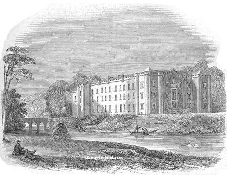
Antrim Castle
Castles · 0.0 km

Six Mile Water
Natural landmarks · 0.4 km

Six Mile Water Caravan Park
Caravan parks · 0.5 km
The Wolfhound
Public art & sculpture · 0.5 km
Garden Heritage Exhibition
Museums · 0.5 km

Clotworthy House
Historic houses · 0.6 km

Duck Pond
Natural landmarks · 0.6 km

South Antrim
Natural landmarks · 0.7 km

Pump Tower
Historic houses · 0.7 km

St Comgall's Church
Historic churches · 0.7 km
Cinema, Antrim
Theatres · 0.8 km
Nearby
📷 3Natural landmarks · Northern Ireland
Massereene Barracks
Massereene Barracks in Northern Ireland, United Kingdom.
📷 5Castles · Northern Ireland
Antrim Castle
Antrim Castle — 17th century house in Antrim, Ireland, now demolished.
📷 4Natural landmarks · Northern Ireland
Six Mile Water
Six Mile Water in Northern Ireland, United Kingdom.
📷 5Caravan parks · Northern Ireland
Six Mile Water Caravan Park
Six Mile Water Caravan Park — a caravan park in northern ireland.
📷 3Public art & sculpture · Northern Ireland
The Wolfhound
The Wolfhound — a public art in northern-ireland, United Kingdom.
📷 3Museums · Northern Ireland
Garden Heritage Exhibition
Garden Heritage Exhibition — a museum in northern-ireland, United Kingdom.
Where to eat & stay near 2009 Massereene Barracks shooting
Places to stay
📷 5Caravan parks · Northern Ireland
Six Mile Water Caravan Park
Six Mile Water Caravan Park — a caravan park in northern ireland.
 📷 3
📷 3 📷 5
📷 5Hotels · Northern Ireland
Maldron Hotel Belfast International
Maldron Hotel Belfast International — a hotel in northern ireland. 3-star. Brand: Maldron Hotels.
 📷 5
📷 5Hotels · Northern Ireland
DoubleTree by Hilton Belfast Templepatrick
DoubleTree by Hilton Belfast Templepatrick — a hotel in northern ireland. 4-star. Brand: Hilton.
 📷 3
📷 3Places to eat & drink
 📷 5
📷 5 📷 7
📷 7Historic pubs · Northern Ireland
Kelly's Cellars
Kelly's Cellars in Northern Ireland, United Kingdom.
 📷 7
📷 7Historic pubs · Northern Ireland
Crown Liquor Saloon
Crown Liquor Saloon in Northern Ireland, United Kingdom.
 📷 5
📷 5 📷 5
📷 5 📷 5
📷 5More natural landmarks in this region
 Flagship📷 4
Natural landmarks · Northern Ireland
Lough Erne
Lough Erne — lake in County Fermanagh, Northern Ireland, UK.
 Flagship📷 4
Natural landmarks · Northern Ireland
Lough Neagh
Lough Neagh — large lake in Northern Ireland.
 📷 3
📷 3Natural landmarks · Northern Ireland
Ballysaggart Lough
Ballysaggart Lough — lake in the United Kingdom.
 📷 5
📷 5Natural landmarks · Northern Ireland
Belmore Mountain
Belmore Mountain — mountain in the United Kingdom.
Frequently asked questions
- Where is 2009 Massereene Barracks shooting?
- 2009 Massereene Barracks shooting is in Northern Ireland, United Kingdom (postcode BT41 4LH).
- What is 2009 Massereene Barracks shooting?
- 2009 Massereene Barracks shooting in Northern Ireland, United Kingdom.
- How do I get to 2009 Massereene Barracks shooting?
- The nearest railway station is Antrim, about 1.3 km away. Drivers can use postcode BT41 4LH.
- Is 2009 Massereene Barracks shooting free to visit?
- Yes, 2009 Massereene Barracks shooting is free to enter.
- How do I get to 2009 Massereene Barracks shooting?
- The nearest railway station is Antrim, about 1.3 km away. Drivers can navigate to postcode BT41 4LH.